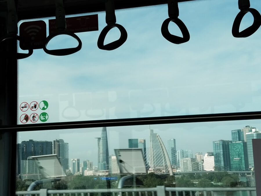
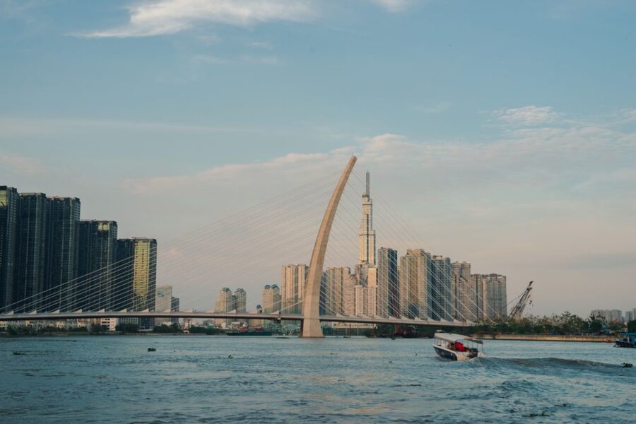
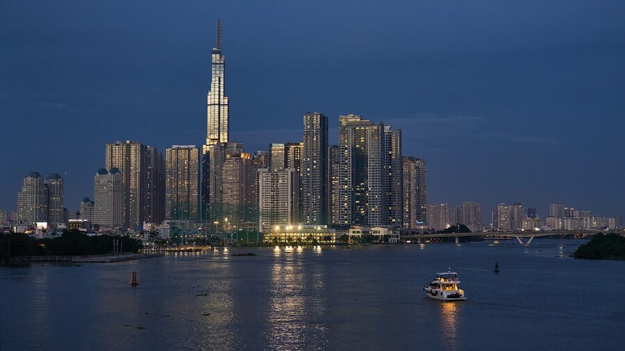
Board Metro Line 1 at Bến Thành and for the first three stops you see nothing but tiled walls: Bến Thành, the Opera House and Ba Son all sit underground. Then, past the old Ba Son shipyard, the train climbs into daylight above the Văn Thánh canal and swings out over the Saigon River. In one sweep of the window you get the whole argument of the city: the brown, tidal river, the towers of the old District 1 behind you, Landmark 81 ahead, and on the far bank the low green tongue of Thảo Điền, where rice fields stood within living memory.
Ho Chi Minh City is easier to enjoy once you know how it is put together: a river port on a low bank between canals, two towns (Saigon and the Chinese city of Chợ Lớn) that grew into each other, and since July 2025 a province-sized municipality reaching from the Cambodian border country to the sea at Vũng Tàu and the islands of Côn Đảo. Locals still call it Saigon; the official name matters on addresses, on government buildings and in the story of the origin of the name Saigon.
The long story of how it got this way is the history of Ho Chi Minh City. A first-timer needs something simpler: where the water runs, who lives here, what the July 2025 reorganization did to the districts every map still shows, which neighborhoods to sleep in, and how to spend the first three days.
On this page
Rivers, canals and the edge of the delta
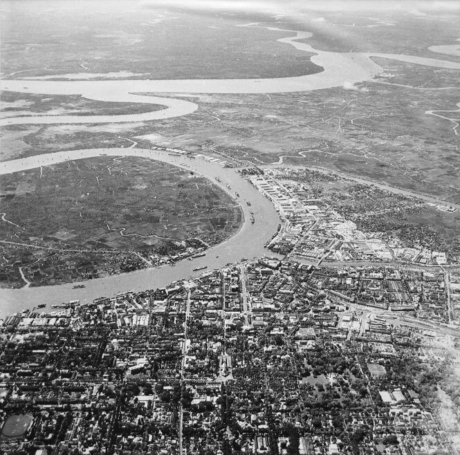
Start with the water, because the city did. The city sits in the lower basin of the Đồng Nai and Saigon rivers, between the old terraces of the southeast and the young, wet soils of the Mekong Delta, and the land tilts toward the sea. The northern edge, out toward Củ Chi and the former Bình Dương province, sits 10 to 25 meters above sea level; the old center is around 5 meters; the south and southwest fall to a meter or less, and the lowest point is half a meter above sea level.
The Saigon River and the port
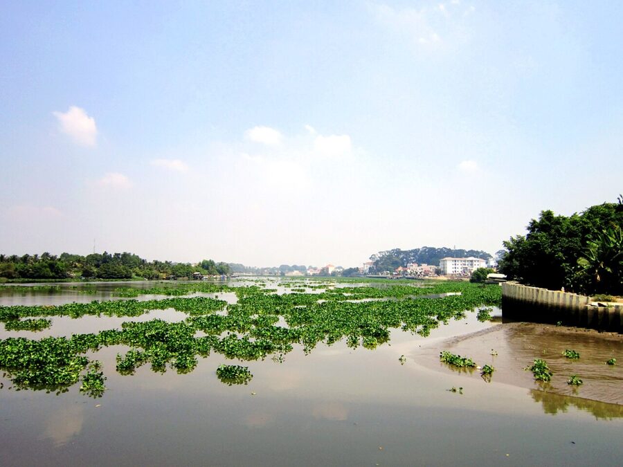
The Saigon River rises in the hills of Bình Phước and runs for more than 200 kilometers, past Thủ Dầu Một, which has been part of Ho Chi Minh City since July 2025. Through the center it is roughly 225 to 370 meters wide and up to 20 meters deep, brown with silt and tidal: clumps of water hyacinth ride upstream on the flood and back down on the ebb. Below the city it joins the Đồng Nai to form the Nhà Bè River, which reaches the sea through two main mouths, the Soài Rạp and the Gành Rái. The Gành Rái is the shipping channel that brings ocean-going vessels up past Cần Giờ.
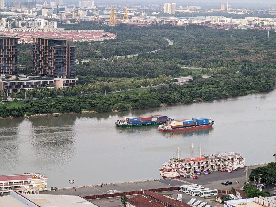
For a visitor the river is mostly a view from a bench on Bạch Đằng wharf, at the foot of Hàm Nghi street. The Saigon Waterbus runs upstream from a terminal there, about 30 trips on an ordinary day in September 2026. Since August 2026 an open-deck sightseeing boat has also run a 45-minute loop from Bạch Đằng past Nhà Rồng wharf, Khánh Hội and Ba Son between 3:30pm and 10:30pm.

The canals
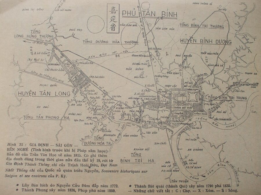
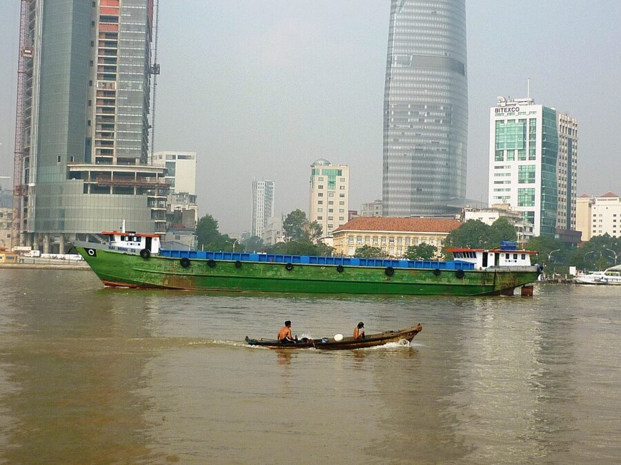
Saigon grew along creeks as much as along the river. The Bến Nghé creek, which gave the old central ward its name, separates the old District 1 from District 4 and continues west as the Tàu Hủ canal toward Chợ Lớn; in the nineteenth century delta rice came up it by junk to the Chinese warehouses. Farther south run the Kênh Tẻ and Kênh Đôi, still busy with barges heading for the Mekong provinces. To the north, the Nhiêu Lộc-Thị Nghè canal loops around the old District 3 and Phú Nhuận to meet the river near the zoo.
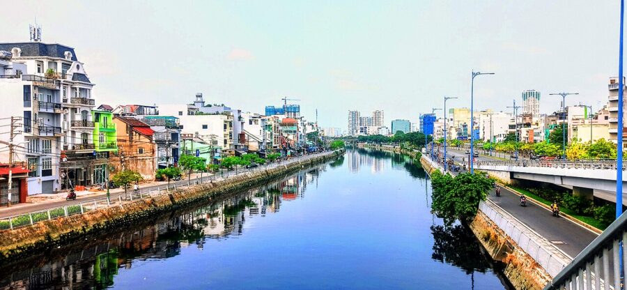

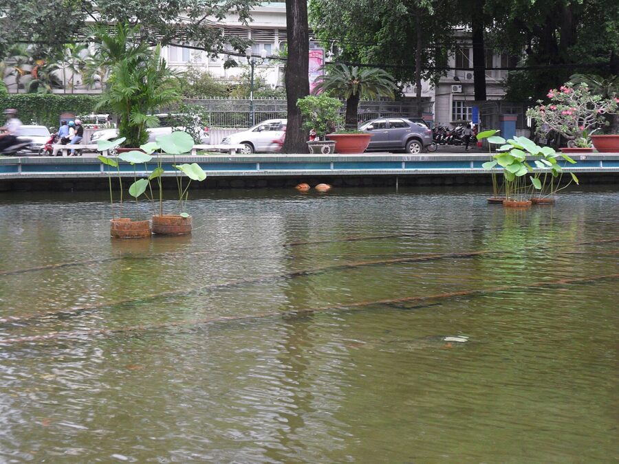
The Nhiêu Lộc-Thị Nghè is the canal you are most likely to walk beside. For decades its banks were stilt houses over black water; a long clean-up replaced them with tree-lined roads and paths, busy with joggers in the evening.

Low ground, high tides
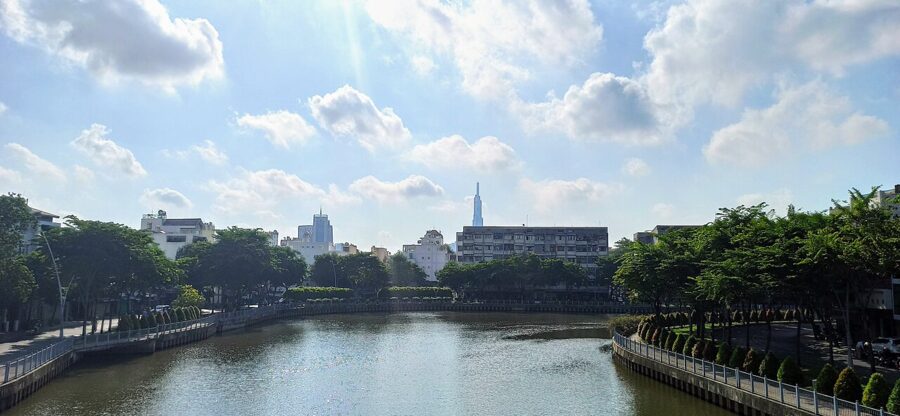
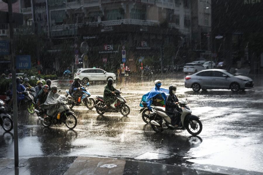
Being low and tidal has a cost. In the rainy season, roughly May to November, a heavy storm at high tide can leave streets in the south and along the canals under water for an hour or two. The highest tides of the year come late in the season, around October and November. Land subsidence makes it worse, and planners estimate that a once-in-a-century flood would cover close to a quarter of the old city area.
Storms are usually short and mornings clear, so walk early and wait out a downpour under an awning. The Ho Chi Minh City weather guide has the month-by-month detail.
Cần Giờ and the mangroves
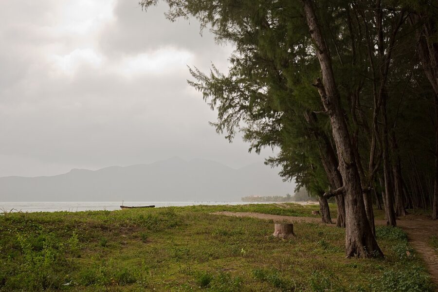
The city’s wilderness lies to the southeast, where the rivers fan out to the sea. Cần Giờ was a rich mangrove forest until herbicide and bombing left much of it dead during the war. Replanting began in 1979, largely by the city’s youth volunteer brigades, and in January 2000 UNESCO recognized Cần Giờ as Vietnam’s first biosphere reserve. The reserve covers about 75,740 hectares, with a strictly protected core of 4,721 hectares, and holds more than 150 plant species.
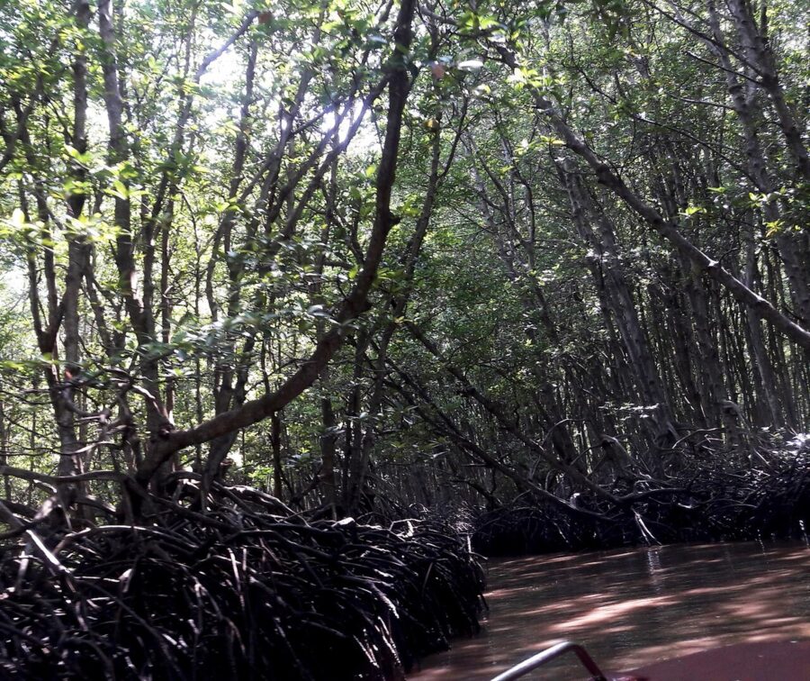

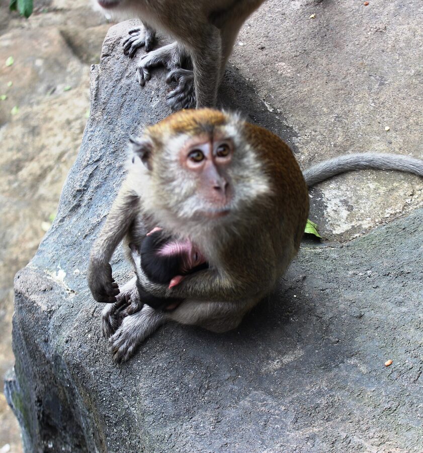
Most visitors go for the long-tailed macaques at the monkey island, the boardwalks and watchtower at Vàm Sát, and seafood at the beach in Cần Giờ commune. During the war the forest was also the base of the Rừng Sác special forces regiment, and its reconstructed base is a sober counterweight to the monkeys.

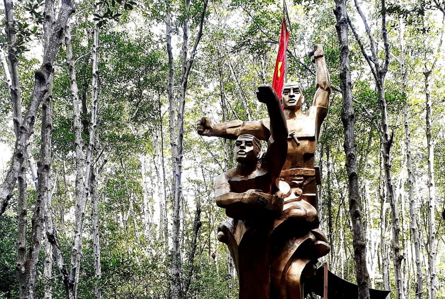

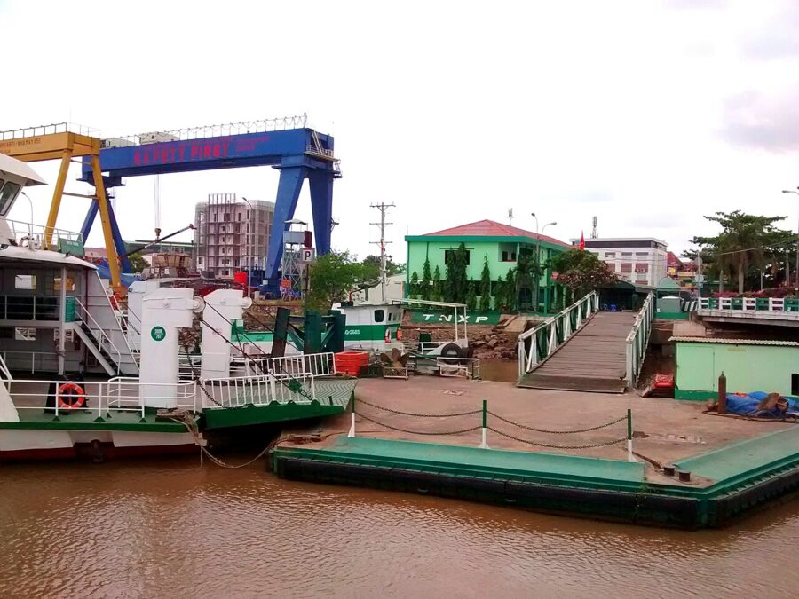
Cần Giờ has no road bridge to the rest of the city, so traffic crosses on the Bình Khánh ferry. A bridge was ceremonially started in January 2026, but news reports since have pushed back the main works and opening is not expected before the end of the decade. Allow an hour and a half to two hours each way from the center by car, more on weekends.

To the sea: Vũng Tàu, Bình Dương and Côn Đảo
On 12 June 2025 the National Assembly merged Bà Rịa-Vũng Tàu and Bình Dương provinces into Ho Chi Minh City, effective 1 July. The new city covers 6,772.59 square kilometers, more than three times its old area, and runs from Minh Thạnh commune in the north to Bình Châu on the eastern coast, the beaches of Vũng Tàu and the islands of Côn Đảo.
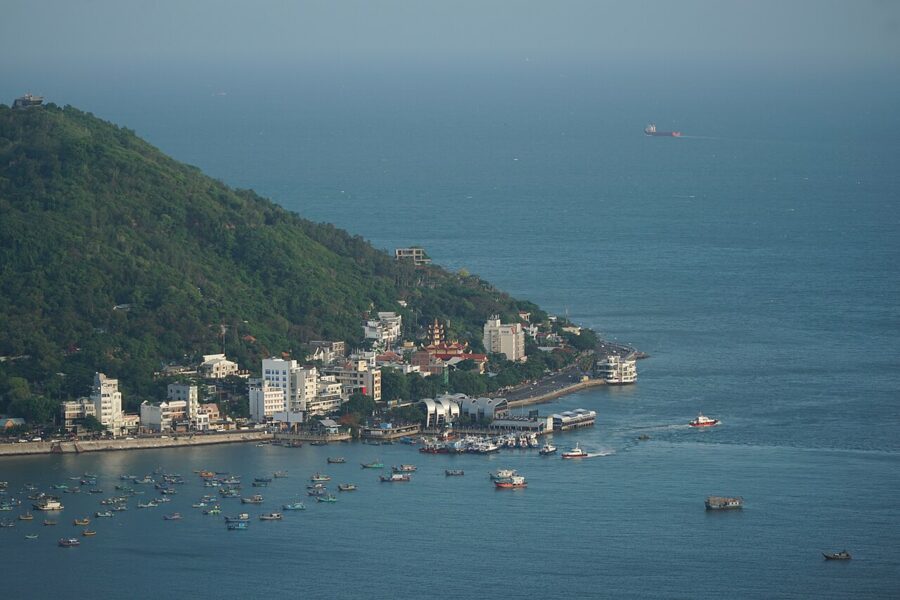

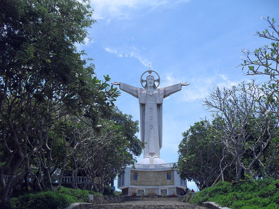
Vũng Tàu, the French Cap Saint-Jacques, is the city’s beach: about two hours by road from the center, with seafood, a lighthouse and a giant statue of Christ on the smaller hill, Núi Nhỏ, whose arms you can climb up into. A car ferry also crosses the bay from Cần Giờ in about half an hour, which makes a loop possible. The fast boat that once ran from Bạch Đằng wharf was suspended in May 2025 to clear the wharf for bridge works, and no restart had been announced in the latest reports, so check before you plan around it.

Bình Dương, to the north, brings in Thủ Dầu Một and a belt of factories and new towns. Côn Đảo is something else again: an archipelago far out in the South China Sea, now a special administrative zone of the city, with a national park, turtle-nesting beaches and the prisons the French began building in the 1860s. Reaching it means a flight or a long fast-boat crossing, not a day trip.


Fourteen million people, give or take
How many people live here depends on who is counting. The documents for the 2025 merger gave the new city 14,002,598 people, the largest population of any province or city in Vietnam. In July 2026 the head of the city’s population office put the figure for the end of 2025 at a little over 13.8 million. The old city alone counted 9,966,166 at the end of 2024, and the real number on any night is higher, because many migrants never register.
The growth is recent: Saigon proper had 123,890 people in 1929, about 12,100 of them French. By 1967 the city had passed 1.48 million, swollen by refugees from the countryside during the war. Figures for 1975 range from 2.5 to 3.5 million depending on the boundary, and since then the city has added roughly a million people every five years.
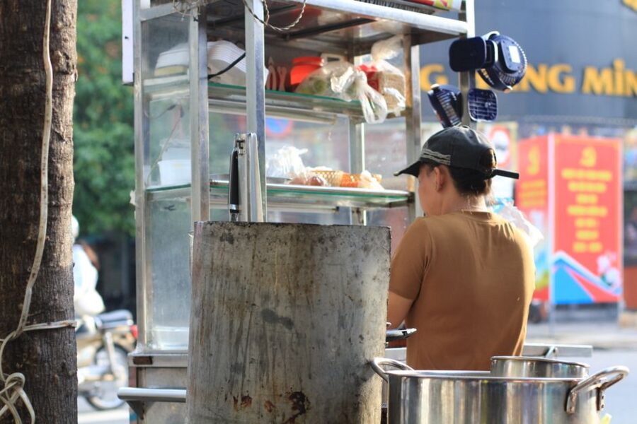
Most of that growth is migration. The city takes in at least 200,000 to 400,000 people from other provinces every year, most of them in their twenties and thirties. More are women than men, giving the city the lowest sex ratio in the country, about 95 men to 100 women in 2019. Its own residents have few children: the fertility rate was 1.51 per woman in 2025, among the lowest in Vietnam.
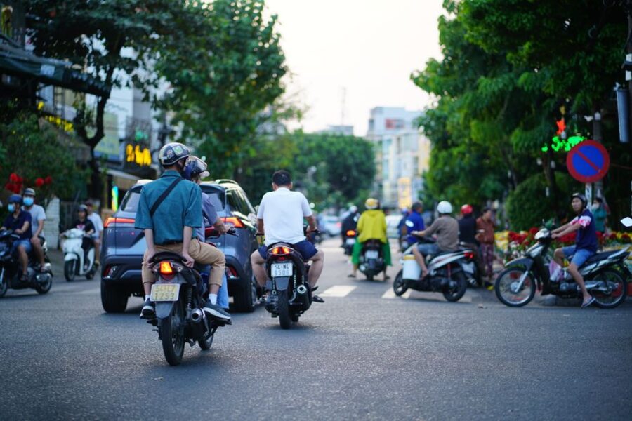
You feel the result on the street. Saigon is young and comes from somewhere else, and on the first days of Tết, when the migrants go home, the city empties.
The Hoa of Chợ Lớn
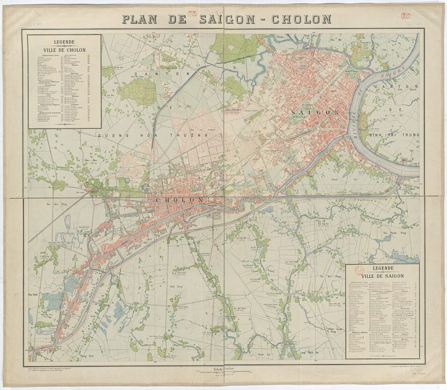
The largest minority are the Hoa, Vietnam’s ethnic Chinese, at a little over 412,000 in city figures from 2021, concentrated in the old Districts 5, 6 and 11. Their town, Chợ Lớn, the “big market”, grew up in the late eighteenth century a few kilometers west of Saigon, and for most of its history was a separate city with its own rice mills and guild halls. In 1931 the French joined the two as Saigon-Cholon.
The Hoa came in groups, by dialect and home region, and each built its own assembly hall: the Cantonese, the Teochew, the Hokkien, the Hainanese and the Hakka. The halls still anchor Chợ Lớn. The best known is the Cantonese community’s Tuệ Thành hall on Nguyễn Trãi, better known as the Thiên Hậu Pagoda after the sea goddess it honors; the Teochew hall, Nghĩa An, stands a hundred meters away.
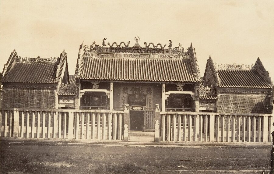
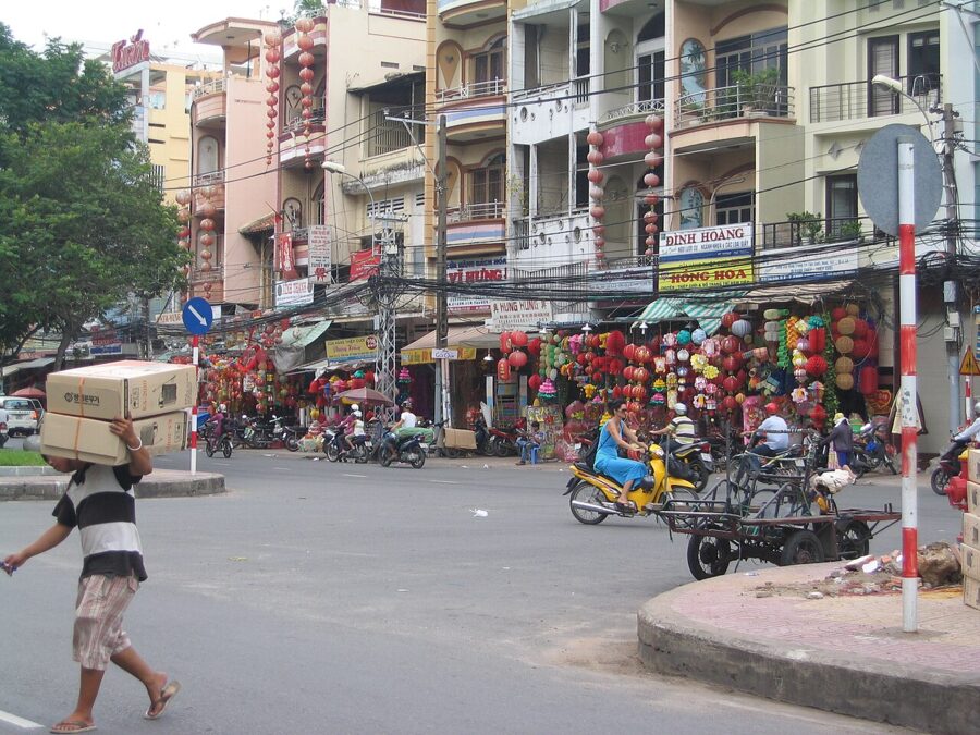

Khmer, Cham and newer communities
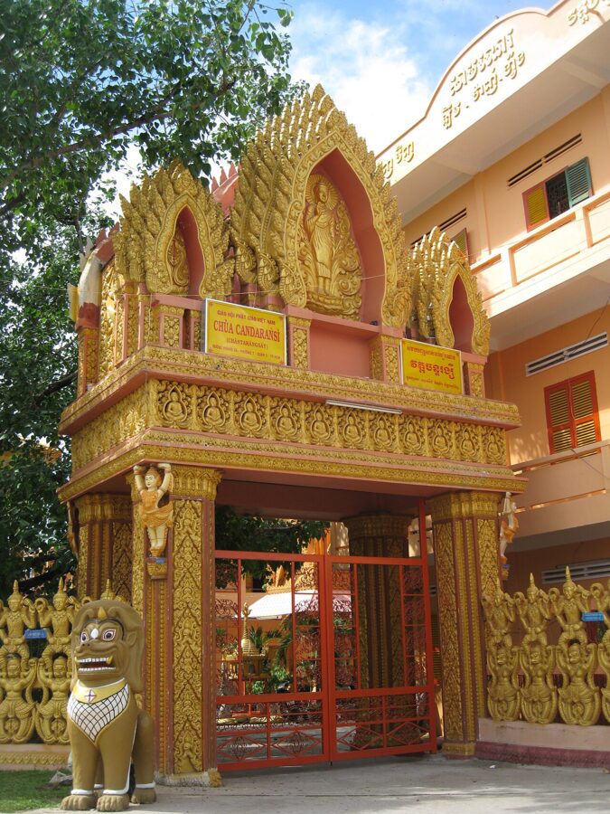
Long before the Vietnamese or the Chinese, this was Khmer country, and the city still has a Khmer community of more than 50,000, many of them from the Mekong provinces. Their best-known temple is Chantarangsay, a Theravāda pagoda founded in 1946 by a monk from Sóc Trăng for Khmer people who had fled the fighting in the countryside. It stands on Trần Quốc Thảo street in the old District 3, beside the Nhiêu Lộc canal, its main hall finished in 1953.

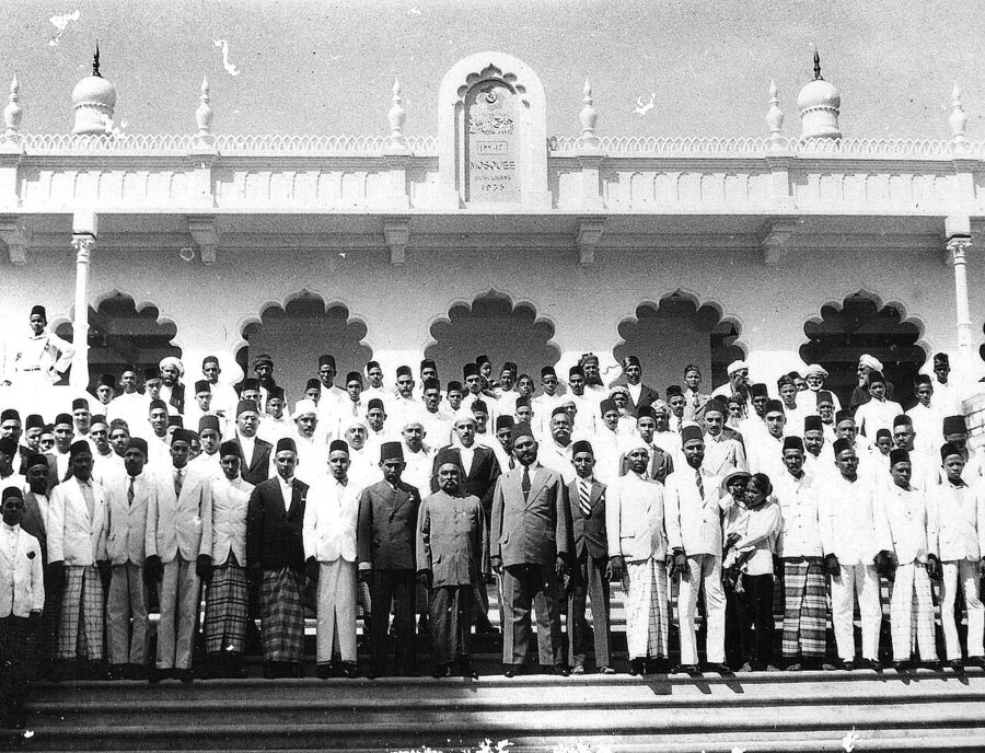
The Cham, Vietnam’s Muslim minority, number more than 10,000 in the city. Islam here has a second root too. The Saigon Central Mosque on Đông Du street, a short walk from the Opera House, was completed in 1935 by South Indian Muslims who had come to the colony as traders. Its whitewashed courtyard is open to respectful visitors outside prayer times.
Newer communities left their mark too. The streets around Lê Thánh Tôn and Thái Văn Lung became a Japanese quarter of izakaya and noodle bars, and Phú Mỹ Hưng, the planned town in the old District 7, had more than 30,000 residents by 2018, over half of them foreign, mostly from Korea, Japan and Taiwan. Religious life is mixed: city figures for 2025 counted about 1.6 million Buddhists, more than 640,000 Catholics, and smaller communities of Protestants, followers of Cao Đài and Muslims, while many families keep ancestor altars without claiming any religion at all.
Districts, wards and the new addresses
Until 30 June 2025, Ho Chi Minh City had three layers of government: the city, then 22 district-level units (16 urban districts, the city of Thủ Đức and five rural districts), then the wards and communes. On 1 July 2025 the district level was abolished across Vietnam, and the city’s small wards and communes were merged into larger ones under a resolution of the National Assembly’s Standing Committee dated 16 June 2025. With Bình Dương and Bà Rịa-Vũng Tàu folded in, the city now has 168 commune-level units: 113 wards (phường), 54 rural communes (xã) and one special zone, Côn Đảo.
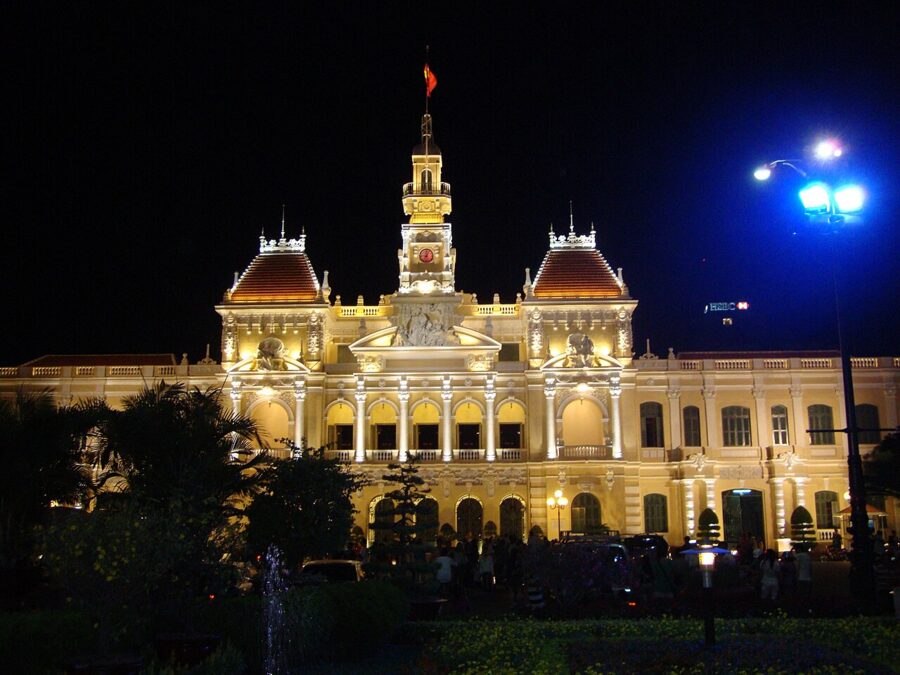

The map has not quite settled. In August 2026 the city council approved a plan to turn 29 communes (Củ Chi, Hóc Môn, Nhà Bè and Cần Giờ among them) into wards, which would give 142 wards and 25 communes. That still needed national approval at the time of the latest reports, so you may see either set of figures.
How addresses work now
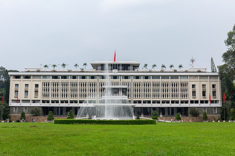
A current address has three parts: the house number and street, the ward, and the city. The Reunification Hall is at 135 Nam Kỳ Khởi Nghĩa, Bến Thành ward; the post office is at 2 Công xã Paris, Sài Gòn ward. Street names and house numbers did not change. What disappeared is the “Quận 1” or “District 3” that used to sit between ward and city.
In practice nobody has stopped saying District 1. Taxi drivers, hotel staff, menus and nearly every sign still use the old district names, and so will most people you ask for directions. When you book a Grab or Be ride, type the name of the place, not the ward, and the app will find it. The table below matches the old names visitors meet most with the new wards that replaced them.
| What people still say | Old units | Ward since July 2025 |
|---|---|---|
| District 1, around the Opera House, cathedral and Nguyễn Huệ | Bến Nghé, plus parts of Đa Kao and Nguyễn Thái Bình | Sài Gòn |
| District 1, the market, the palace and the backpacker streets | Bến Thành, Phạm Ngũ Lão, part of Cầu Ông Lãnh, rest of Nguyễn Thái Bình | Bến Thành |
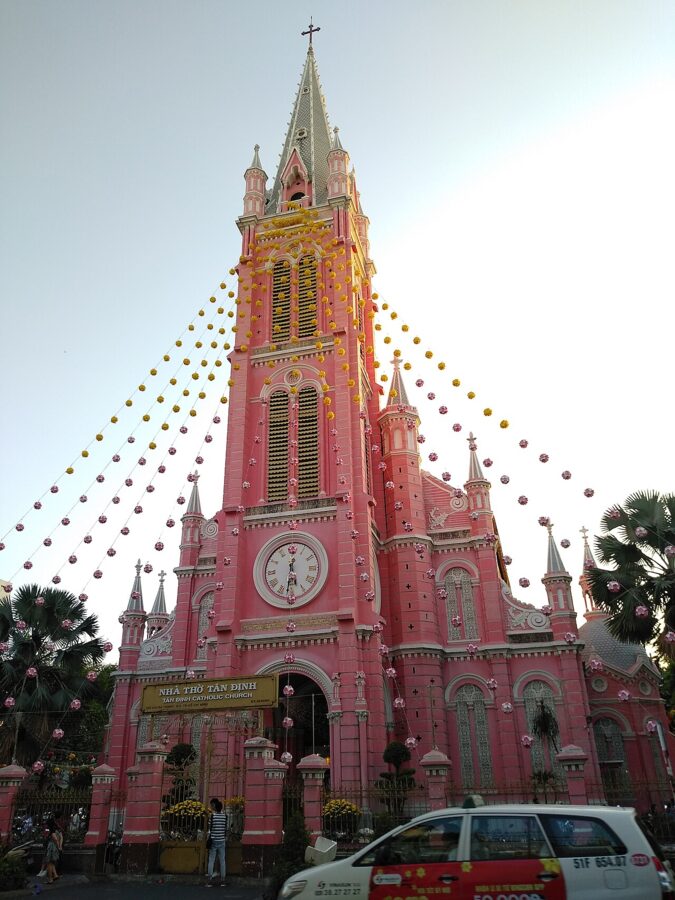
| District 1, north end | Tân Định, rest of Đa Kao | Tân Định |
| District 1, south end by the Bến Nghé creek | Nguyễn Cư Trinh, Cầu Kho, Cô Giang, rest of Cầu Ông Lãnh | Cầu Ông Lãnh |
| District 3 | Võ Thị Sáu and part of Ward 4; Wards 1, 2, 3, 5 and part of 4; Wards 9, 11, 12, 14 | Xuân Hòa; Bàn Cờ; Nhiêu Lộc |
| District 4 | The old numbered wards, regrouped | Vĩnh Hội, Khánh Hội, Xóm Chiếu |
| District 5, Chợ Lớn | Wards 11 to 14; Wards 5, 7, 9; Wards 1, 2, 4 | Chợ Lớn; An Đông; Chợ Quán |
| District 6, around Bình Tây Market | Wards 2 and 9 | Bình Tây |
| Thảo Điền and Thủ Thiêm (District 2, later Thủ Đức city) | Thảo Điền, An Khánh, Thủ Thiêm, An Lợi Đông, part of An Phú | An Khánh |
| Vũng Tàu town center | Wards 1 to 5, Thắng Nhì, Thắng Tam | Vũng Tàu |
| Cần Giờ beach town | Long Hòa commune, Cần Thạnh township | Cần Giờ (commune) |
Two traps catch newcomers. “Chợ Lớn” is now both the name of the old Chinese quarter and of one ward within it, which does not include Bình Tây Market; and “Sài Gòn” on an address now means one central ward, not the whole city. If a ward name looks unfamiliar, ask for the old district, and you will usually get a smile and an answer.
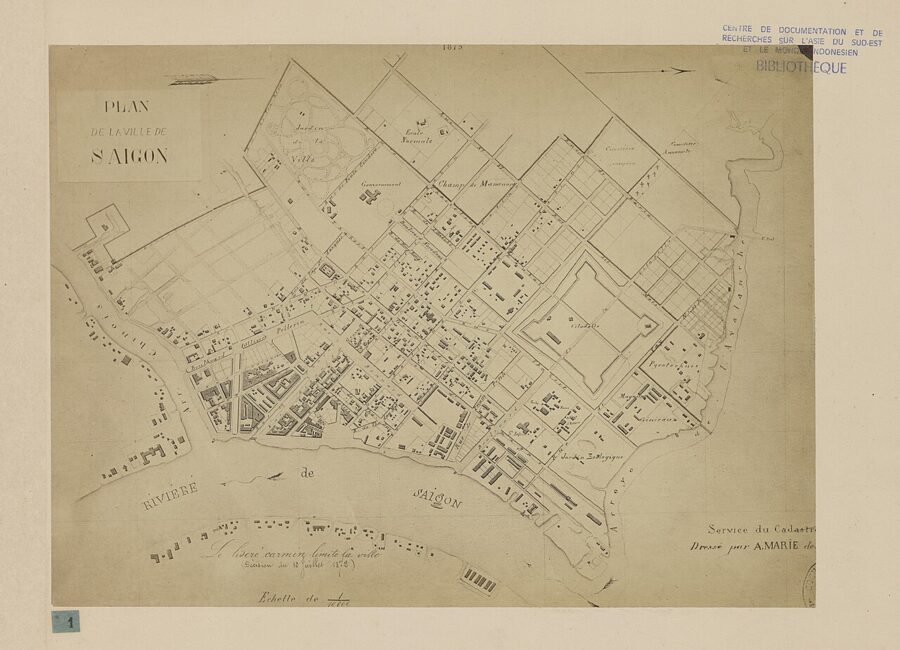
The neighborhoods you will actually use
Most first visits happen in a small part of this enormous city: the old District 1 and its neighbors, plus a trip west to Chợ Lớn and one across the river.
The old District 1: Sài Gòn and Bến Thành wards
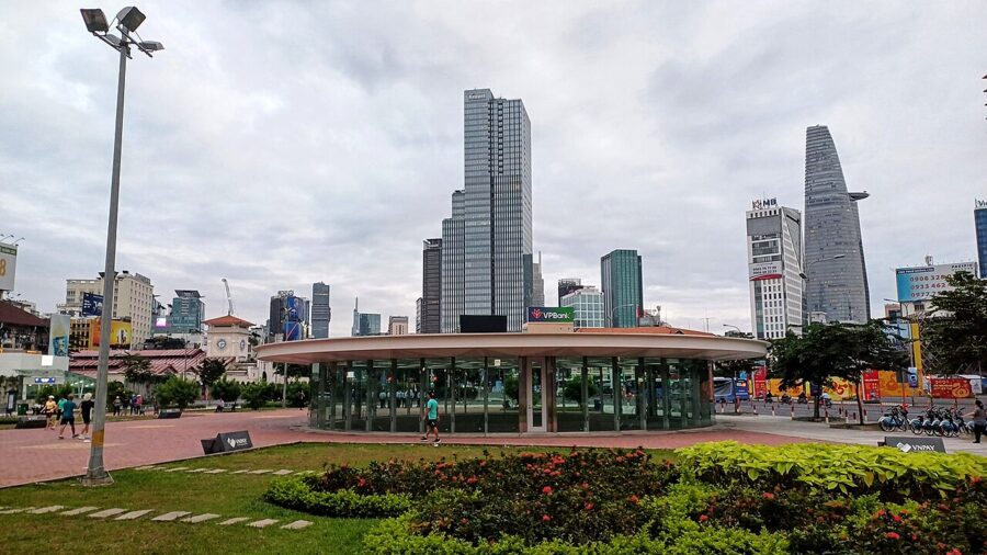
The colonial core, now Sài Gòn ward, runs from the river up Nguyễn Huệ and Đồng Khởi streets. Nguyễn Huệ is a pedestrian boulevard from the People’s Committee building down to the river, crowded with families after dark and the main stage for Tết flowers and New Year’s Eve.
Around it stand the Municipal Theatre, the Central Post Office and Notre-Dame Cathedral. The cathedral has been under restoration since 2017, and as of November 2026 the parish lets people in only for Mass. The Museum of Vietnamese History sits at the far end of Lê Duẩn by the zoo.
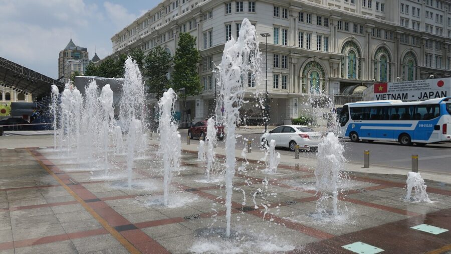

Down by the river a footbridge is going up from Bạch Đằng to the Thủ Thiêm riverside park. Its steel arch was joined over the water on 21 October 2026, and the city expects to open it around Tết 2027. Until then the river walk at Bạch Đằng is a good place to sit at dusk.
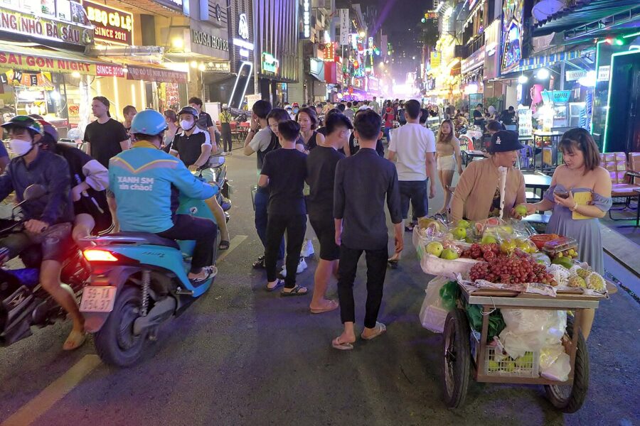
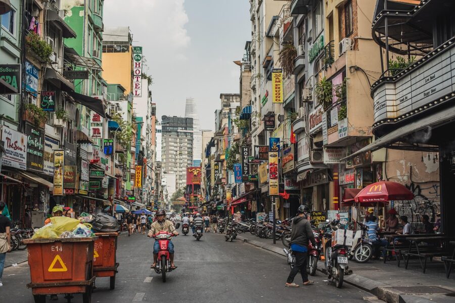
Bến Thành ward, to the west, covers Bến Thành Market, the Reunification Hall, Tao Đàn park and the Fine Arts Museum. It also took in the old Phạm Ngũ Lão ward, home to Bùi Viện street, the backpacker strip of bars and cheap rooms. Bùi Viện is loud until the small hours, especially at weekends.

District 3
Cross Cách Mạng Tháng Tám and the streets change: shaded lanes, French villas turned into cafés and consulates, apartment blocks from the 1960s. District 3 is where many Saigonese of means lived before 1975, and it is still quieter than the center while staying within walking distance of it. The War Remnants Museum stands on Võ Văn Tần street, just inside the old district line.

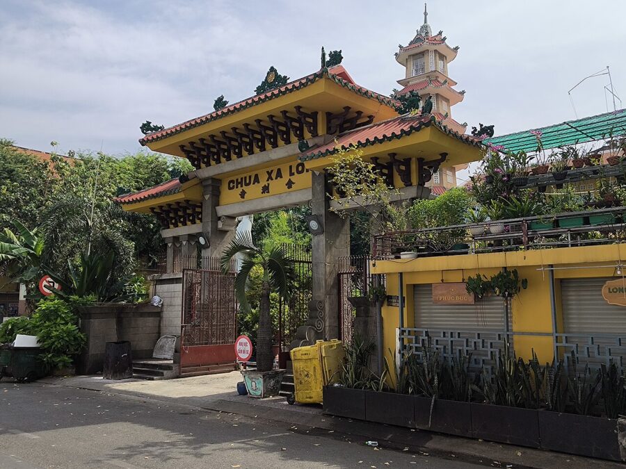
Two of the city’s most important Buddhist temples are here. Xá Lợi Pagoda was the center of the Buddhist protests against Ngô Đình Diệm’s government in 1963, and Vĩnh Nghiêm Pagoda on Nam Kỳ Khởi Nghĩa, with its tall tower, was built for the northern Buddhists who came south after 1954. Between them lies the Con Rùa (Turtle Lake) roundabout, a meeting place for students at night.


Chợ Lớn
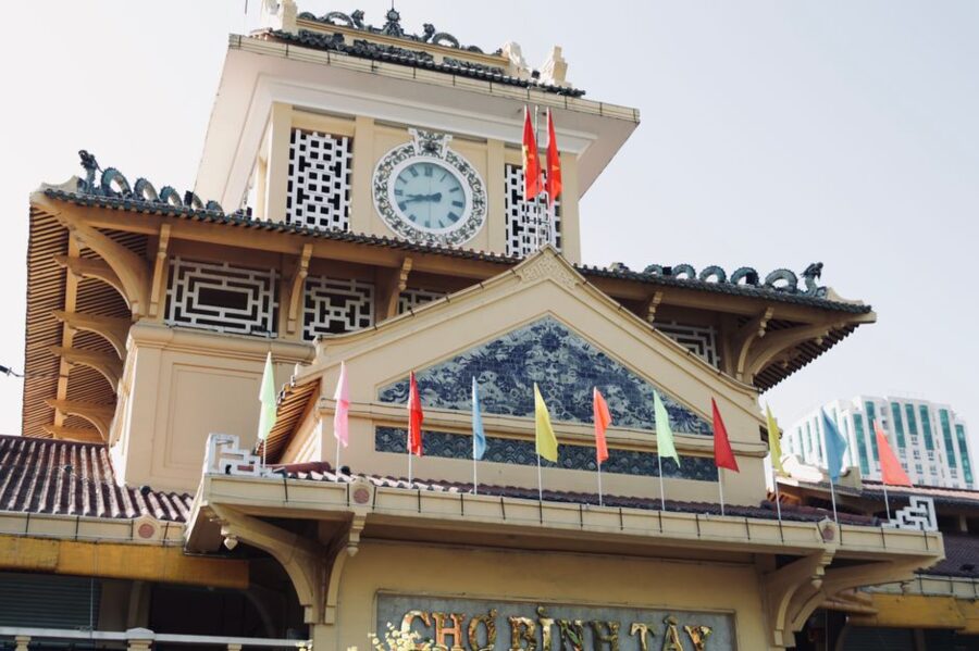
Chợ Lớn is a twenty- to thirty-minute Grab ride west of Bến Thành, and it feels like a different city. The trades cluster by street (herbs on Hải Thượng Lãn Ông, cloth on Trần Hưng Đạo), the assembly halls smell of incense coils, and the wholesale Bình Tây Market, restored between 2016 and 2018, still supplies small shops across the south. Metro Line 1 does not reach it, so go by Grab or Be, or by city bus if you can confirm the route that day.
District 4
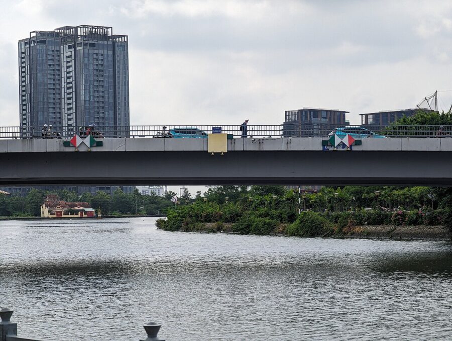
Across the Bến Nghé creek from the center, District 4 was for decades the port quarter of Khánh Hội, a place of warehouses, dockers and a reputation for gangs. It has calmed and filled with apartment towers, but it keeps an older street life, and after dark it is one of the best places in the city to eat. Vĩnh Khánh street, the “snail street”, fills its pavement from dusk with stalls selling snails, clams and grilled seafood, and it draws crowds of locals and visitors alike.
Thảo Điền, Thủ Thiêm and the east bank
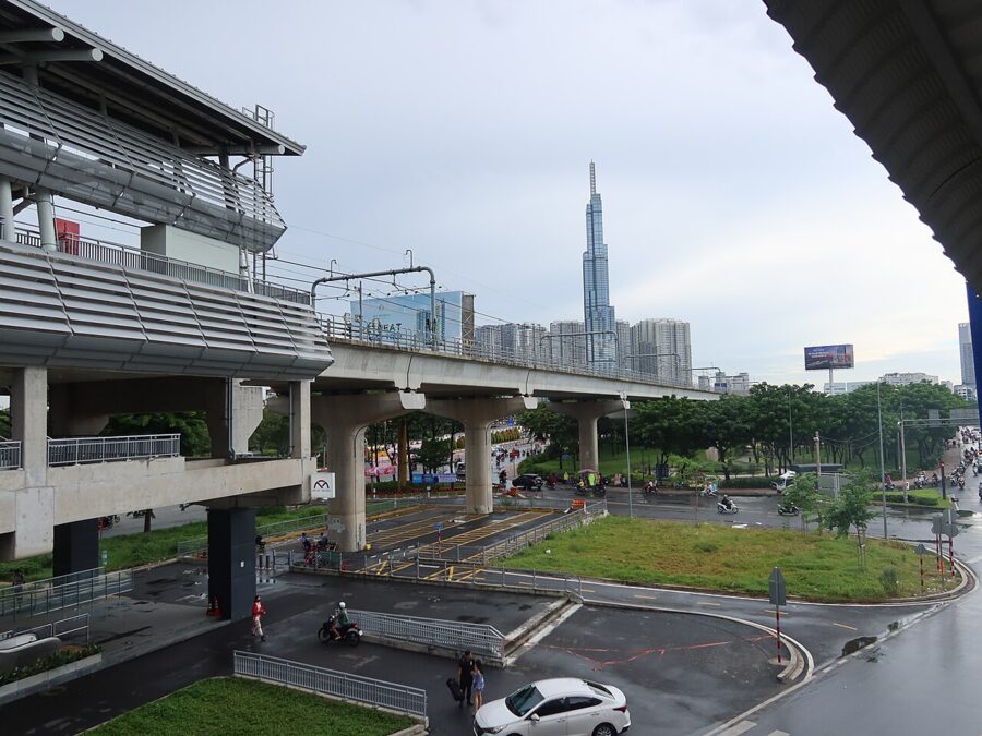
Across the river, Thảo Điền is the leafy peninsula where many foreign residents live: villas, international schools, riverside cafés, bakeries and wine bars. Since July 2025 it has been part of An Khánh ward, along with Thủ Thiêm, the new town rising on the old marsh opposite the center. Thảo Điền has its own station on Metro Line 1, which makes it practical as a base even though it is not walkable to the sights.


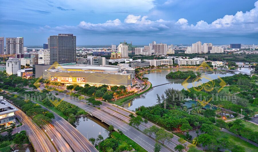
Farther south, Phú Mỹ Hưng in the old District 7 is a planned town of wide boulevards, malls and Korean restaurants, comfortable for families on long stays but a taxi ride from anything historic.

Where to stay, by kind of trip
Hotels change hands and names often, so the area matters more than the building. A few rules of thumb by kind of trip:
A first visit of three or four days: stay in the old District 1, in Sài Gòn ward or the eastern half of Bến Thành ward. You can walk to the market, the palace, the post office and the river, and you are minutes from the Bến Thành and Opera House metro stations. Rooms on the main boulevards cost more; a side street is usually quieter.
On a budget, or for nightlife: the old Phạm Ngũ Lão area has the cheapest beds and the most bars, with the nightclubs in Ho Chi Minh City a short walk away. Choose a room in a lane off Bùi Viện rather than on it, and ask for a room at the back.
A longer or slower stay: the old District 3 puts you among cafés, pagodas and ordinary city life, within a twenty-minute walk of the center. It has fewer big hotels and more small guesthouses and serviced apartments.
Families and long stays: Thảo Điền has space, greenery, international supermarkets and the metro, at the cost of a ride to the sights. Phú Mỹ Hưng is calmer still but has no metro.
Food first: stay at the southern end of the old District 1, near the Bến Nghé creek, and you are one bridge from District 4’s night stalls and a short ride from Chợ Lớn. The restaurants in Ho Chi Minh City guide covers where to eat.
A Grab from Tân Sơn Nhất airport reaches any of these areas easily outside rush hour; getting to Ho Chi Minh City has the options. The guides to banking and currency in Vietnam and to hospitals in Ho Chi Minh City are worth a glance before you land.
The first three days
The plan below keeps each day in one part of the city, so you spend your time in places rather than in traffic. Hours and prices are as of November 2026; check again if your trip is months away.
Day one: the center on foot
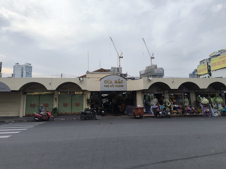
Start at Bến Thành Market at 7am, when the hall opens and the clothing aisles are still half asleep; the fresh food section has been running since 4am. The market keeps 7am to 10pm and costs nothing to enter. From the market it is a fifteen-minute walk to the Reunification Hall, open daily from 7am to 6pm; the palace alone costs 40,000₫ (about US$1.50), or 80,000₫ (about US$3) with the exhibition on the colonial Norodom Palace.

From the palace it is a ten-minute walk to the War Remnants Museum, open 7:30am to 5:30pm daily with the ticket counter closing at 5pm. Since 1 October 2026 a ticket costs 60,000₫ (about US$2.30). It is hard going; most people need an hour and a half and a quiet lunch afterward.
In the afternoon, walk down Lê Duẩn, the boulevard that runs from the palace gates to the cathedral, to the post office, open 7am to 7pm on weekdays, 7am to 6pm on Saturdays and 8am to 6pm on Sundays, and to the cathedral square opposite. Cross to the Opera House as the light softens, then walk down Nguyễn Huệ to the river at dusk.
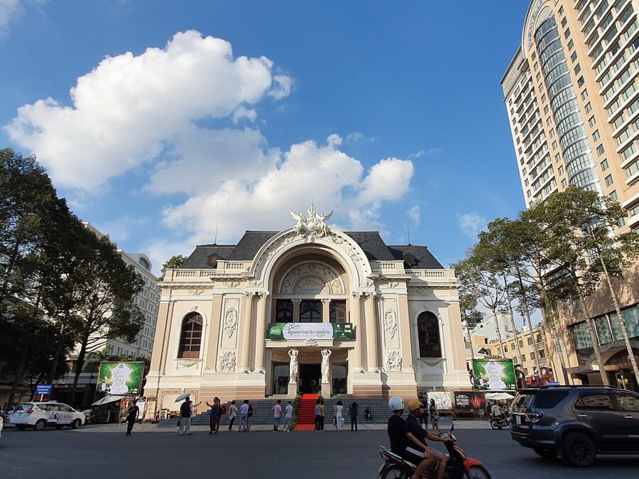

Day two: Chợ Lớn, then the pagodas and the river
Take a Grab to Chợ Lớn early. The Thiên Hậu Pagoda opens around 6:30am in listings dated 2026 and closes about 4:30pm, and the hour after opening is the most atmospheric, with incense coils smoking overhead and few visitors. From there it is a short ride to Bình Tây Market, where the wholesale trade is at its busiest in the morning. Eat in Chợ Lớn; the noodle and dumpling shops around the market are among the best value in the city.
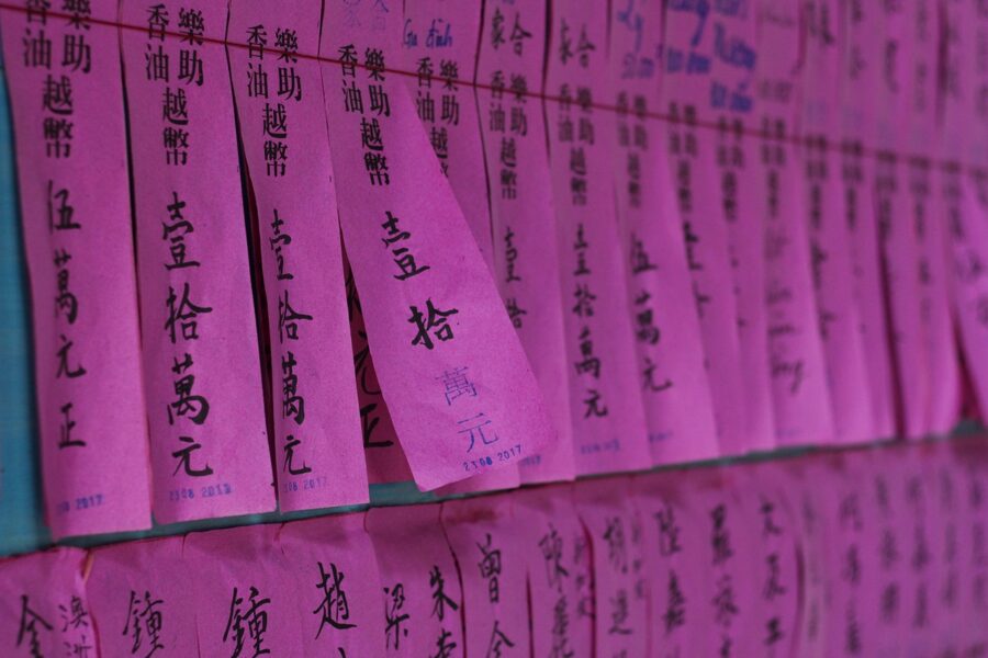
After lunch, ride back to the old District 3 for Xá Lợi and Vĩnh Nghiêm pagodas, or stay central for the Fine Arts Museum in its 1930s mansion on Phó Đức Chính street. Respect the usual temple rules: covered shoulders and knees, shoes off in the halls. The dos and don’ts guide covers the rest.
Spend the evening by the water. The waterbus from Bạch Đằng is the cheapest way onto the river, and the sightseeing boat makes its loop from mid-afternoon into the night. Afterward, walk over Khánh Hội Bridge for dinner on Vĩnh Khánh street.
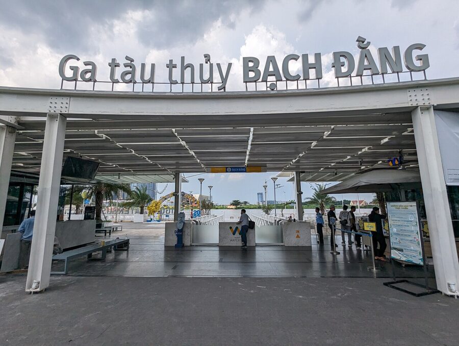
Day three: out of the city
Most people spend the third day on the Củ Chi tunnels, about two hours northwest by road. Both public sites open daily from 7am to 5pm, and foreign visitors have paid 135,000₫ (about US$5.10) since 1 February 2026, which covers admission and a guide. Leave early: the first hour is quieter and cooler than the late-morning rush.

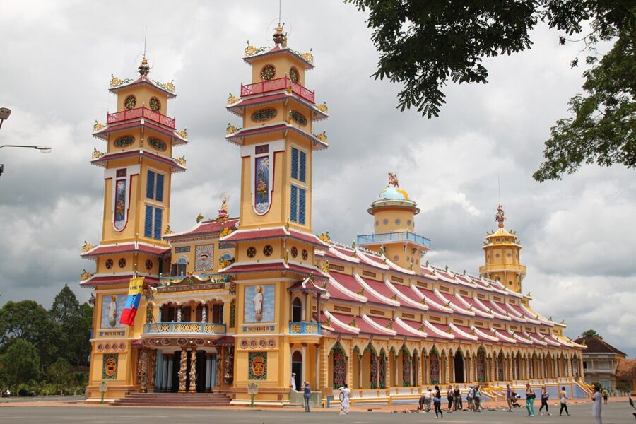
The tunnels pair well with the Cao Đài Holy See in Tây Ninh province, a long but well-worn day. For the delta, Cần Thơ and its floating market need an overnight to do properly, and An Giang province, on the Cambodian border, needs two. If you want nature rather than history, go to Cần Giờ for the mangroves, or to Vũng Tàu for a seafood lunch and an afternoon on the beach.
To stay in the city instead, spend the day on the markets (the shopping overview has the details), the Museum of Vietnamese History (Tuesday to Sunday, 8am to 11:30am and 1pm to 5pm), or a slow ride on Line 1 to Thảo Điền for coffee by the river.
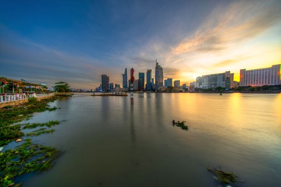
Whichever you choose, end it on the river. Take Line 1 back from Thảo Điền around sunset and sit on the side facing the water: as the train comes off the bridge and slides into the tunnel at Ba Son, the towers of the old District 1 stand black against the sunset, and then the windows go dark until Bến Thành.