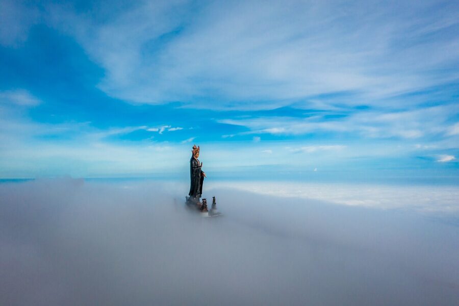
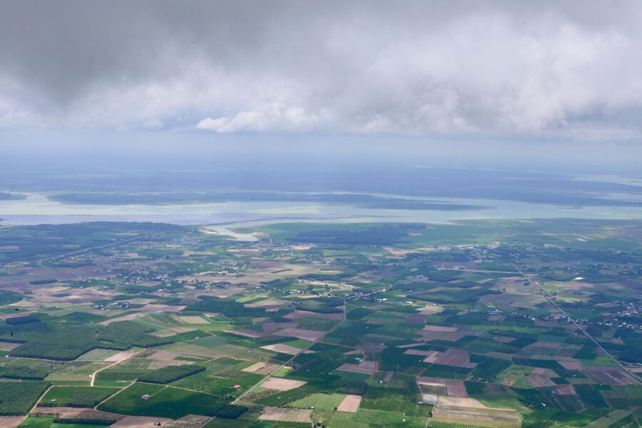
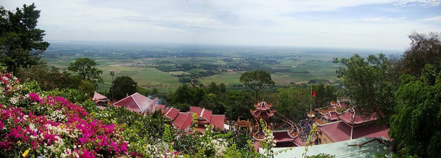
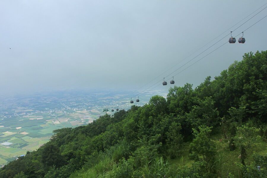
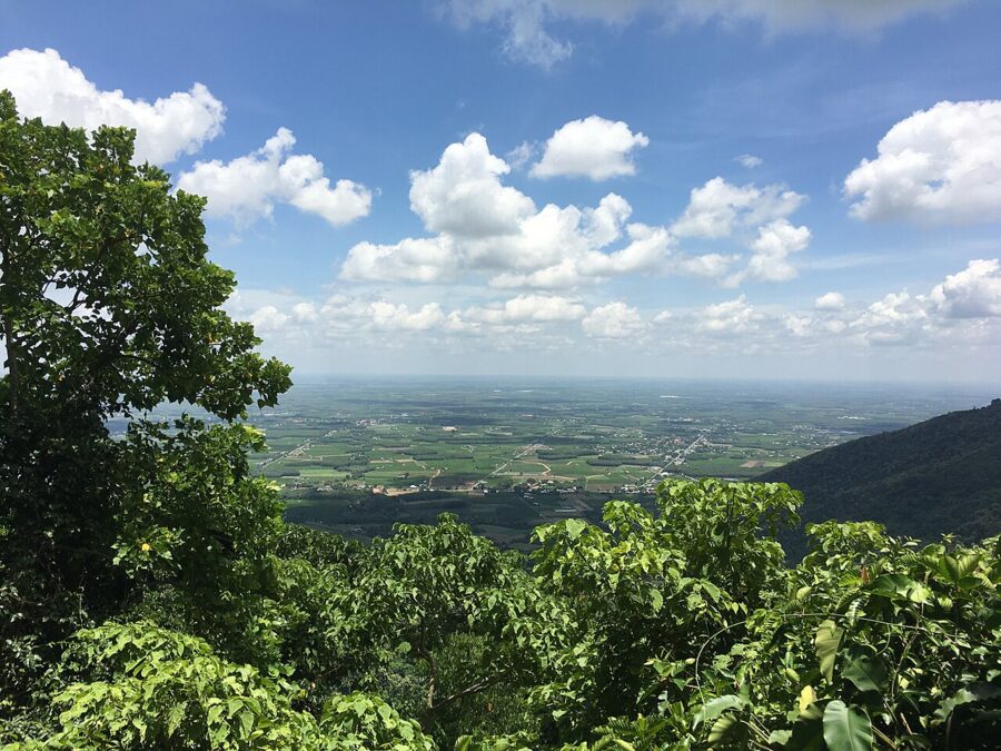
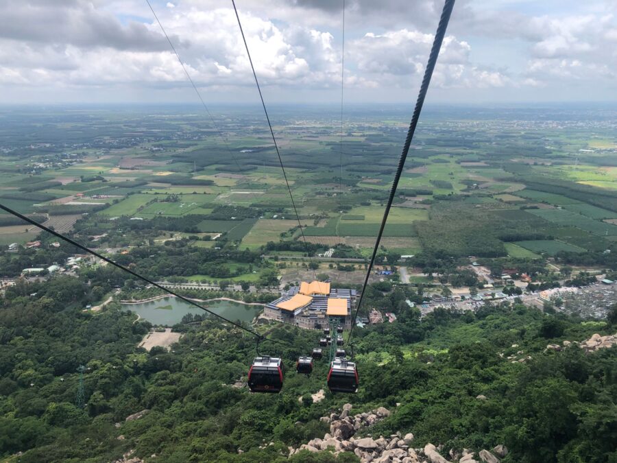
At 5:30 on a Saturday morning, the first cabins swing out of the cable-car station at the foot of Bà Đen Mountain (Núi Bà Đen) and climb into cloud. Eight minutes later they set down 986 meters up, beside a bronze Bodhisattva as tall as a twenty-story tower. Below, if the fog has lifted, the plain of Tây Ninh runs flat to the horizon: rubber, sugarcane, cassava, the glint of a reservoir, and somewhere to the west, Cambodia.
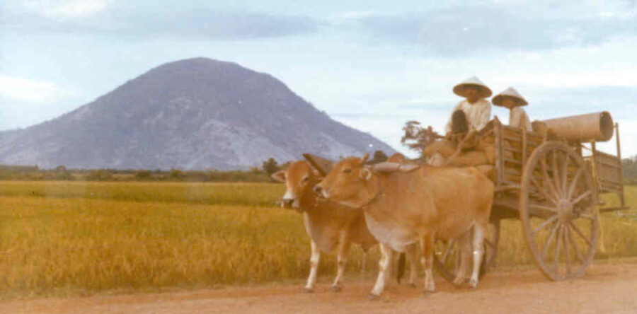
Nothing else in southern Vietnam stands up like that. The mountain rises alone from a plain about 100 km northwest of Saigon, and in the early 1800s Trịnh Hoài Đức wrote in his gazetteer of the Gia Định region that on fine days it showed faintly in the clouds from Saigon, with a golden bell said to lie hidden in a lake on its slopes.
For most people the mountain is the trip: a place of pilgrimage for at least two and a half centuries, a fortress for three armies, and since January 2020 one of Sun Group’s cable-car parks. The rest of the province is quieter and often more rewarding, with the Cao Đài Holy See, Vietnam’s largest irrigation reservoir, a border forest with storks and langurs, and a highway lined with racks of drying rice paper.
On this page
A plain, a border and one mountain
Tây Ninh lies northwest of Saigon, against the Cambodian provinces of Tbong Khmum, Svay Rieng and Prey Veng. The name dates from 1836, when Emperor Minh Mạng made the area a prefecture of Gia Định; it reads as “peace in the west”. Before that it was part of the Khmer world, and local histories give its old Khmer name as Rom Dumray, “the elephant stable”.
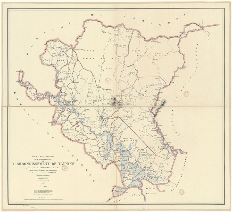
Today’s province is far larger than the one in older guidebooks. In June 2025 the National Assembly merged Long An into Tây Ninh, and from 1 July 2025 districts were abolished nationwide, so the new Tây Ninh runs from the Cambodian border to the mouth of the Soài Rạp River. Locals still say “Tây Ninh town” for the old provincial capital, now split into Tân Ninh and neighboring wards.
The northern half, the old Tây Ninh, is the part you come for: low, dry, rolling country of red soil, rubber and sugarcane, and much fought over. The Cao Đài faith, founded here in 1926, raised its own army in the 1940s, and in the American war the province was the southern end of the Hồ Chí Minh Trail.
Bà Đen Mountain
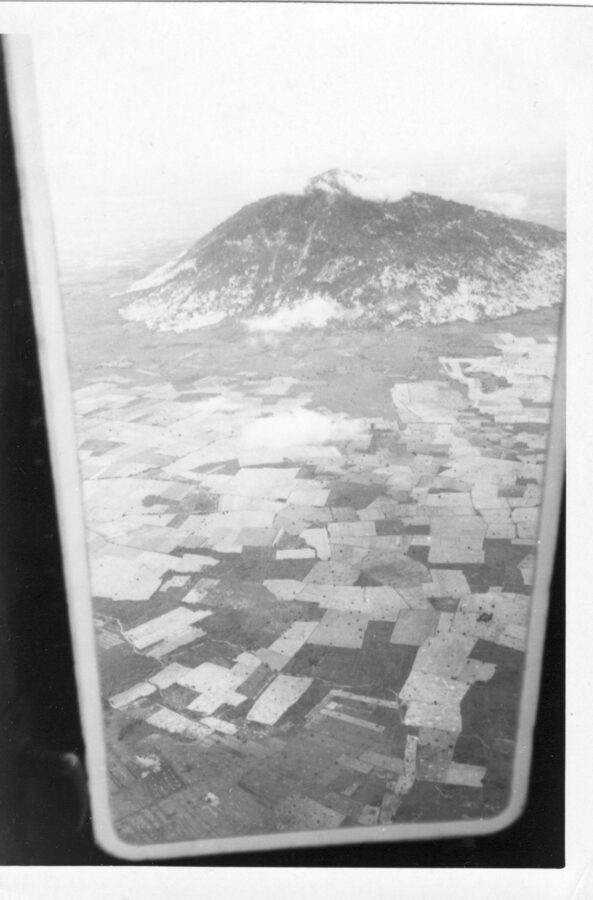
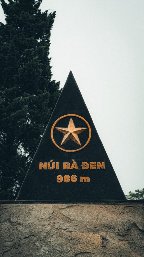
Bà Đen is the highest point in southern Vietnam, 986 meters by the official figure (some older sources say 996). It is an extinct volcano, nearly a perfect cone, its slopes heaped with basalt boulders and riddled with caves. Two lower hills share its base, Núi Phụng and Núi Heo, and the three together, about 24 square kilometers, were listed as a national historic and scenic site in January 1989.
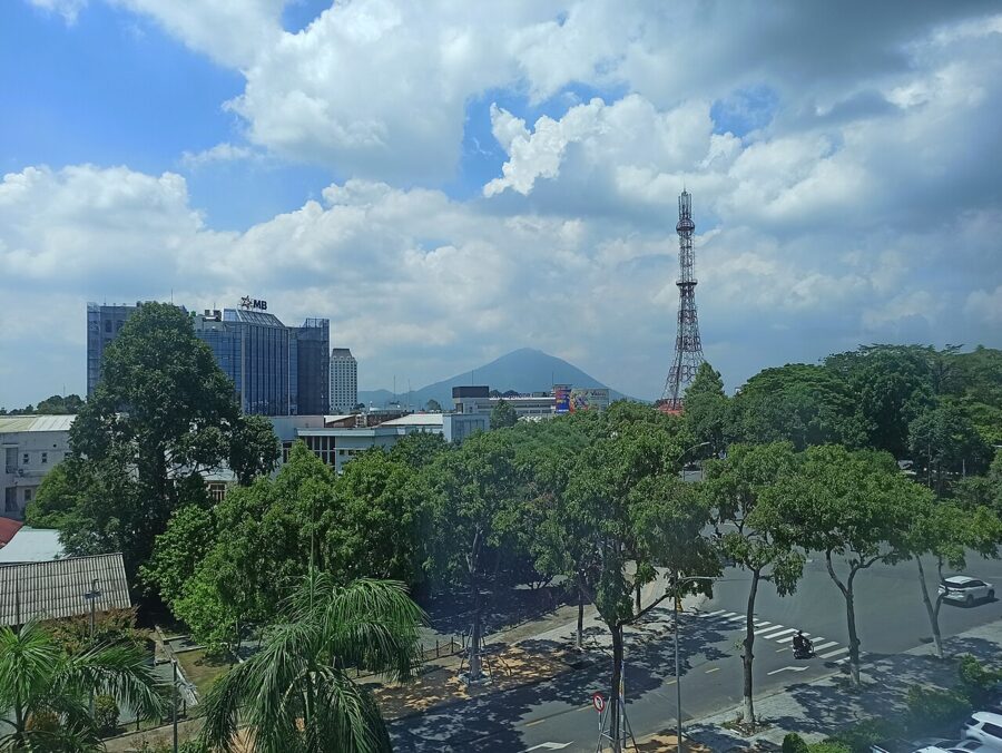
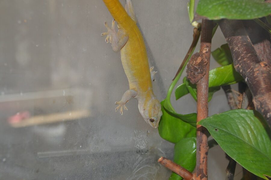
It stands in Bình Minh ward (formerly Thạnh Tân commune of Tây Ninh city), 11 km northeast of town, and a gecko found nowhere else, Gekko badenii, is named after it. By Sun World’s count more than nine in ten visitors to Tây Ninh in 2024 rode its cable cars, and the mountain recorded about 3.73 million visitors in the first ten months of 2026.

Lady Đen, and the names before her
The Gia Định gazetteer calls the mountain Bà Dinh. Village elders said its first name was simply Núi Một, “Mountain One”; from the mid-1700s it was Bà Đênh, which slid into Bà Đen, “the Black Lady”. Pilgrims also call it Núi Điện Bà, the mountain of the Lady’s shrine.
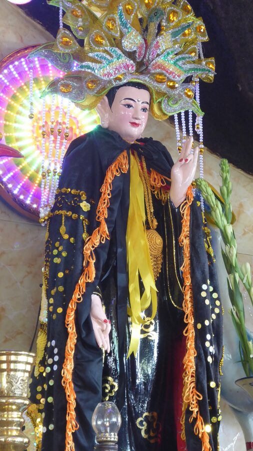
Who the Lady was depends on who tells it. The oldest version is Khmer, and speaks of a goddess, Neang Khmau, who left her footprints in the rock. The best-known Vietnamese story makes her Lý Thị Thiên Hương, a mandarin’s daughter from Trảng Bàng, promised to a young man named Lê Sĩ Triệt.
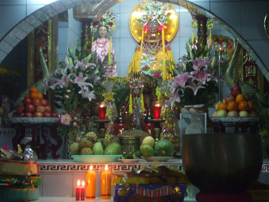
While he was away fighting the Tây Sơn, she climbed the mountain to pray, was surrounded by bandits, and threw herself into a ravine rather than be taken. She later appeared in a dream to the abbot of the pagoda with dark skin, and so became the Black Lady. Whichever story is told, she is worshipped today as Linh Sơn Thánh Mẫu, the Holy Mother of the Sacred Mountain, and her feast was listed as national intangible heritage in August 2019.

The pagodas on the slope
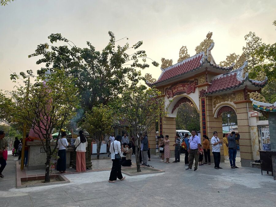
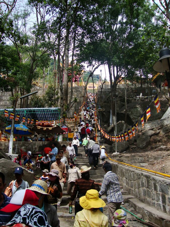
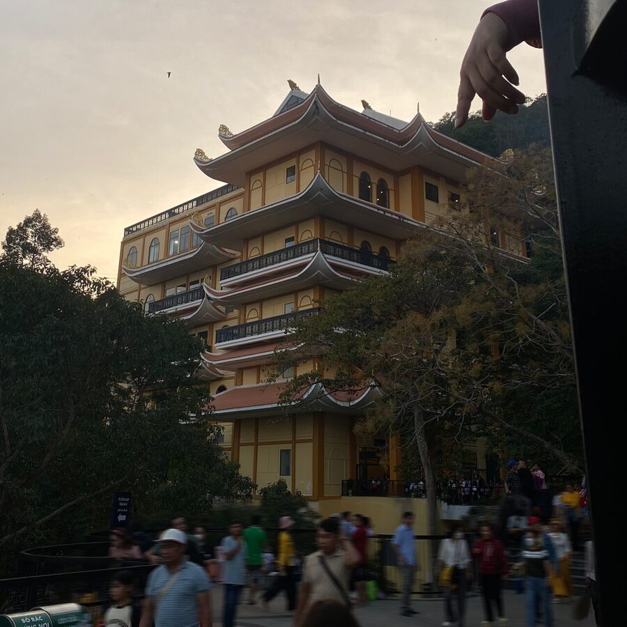
Partway up the mountain is the cluster pilgrims call Chùa Bà, the Lady’s Pagoda. Its formal name is Linh Sơn Tiên Thạch Tự, it is traditionally dated to the 18th century, and its halls have been rebuilt many times since the wars. The Lady’s shrine, Điện Bà, is the center of it, and on weekend mornings the courtyard fills with incense smoke and the rustle of red envelopes.
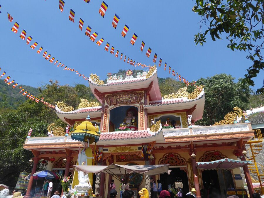

Around it are smaller pagodas and caves: Chùa Hang, the Cave Pagoda, set into the rock; Chùa Trung, the Middle Pagoda, on the path below; and grottoes such as Động Kim Quang that served as bases in the war. In 2026 the management board added multilingual audio guides, read through QR codes, at five of these sites.




A mountain at war
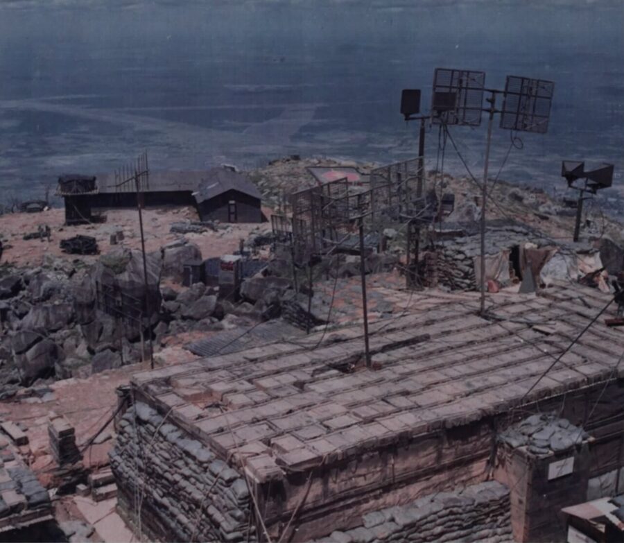
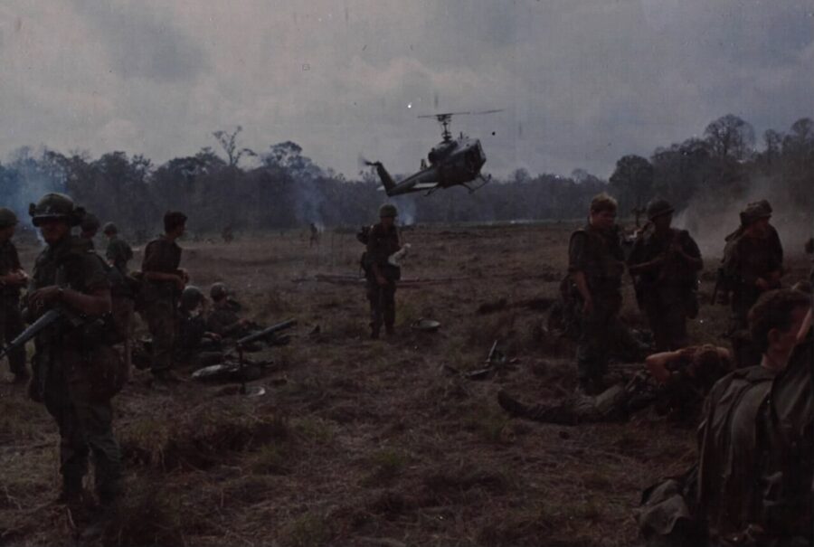
A peak that commands the whole plain was worth holding. The Japanese occupied it in the Second World War; the Việt Minh, the French and the National Liberation Front held it in turn. In May 1964 American-led Special Forces took the summit, and from February 1966 the US Army ran a radio relay station there, call sign Granite Romeo Tango, supplied for years by helicopter while the guerrillas kept the slopes and caves.
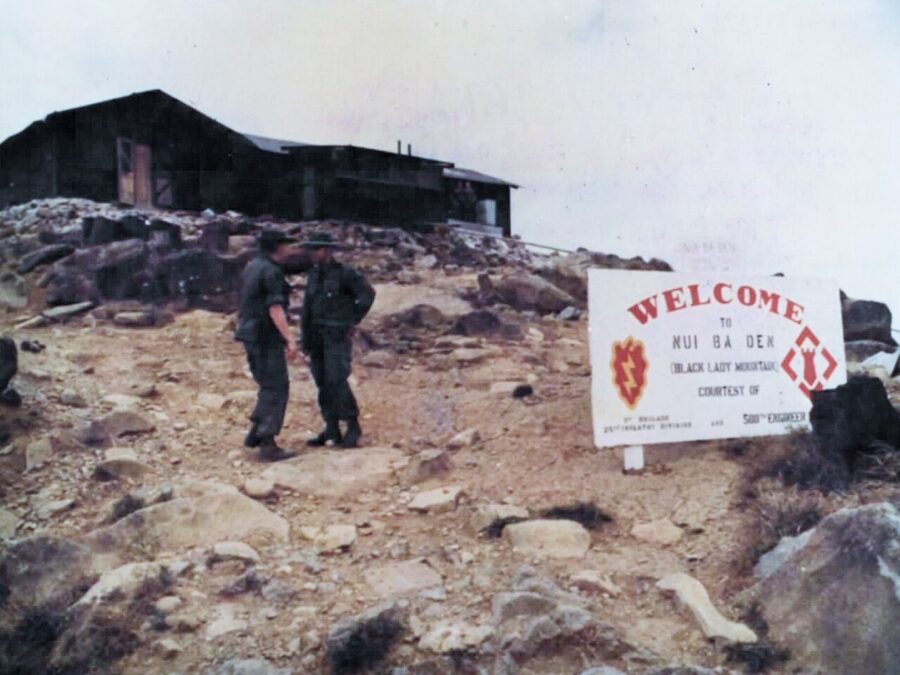
On the night of 13 May 1968 the summit camp was attacked and partly overrun; by 2:30am the attackers had been driven off, and 24 Americans were dead. In December 1974 a Liberation Army reconnaissance battalion besieged the South Vietnamese company holding the relay station, and on 6 January 1975 the defenders, out of water, walked down the mountain. A memorial stele in front of Chùa Hang names 181 Liberation Army soldiers who died here.

The three cable cars
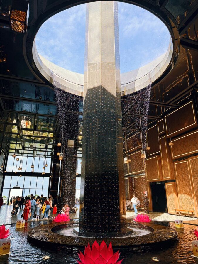
A small cableway already carried pilgrims to the pagodas before 2020. The system that matters now opened on 18 January 2020, built by Sun Group as Sun World Ba Den Mountain. Its base station, Ga Bà Đen, covers 10,959 square meters, and Guinness lists it as the largest cable-car station in the world; it feels more like an airport terminal than a mountain hut.
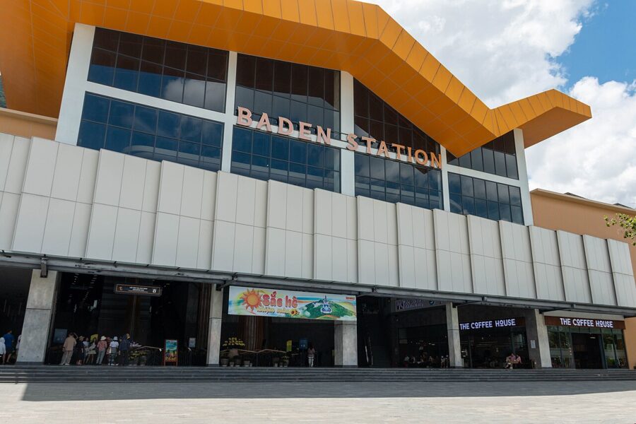

Three lines run from it:
- Vân Sơn, from the base to the summit: about 1,847 m and 8 minutes. This is the one for the statue and the view.
- Chùa Hang, from the base to the pagodas halfway up: about 1,210 m and 5 minutes. Pilgrims use this one.
- Tâm An, linking the pagodas with the summit: about 1,208 m and 5 minutes, so you can do both without coming down. It runs mainly at weekends.


Prices change through the year and with promotions, so treat these as a guide and check the Sun World booking site before you go:
| Ticket | Price (2026) |
|---|---|
| Entrance to the national tourist area (state ticket, separate) | 10,000₫ adults, 5,000₫ children (about 40 US cents) |
| Vân Sơn line to the summit, return | about 450,000₫ (about US$17); online offers from 300,000₫ |
| Chùa Hang line to the pagodas, return | 150,000₫ to 250,000₫ (about US$6 to US$10) |
| Vân Sơn return with lunch buffet on the summit | about 630,000₫ to 650,000₫ (about US$25) |
| All-in-one combo (several lines and buffet) | about 775,000₫ to 800,000₫ (about US$30) |
| WOW Pass priority boarding (added to a ticket) | 300,000₫ (about US$11.50) |
Children under 1 m ride free. Vân Sơn and Chùa Hang run from 6am to 8pm Monday to Friday, 5:30am to 9pm on Saturday and 5:30am to 8pm on Sunday; Tâm An runs from 6:30am to 7pm, mainly at weekends. Hours shift with festivals and weather, so check the last cabin down.
Is the summit worth the extra over the pagoda line? On a clear morning, yes, for the view alone. On a hazy April afternoon, when the plain dissolves into white glare, the Chùa Hang line and the pagodas are the better buy.
The summit: a statue, a sutra pillar and a theme park
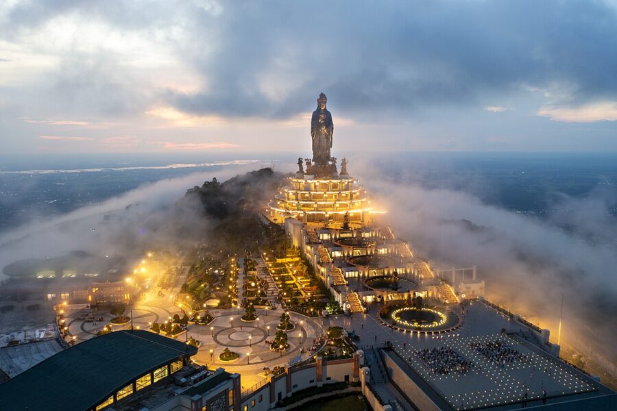
The rebuilt summit’s centerpiece is the Tây Bổ Đà Sơn statue, a Quan Âm (Avalokiteśvara) 72 m tall, cast from about 170 tonnes of copper, and recorded as the tallest bronze Bodhisattva on a mountaintop in Asia. The sculptor, Phạm Bá Đua, modeled it on Lê-dynasty statues in northern pagodas rather than on Chinese types: look for the Amitābha figure in the crown, the vase tipped in the left hand, and the cloud and water-drop pattern on the lotus base.
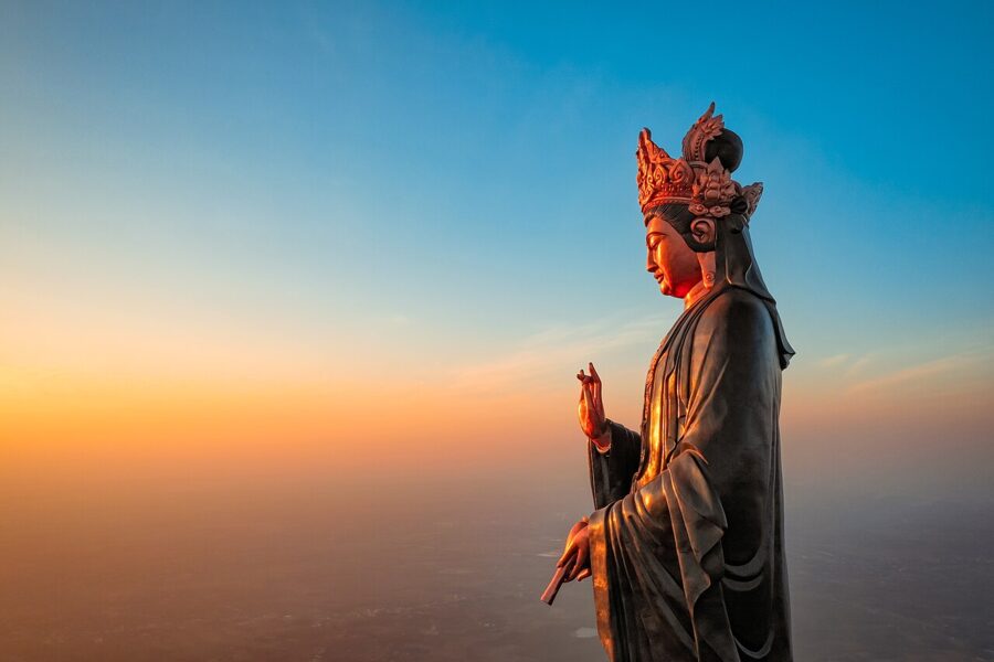

The base is a four-story building of about 4,410 square meters shaped like an opening lotus. Inside is a Buddhist exhibition center of 83 statues and 83 works of art around a thousand-armed Quan Âm, with replicas of famous Buddhist sculpture and a few real antiquities, including Lý-dynasty stone carvings of the 11th and 12th centuries. Outside stand five black granite pillars carved with the Heart Sutra, the tallest 19.8 m, their 12,000 characters gilded.
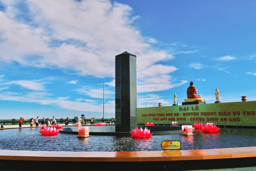
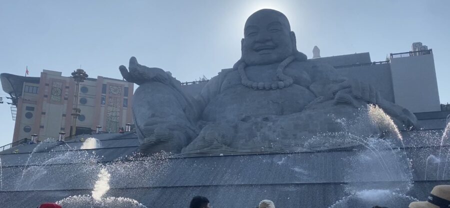
Farther along is a laughing Maitreya Buddha in sandstone, 36 m high and assembled from 6,688 blocks weighing about 5,112 tonnes, installed in January 2024 with an artificial waterfall pouring around it. A gilded statue of the Koṇāgamana Buddha (Câu Na Hàm Mâu Ni), the Buddha of the udumbara tree, has since joined it, and the summit garden, Vườn Ưu Đàm, is named for that tree’s flower.

More is coming: a summit resort of almost 70 hectares was due to break ground in 2026, and building work has marked the mountain before, when a landslide in November 2021 was traced to construction spoil washed off the peak by rain. The summit is now, in plain terms, a Buddhist theme park on a sacred mountain, and opinion in Vietnam is divided on that. The older mountain of the Lady and her pilgrims survives better halfway down.
Climbing on foot
For years young people from Saigon climbed Bà Đen at night to watch the sunrise from the top. That has stopped. After a run of accidents and rescues the management board closed every route in October 2025 and reopened one that December, and through 2026 only the Cột Điện route, which follows the electricity pylons, has been allowed; Ma Thiên Lãnh valley and the back path behind Chùa Bà stay closed.
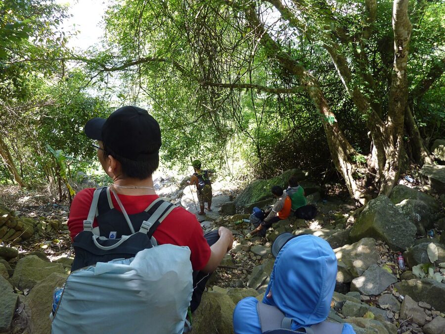
To climb, register at the Sơ Ri checkpoint at the start of the Cột Điện route and set off between 5am and 11am; later starts are refused. Carry more water than you think you need, a flashlight and a first-aid kit, and if your legs give out, a one-way ticket down on the cable car is an option. Leading groups or camping on unapproved routes can bring fines of 4 to 10 million dong.

The spring pilgrimage, and its crowds
The great event of the year is the spring festival, Hội Xuân Núi Bà Đen, from the 4th day of the first lunar month to the end of that month, with the main days on the 4th, 5th and 6th. Pilgrims come to ask the Lady for luck in the new year and take home lộc Bà, a red packet holding a pinch of rice or a few coins. On the opening day in 2026, 20 February, nearly 157,000 people rode the cable cars.
On the main days the queues run to hours, the road from town jams, and the pagodas are shoulder to shoulder. In 2027 Tết falls on 6 February, so the festival opens on 9 February and runs into early March. Go if you want to see the pilgrimage at full strength; otherwise any weekday from mid-March onward, at opening time, is far calmer.
The Cao Đài Holy See
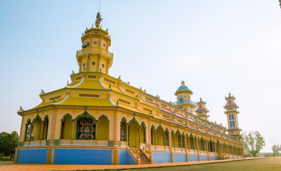
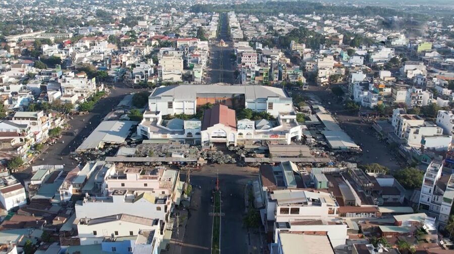
Most day trips pair the mountain with the Cao Đài Holy See (Tòa Thánh Tây Ninh), mother temple of Vietnam’s best-known homegrown religion, about 4 km southeast of the old town in Long Hoa ward (formerly Hòa Thành town). Its temple, begun in the early 1930s and finished in 1955, is a cathedral in pink, yellow and sky blue with dragons coiled up its columns.
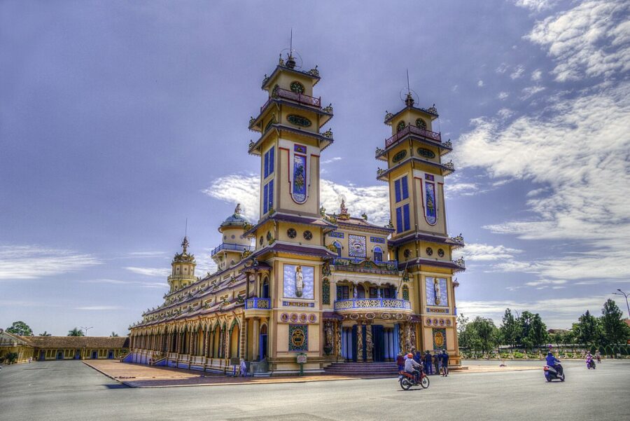

Entry is free. Ceremonies are held at 6am, noon, 6pm and midnight, and visitors watch the noon one from the upstairs gallery. Arrive half an hour early, take off your shoes, keep to the side aisles and never walk across in front of the worshippers.
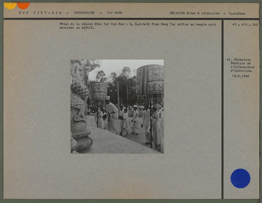
The Holy See’s great festivals are the feast of the Supreme Being on the 9th day of the first lunar month and the Diêu Trì feast on the 15th of the eighth. Nearby, the octagonal Long Hoa Market (Chợ Long Hoa), laid out by Phạm Công Tắc from 1952, is the best place in the province to buy rice paper, shrimp salt and vegetarian goods, busiest from 6am to 10am.

Dầu Tiếng Lake
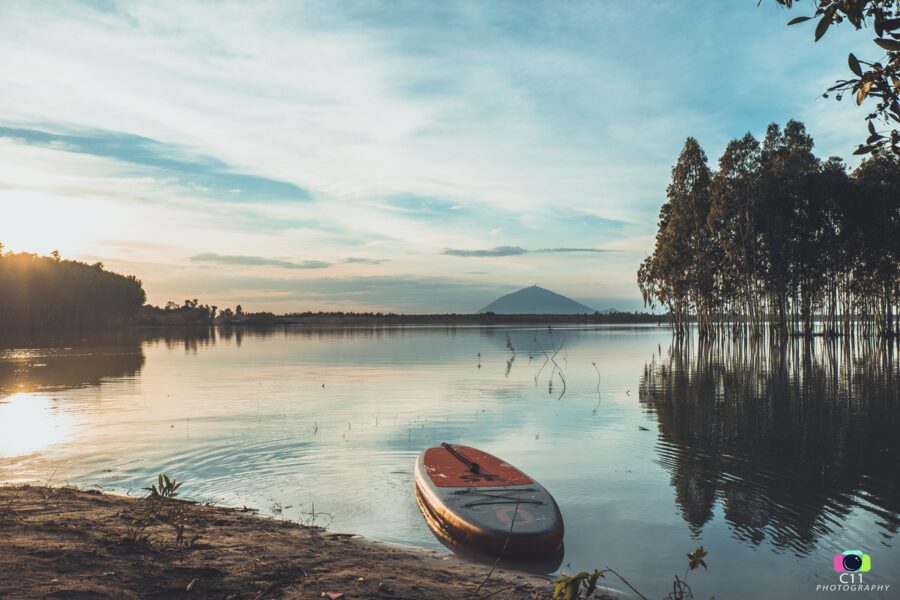
From the summit of Bà Đen a wide sheet of water fills the eastern horizon. This is Dầu Tiếng Lake (Hồ Dầu Tiếng), made by damming the upper Saigon River: about 270 square kilometers at full level, holding 1.58 billion cubic meters, and watering nearly 117,000 hectares of farmland across Tây Ninh, Hồ Chí Minh City and Đồng Nai.
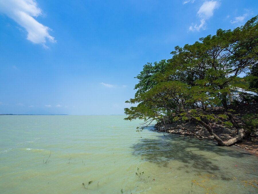

The lake is young. Surveys began in 1976 and construction in 1981, and the project cost over US$100 million borrowed from the World Bank, the first in reunified Vietnam built with American dollars. Many of its workers came from central Vietnam, and one local theory holds that they brought dried shrimp with them, mixed it with Tây Ninh salt and chili, and so invented the province’s shrimp salt.
There is no single sight at Dầu Tiếng, and after the mountain that is the appeal. People come for sunsets with the cone of Bà Đen across the water, for fishing, and to camp on the shore in the dry season, when the water drops and cattle graze the exposed flats. The usual way in from the Tây Ninh side is through Dương Minh Châu commune, about 20 km northeast of town.
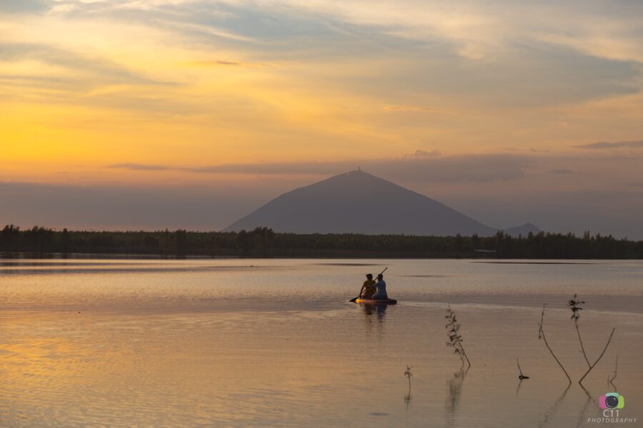
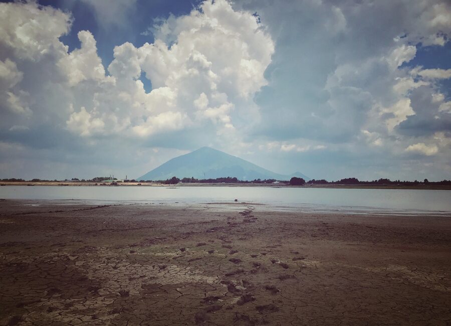
Two cautions. The reservoir is a protected work of national security, and the press has reported repeated encroachment of its shores by unlicensed huts and camps, so use an established campsite. And from about August to November the water is high and the flats are flooded; December to April is the time to go.
Lò Gò–Xa Mát National Park
On the Cambodian border, 30 to 40 km northwest of town, is the province’s last big forest. Lò Gò–Xa Mát National Park (Vườn quốc gia Lò Gò – Xa Mát) was created in 2002 from a nature reserve and in 2020 absorbed the Chàng Riệc historical forest, bringing it to about 30,000 hectares in the communes of Tân Biên, Tân Lập and their neighbors (formerly Tân Biên district).
It is flat country, 15 to 65 meters above sea level, of dry dipterocarp forest broken by grassy wetlands called trảng, with the Vàm Cỏ Đông River forming part of the border. The park’s managers count more than 930 plant and 580 animal species. Black-shanked douc langurs, woolly-necked storks, lesser adjutants and Germain’s peacock-pheasant have been recorded here, and sarus cranes stop over between the Mekong Delta and their breeding grounds in Cambodia.
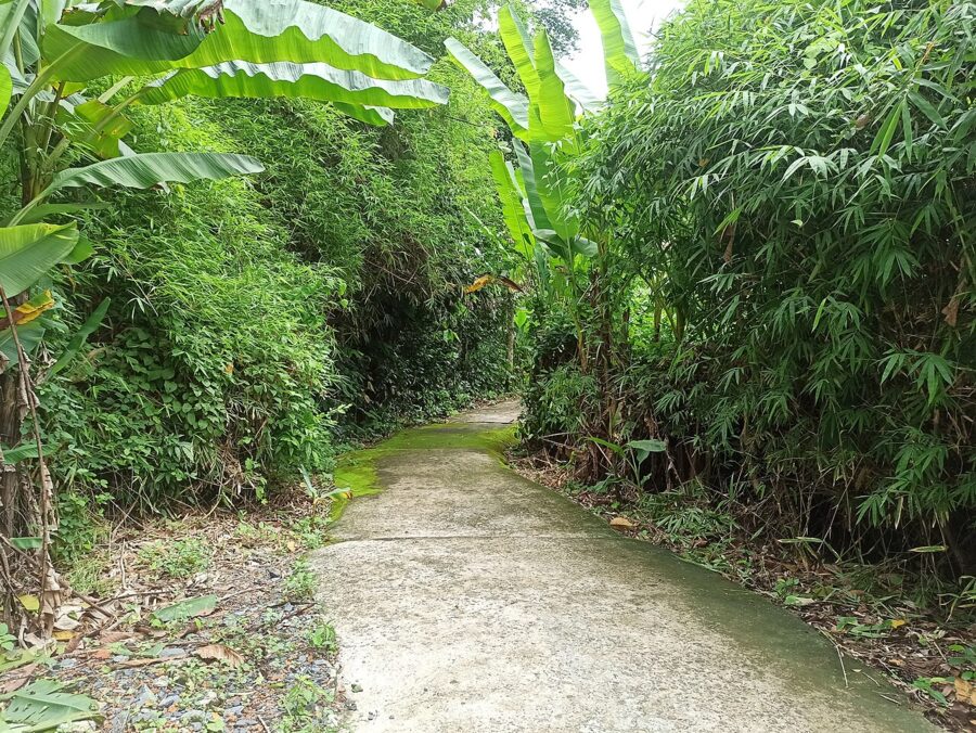

Expect few facilities. Visits are arranged through the park’s Đa Ha ecotourism center beside the Đa Ha stream, which has a few bungalows and has run walks, cycling, boat trips on the Vàm Cỏ Đông and overnight stays; it received about 27,000 visitors in the five years to 2024. Roads in are rough and there is almost nowhere to eat, so contact the park ahead and go with a driver who knows the way.
The Central Office base at Chàng Riệc
Inside the park’s core is the special national relic site of the Central Office for South Vietnam (Trung ương Cục miền Nam), the headquarters that directed the communist war effort in the south. The Americans spent years hunting for it; Operation Junction City swept this forest in 1967 without catching the leadership. The site has rebuilt leaf-roofed huts, bunkers and the working quarters of Nguyễn Văn Linh, later the Communist Party’s general secretary.
The base is about an hour’s drive from Tây Ninh town, worth it only with a car and a full day, or on the way to the Xa Mát border gate.
On the road: Trảng Bàng and Gò Dầu
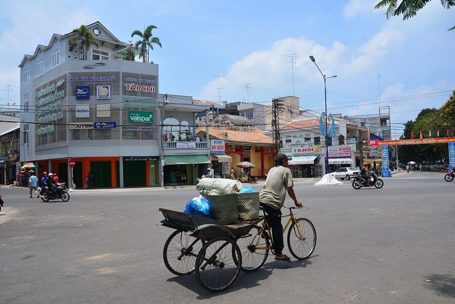
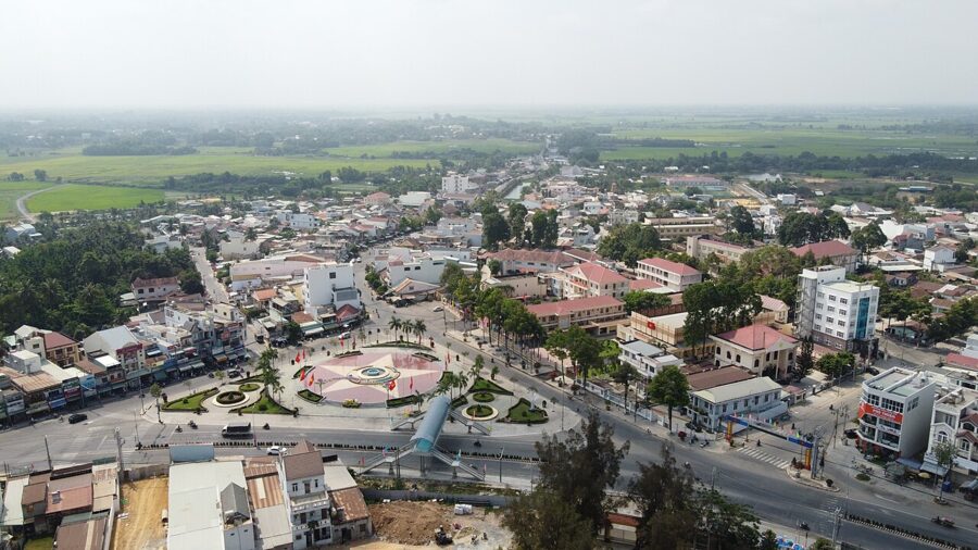
Highway 22, the old Trans-Asia road to Phnom Penh, leaves Saigon through Hóc Môn, passes the turning for the Củ Chi Tunnels, and enters Tây Ninh at Trảng Bàng. Trảng Bàng and Gò Dầu, two market towns on it, are the stops Saigon families make on the way, and both are now wards of the new province.

Trảng Bàng
Trảng Bàng is a rice-paper town. Along the highway and the lanes behind it are racks of round sheets drying in the sun and low ovens where they are toasted over burning peanut shells. It is also the home of bánh canh Trảng Bàng, a thick rice-noodle soup, and most cars from Saigon pull in here for breakfast.

The name carries a darker memory. On 8 June 1972 South Vietnamese planes dropped napalm on Trảng Bàng, then held by North Vietnamese troops, and the Associated Press photograph of nine-year-old Phan Thị Kim Phúc running burned down the highway became one of the defining images of the war. A 2025 documentary questioned who took it, long credited to Nick Út; the place and the date are not in doubt.

Gò Dầu
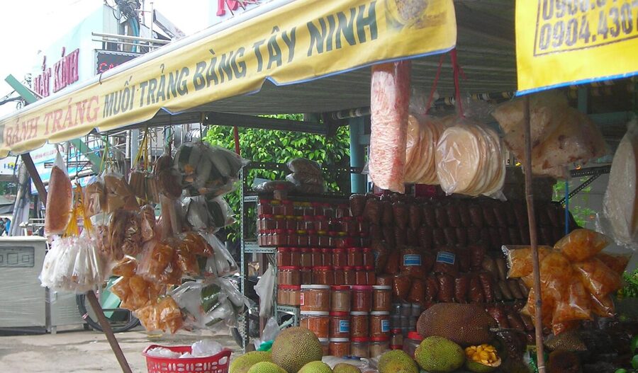
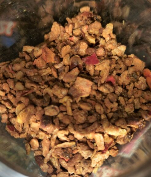
Gò Dầu, 12 km on, is shrimp-salt country. Muối tôm, coarse salt roasted with dried shrimp, chili and garlic, is Tây Ninh’s best-known souvenir, and the shops near the roundabout and the market sell it by the jar in a dozen versions, including vegetarian ones for Cao Đài and Buddhist customers. The craft of Tây Ninh chili and shrimp salt, centered on Trảng Bàng and Gò Dầu, was listed as national intangible heritage in 2023.

What to eat
Tây Ninh food is country food, built on rice, pork, beef, forest leaves and salt, and the two dishes that bring people out from Saigon both come from Trảng Bàng.
Bánh tráng phơi sương
Bánh tráng phơi sương, “dew-dried rice paper”, is the province’s signature. Salted rice batter is spread thin in two layers, sun-dried, then toasted lightly over a peanut-shell fire until small bubbles rise and the sheet turns opaque. The final step gives it its name: the sheets are laid out in the small hours to take in the night dew, just long enough to turn soft and chewy, then packed at once.
The story in Trảng Bàng is that a tired young bride forgot two racks outside overnight, and her husband, to spare her a scolding, rolled the damp sheets around boiled pork and herbs for the family, who liked them better. The craft was listed as national intangible heritage in 2016, and in 2025 the product was rated five-star under OCOP, the national scheme for local products.
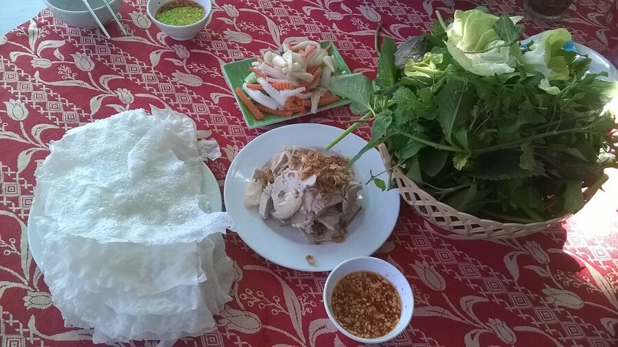

The classic way to eat it is wrapped around thin slices of boiled pork leg with a heap of herbs and forest leaves, the real point of the dish: lá cóc (hog-plum leaf), lá săng mào, lá bứa, tràm ổi, perilla, mint and cucumber, several of them found only in the south. You dip it in fish sauce or mắm nêm.
Bánh canh Trảng Bàng
Bánh canh here is a bowl of thick, chewy rice noodles in clear pork-bone broth with slices of boiled pig’s trotter, usually with a plate of the rice paper on the side. It looks plain, and all the quality is in the broth and the noodles. Local lore says the best houses taught their recipe only to daughters, since a son would carry it to his wife’s family.
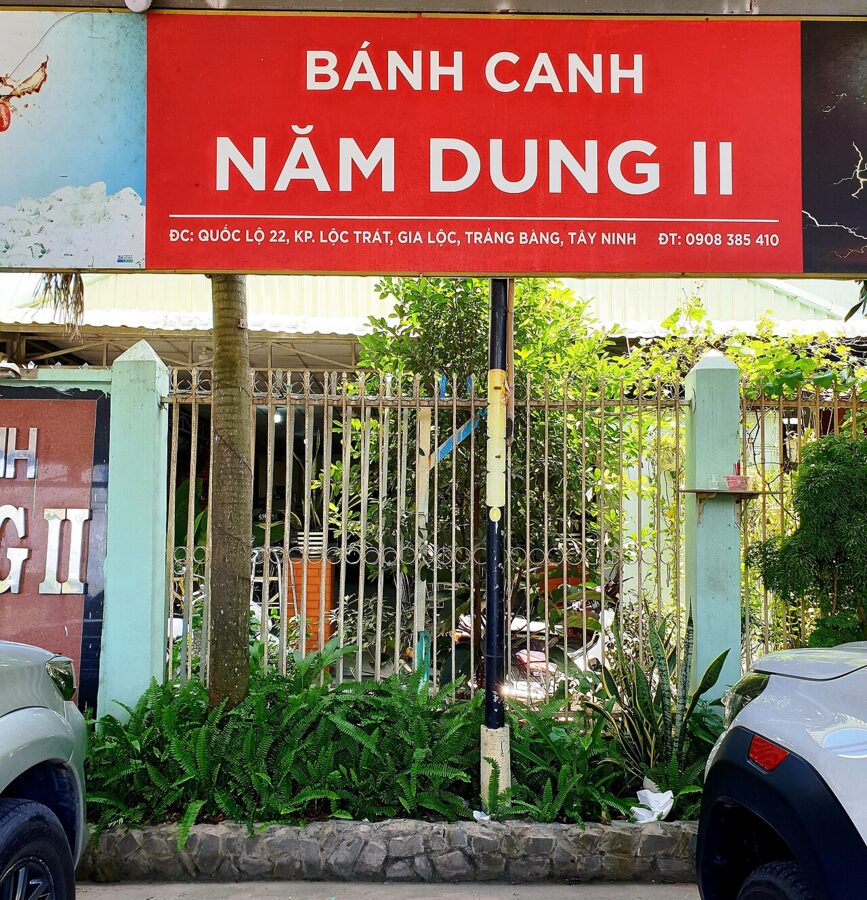

Long-running houses cluster on Nguyễn Văn Rốp street in Trảng Bàng ward, among them Năm Dung at number 90 and Út Huệ at number 88, both open from about 6am to 9pm. A bowl at Út Huệ was 35,000₫ to 50,000₫ (US$1.35 to US$2) in late 2025. Go early: breakfast is the busy hour.
Bò tơ Tây Ninh
Bò tơ is young beef from calves raised on the province’s grass, thin-skinned and tender. It comes steamed, grilled with lemongrass or rare with lime, and above all in rolls of steamed beef with the skin on, wrapped in dew-dried rice paper with the same herbs. Năm Sánh, on Highway 22B at Hiệp Trường in Thanh Điền ward, is the best-known name; in Trảng Bàng, Sáu Hùng on Nguyễn Trãi street is a local favorite.
From the mountain
Bà Đen has specialties of its own, sold at the foot. Mãng cầu Bà Đen, custard apples grown on the lower slopes, are big, sweet and short on seeds. Ốc núi, small mountain snails boiled or cooked with tamarind, are a snack to go with beer. And around the Holy See, the vegetarian restaurants that serve Cao Đài followers are a good, cheap meal.


Getting there from Saigon
Tây Ninh town is about 100 km northwest of central Saigon by Highway 22 and 22B, two to two and a half hours by road depending on traffic at the city’s edge. An expressway from Hồ Chí Minh City to the Mộc Bài border is being built, with completion targeted for 2027 to 2028; until then, Highway 22 is slow through the towns.
By bus
The cheapest way to the mountain is bus 70-2, from Củ Chi bus station through the Holy See to the foot of Bà Đen. It covers about 73 km in about an hour and three quarters, leaves every 25 to 30 minutes, and costs 10,000₫ to 40,000₫ by distance, 40,000₫ (about US$1.50) for the whole route. The last bus back from the mountain leaves around 5pm. Allow an hour or more to reach Củ Chi bus station from central Saigon by city bus or Grab.
Coaches and limousine vans, the small vans with reclining seats, run all day from An Sương bus station on the northwest edge of Saigon to Tây Ninh town and Hòa Thành. Huệ Nghĩa is one long-established company, with a counter at An Sương; some operators will pick up in the city if you book ahead by phone or through a ticketing app. From town, a Grab or taxi to the mountain takes 20 to 30 minutes.
By private car or tour
For a day trip, a car with a driver is the easiest choice, and the only practical one if you want Dầu Tiếng or Lò Gò–Xa Mát too. Many Saigon hotels arrange one, and a Grab or Be car can be booked for the run.
Group tours from Saigon usually pair the noon ceremony at the Holy See with either Củ Chi or the mountain. If the mountain is your reason to go, check that the tour includes the Vân Sơn line to the summit, not just the pagodas.
One day or two
A one-day plan
Leave Saigon by 5am, stop in Trảng Bàng for bánh canh and rice paper at about 6:30am, and be at the cable-car station by 8am. Ride Vân Sơn to the summit, then Tâm An down to the pagodas if it is running (otherwise go down and take the Chùa Hang line). Leave the mountain by 11am for the noon ceremony at the Holy See, eat in Long Hoa, and start back by 2pm to beat the evening traffic into the city.
It is a full day, and it works. What it leaves out is the lake, the forest and the evening light on the mountain, which is when Tây Ninh looks its best.
A two-day plan
On day one, leave Saigon mid-morning, stop in Trảng Bàng and Gò Dầu, see the noon ceremony at the Holy See, and spend the late afternoon at Dầu Tiếng for sunset. Eat bò tơ for dinner. On day two, be on the first cabin up at 5:30am at the weekend (6am on weekdays) for the chance of a sea of clouds, walk the pagodas, and drive back in the afternoon, or out to Lò Gò–Xa Mát if you have a car.

Where to sleep
Most hotels are in Tân Ninh ward, the old town center, 20 to 30 minutes from the mountain and about 10 from the Holy See. They are business and mid-range hotels rather than resorts. Homestays and farmstays have opened around the foot of Bà Đen and near the lake.
When to go, and when not to
Tây Ninh shares the pattern of Ho Chi Minh City’s weather, with a dry season from December to April and the rains from May to November. It runs hotter than the city, though; December and January nights can drop below 20°C in the north of the province, and March and April afternoons can pass 38°C, with a haze that hides the view from the summit.
December to February is the best time for the mountain: cool mornings, clear skies and the best odds of cloud below the peak. Avoid the spring festival unless the crowds are the point, avoid weekends and public holidays if you can (the National Day break in 2026 brought 118,000 people to the mountain in five days), and in the rainy season expect the hiking route to close at short notice.
Whatever the season, fix your day around the last ride home: the 70-2 bus leaves the mountain around 5pm, and the cabins stop at 8pm on most days. Take the first cabin up instead, and you will have the plain, the cloud and the Lady before most of Saigon is awake.