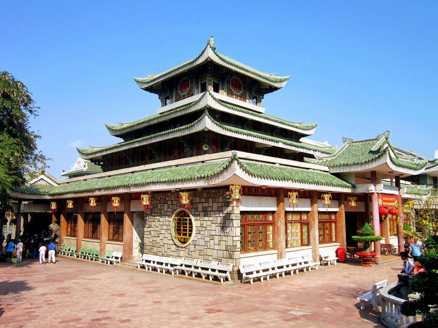
Inside the temple at the foot of Sam Mountain, the Lady of the Realm sits behind glass in a robe of embroidered silk, a crown on her head and her face painted gold and pink. Pilgrims bring her roast pigs, flowers and new robes, and come back a year later to give thanks when a wish has come true. In 2009 the temple counted some 15,000 robes given to her.
Under the silk is a figure of red sandstone. The French archaeologist Louis Malleret, who examined it in 1941, took it for a statue of the Hindu god Vishnu carved at the end of the sixth century; the writer Sơn Nam thought it a Khmer Buddha that settlers repainted as a woman. Either way, a carving from a vanished kingdom was found on a hilltop in country that was Khmer for centuries, carried down by Vietnamese villagers and made into the mother goddess of the southwestern frontier.
That layering is the reason to come to An Giang. The province sits where the Mekong crosses from Cambodia into Vietnam and splits into its two southern arms, and Vietnamese, Khmer, Cham and Chinese communities have shared it for two centuries.
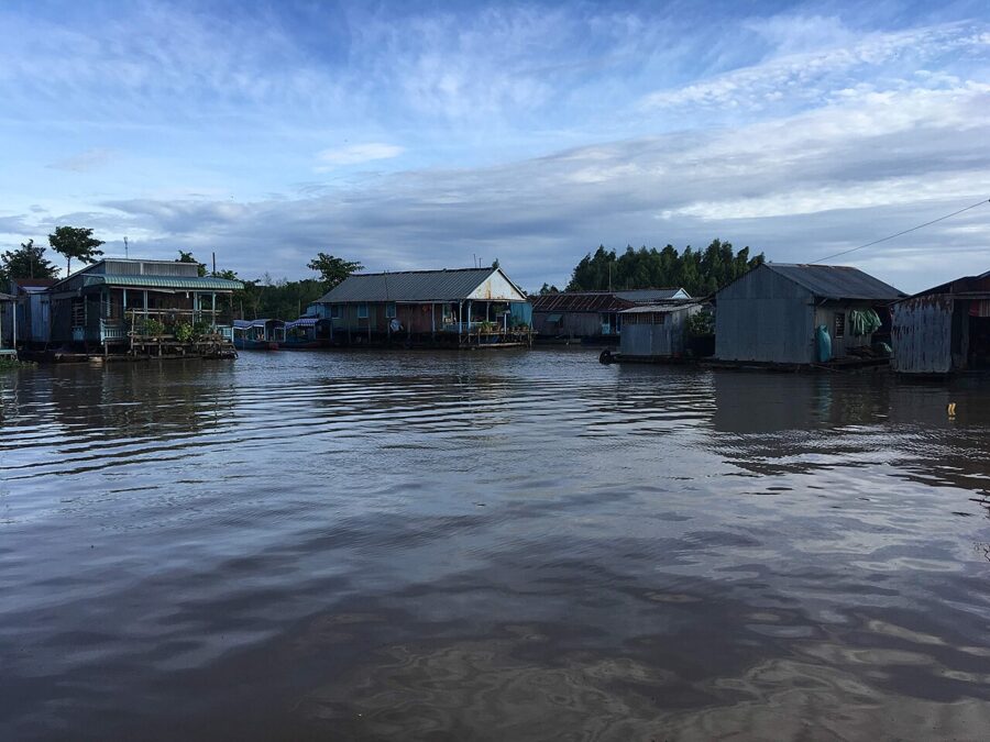

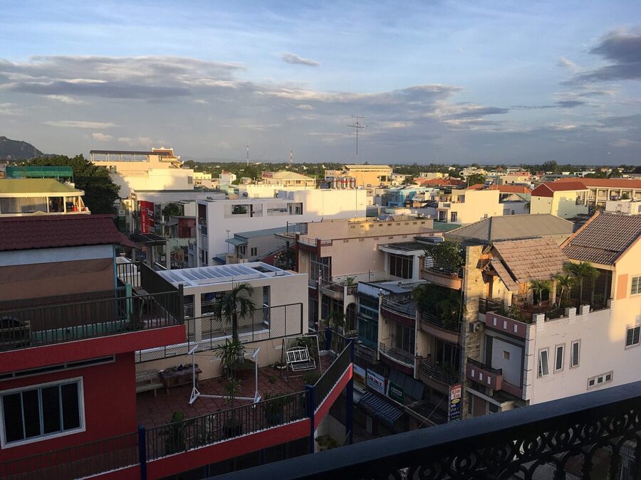
In Châu Đốc, the border town that serves as the base, families live on rafts over cages of catfish and the call to prayer carries across the water from Cham mosques. West of town, Khmer pagodas stand among sugar palms in the Seven Mountains. To the southeast, the foundations of a port that handled goods from India and coins from Rome some 1,800 years ago lie in a rice field at Óc Eo.

Châu Đốc lies about 250 km west of Saigon, six to seven hours by bus. A day trip is possible, but most of it goes to the road. Two days is the right length: one for Châu Đốc and Sam Mountain, one for the melaleuca forest at Trà Sư and the mountains beyond.

On this page
- Where An Giang is, and what changed in 2025
- Châu Đốc: the river town on the border
- Sam Mountain: the temple, the pagoda and the tomb
- Trà Sư melaleuca forest
- The Seven Mountains and the Khmer pagodas
- Óc Eo and Ba Thê: the port of Funan
- What to eat in An Giang
- Getting there from Saigon
- Planning the trip
Where An Giang is, and what changed in 2025
An Giang is the top left corner of the Mekong Delta, running along the Cambodian border opposite Takéo and Kandal. The Mekong enters in two branches: the Tiền River past Tân Châu, and the Hậu River (the Bassac) past Châu Đốc and Long Xuyên toward Cần Thơ and the sea.
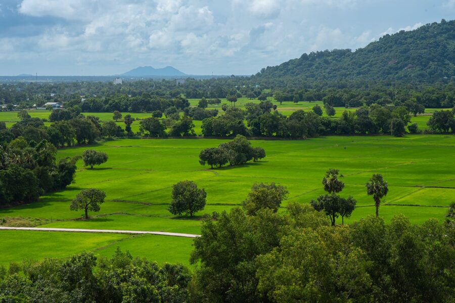
Most of the province is flat, and most of it floods every year. From about August the river rises with monsoon rain from far upstream, spreads over the fields and leaves a layer of silt when it drains in November and December. Locals call it mùa nước nổi, the floating-water season, and plan their year around it.
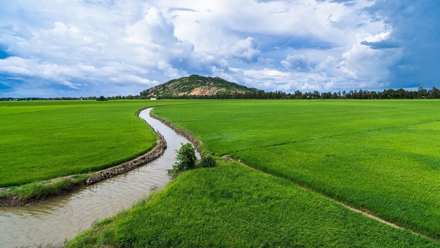
The exception is in the west, where the Seven Mountains (Bảy Núi, or Thất Sơn) rise abruptly out of the paddies near the border. The highest reaches only 705 m, but on a plain this flat they look like real mountains, and for two centuries hermits, prophets and rebels have treated them as holy ground.
The new province
In mid-2025, as part of a national reorganization, the National Assembly merged Kiên Giang province into An Giang, and the new province kept the name. Its capital moved from Long Xuyên to Rạch Giá on the Gulf of Thailand, and it now stretches from the Cambodian border to the island of Phú Quốc, about 9,900 km² with close to five million people.
Districts were abolished from 1 July 2025 and communes and wards merged. The old Châu Đốc city is gone as a unit: the town center is now Châu Đốc ward, and the old Núi Sam ward around Sam Mountain joined the commune of Vĩnh Tế to form Vĩnh Tế ward. Signs, maps, bus companies and everyone you meet still use the old names.
Four peoples
In 1757 the Cambodian court ceded the area around Châu Đốc to the Nguyễn lords, part of the same southward push that had turned the Khmer town of Prey Nokor into Gia Định, the citadel that grew into Saigon. Khmer villages stayed, especially around the Seven Mountains, with their own pagodas, language and festivals. The Cham, who are Muslims, settled along the Hậu River in the 19th century, and Chinese merchants settled in the market towns.
The Vietnamese majority produced two homegrown religious movements here: Bửu Sơn Kỳ Hương in the 1840s, and Hòa Hảo Buddhism, founded in 1939 by Huỳnh Phú Sổ in the village of Hòa Hảo. Both belong to the same southern current as Cao Đài, born in the 1920s in Tây Ninh.

Châu Đốc: the river town on the border
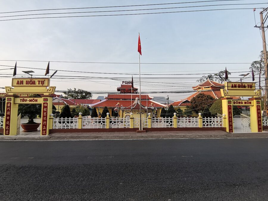
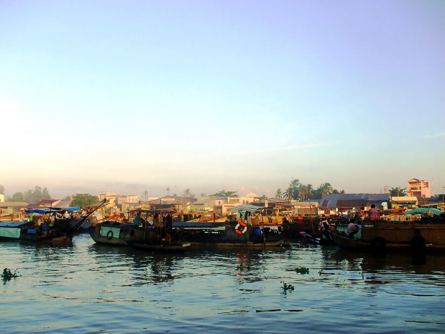
Châu Đốc stands where the small Châu Đốc River leaves the Hậu, a few kilometers from the frontier. Its Khmer name may have been Moat Chrouk, “pig’s snout,” though the origin is disputed. A citadel was built in 1815, and in 1832 the emperor Minh Mạng made the town the seat of a new province called An Giang.
The French took it in 1867, and in 1956 the capital moved to Long Xuyên. Châu Đốc settled into the life of a border market town, trading fish, cloth and rice with Cambodia upriver. Neither its city status in 2013 nor its dissolution into wards in 2025 has changed the waterfront.

The market and the mắm
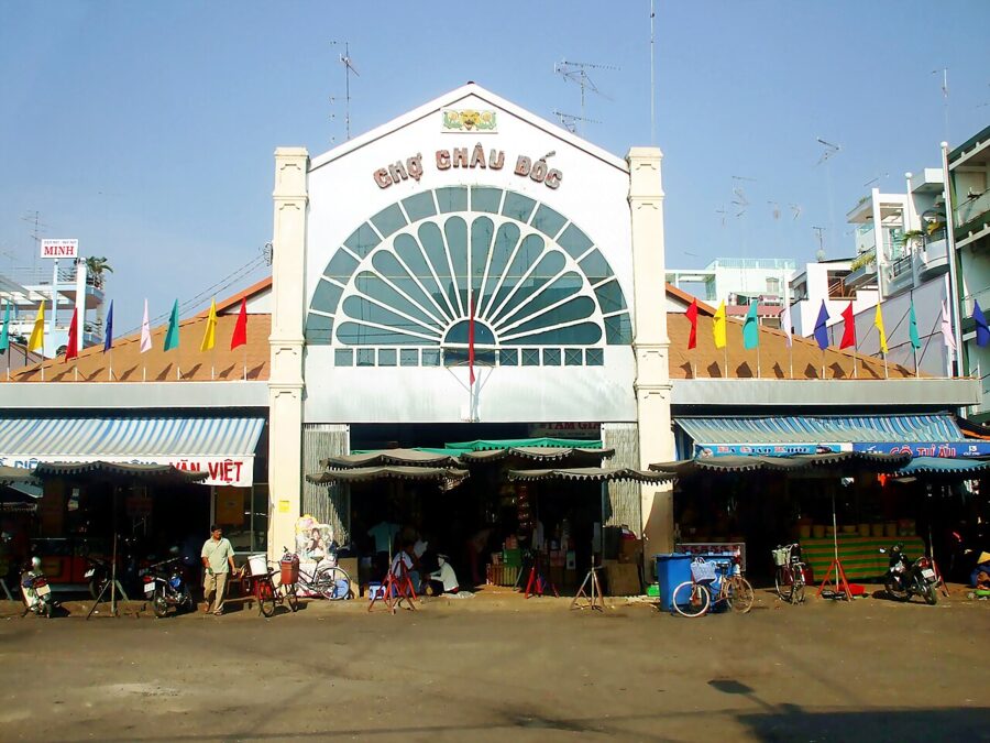
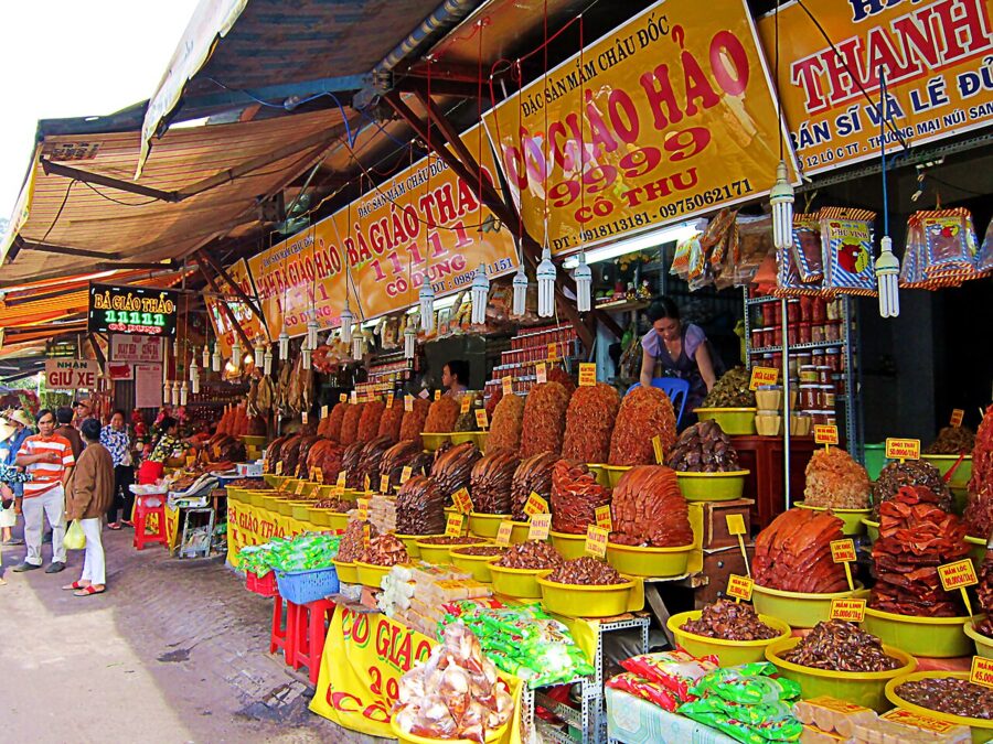
Start at the market (Chợ Châu Đốc), a block back from the river, early in the morning. The streets around the covered hall are given over to mắm, fish fermented in salt and sometimes rice, sugar or palm sugar, piled in trays and tubs. Châu Đốc calls itself the capital of mắm, and it is hard to argue.

Mắm cá linh is made from the small linh fish that come down with the flood. Mắm lóc uses snakehead, mắm sặc uses gourami, and mắm thái is a sweet-sour mix of fish and shredded green papaya eaten with boiled pork and herbs. Vendors will let you taste, and most will vacuum-pack a box for the bus.

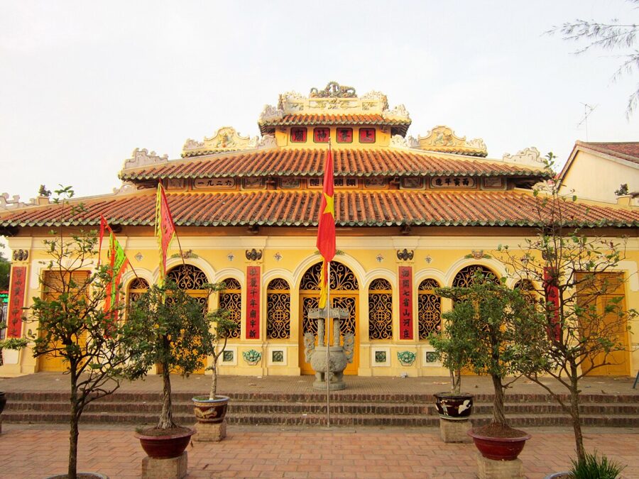
Beside the market stands the Châu Phú communal house (Đình Châu Phú), dedicated to Nguyễn Hữu Cảnh, the general who organized the first Vietnamese administration in the south in 1698. Its hall holds a wooden statue of him and royal decrees from the reigns of Minh Mạng and Tự Đức, and it is a national architectural monument.

The waterfront and the fish
At the junction of the rivers, a park centers on a monument to the basa fish, a steel column of leaping catfish. The Mekong Delta produces most of the world’s farmed pangasius (basa and tra), An Giang is one of its biggest producers, and the frozen fillets sold across Europe and the United States often start here.
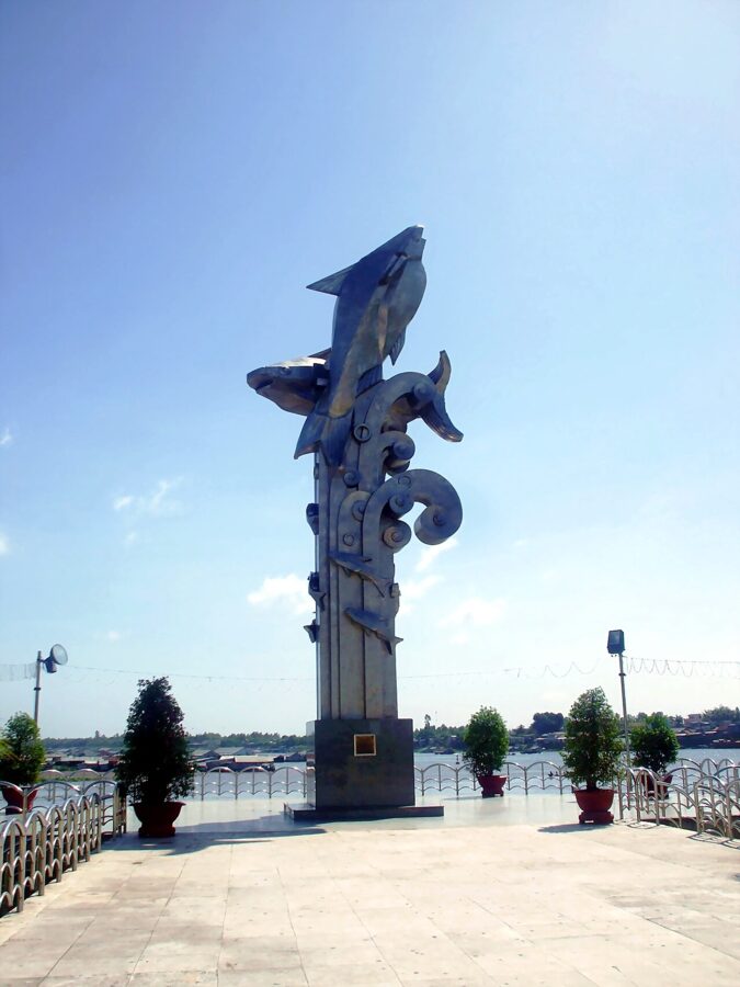

The farming began on the river. Families built houses on rafts of barrels and timber and hung cages of fish underneath, feeding them through hatches in the floor. Most big farms have moved into ponds on land, but a raft village remains on the Châu Đốc side, a kilometer of floating homes, many painted in bright colors since 2023 to draw visitors.
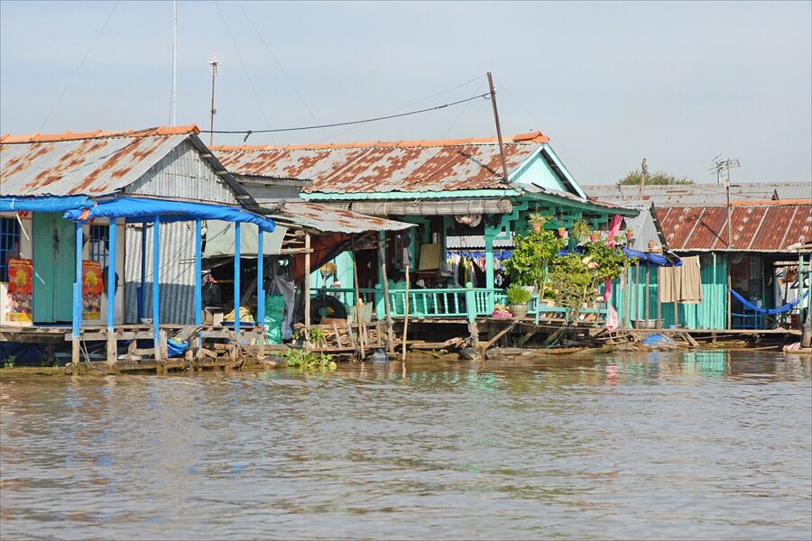

Boatmen at the landings near the park offer trips to the rafts, often combined with a crossing to a Cham village; agree the route and price before you step in. Go early in the morning, when the ferries are busy, or late in the afternoon, when the heat goes out of the day.
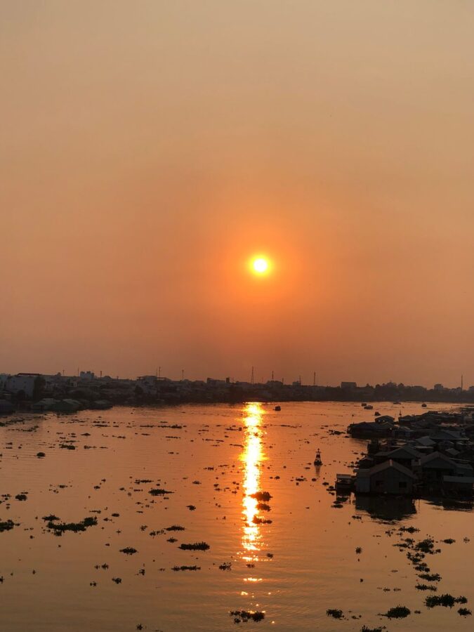
The Cham villages across the water
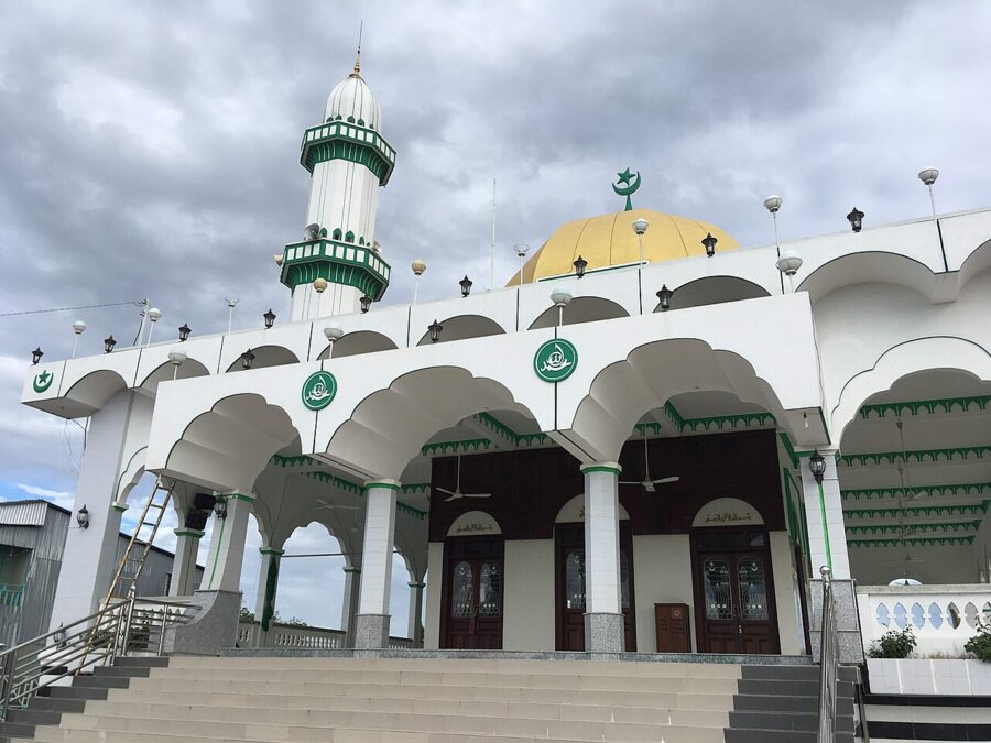
Across the Hậu, a short ferry ride from town, are the Cham hamlets of Châu Giang and Phũm Xoài, with more Cham villages upstream at Đa Phước. The Cham of An Giang are Sunni Muslims, unlike most Cham in central Vietnam. Their houses stand on stilts, high enough to stay dry in the flood and leave room for a loom underneath.
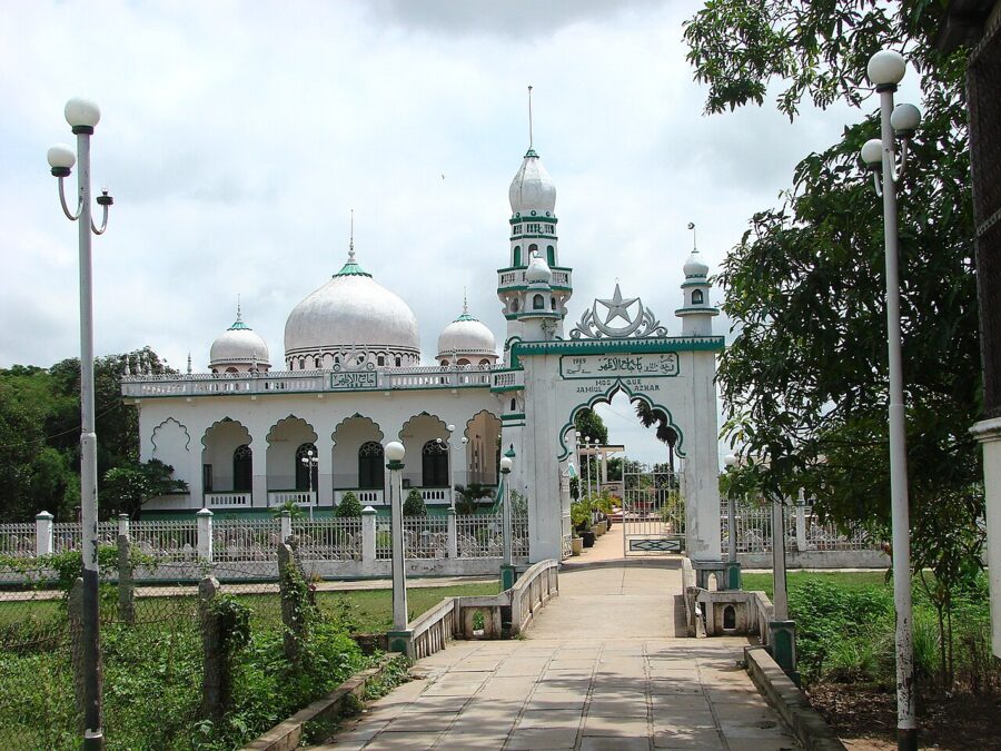

The Mubarak mosque in Châu Giang, one of the community’s oldest, was rebuilt in concrete in 1965 and is a national historic monument; tradition dates its first wooden building to 1750, though historians doubt the Cham had settled here that early. Visitors are usually welcome outside prayer times, and Friday midday is the time to stay away. Cover shoulders and knees, take off your shoes and keep to the back of the hall.
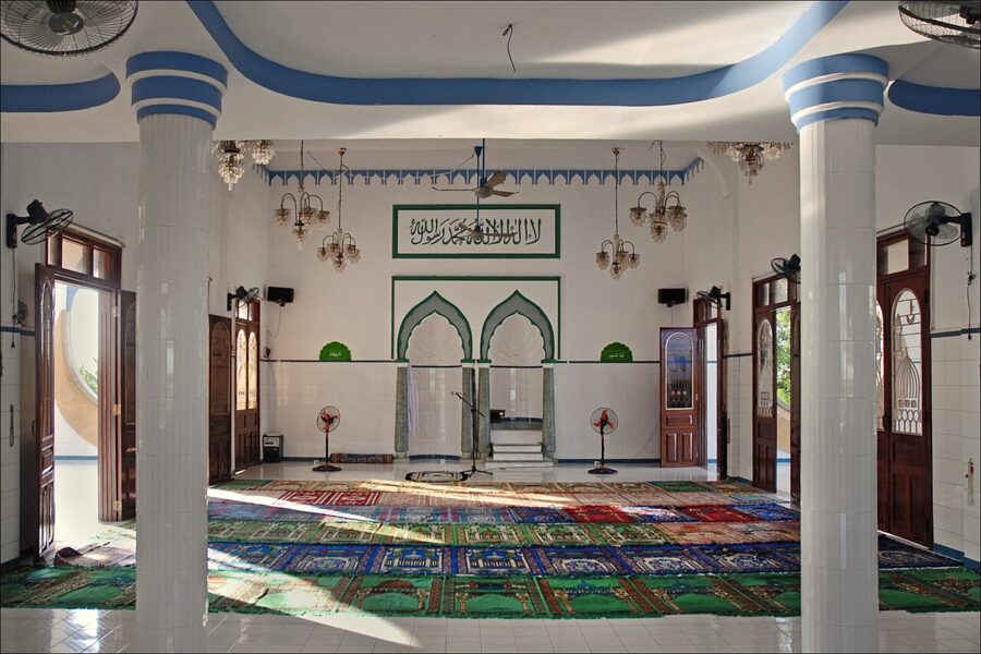

The villages are known for weaving. Women work at looms under the houses and sell sarongs, scarves and checked cloth, and boat trips from town often stop at one.

Sam Mountain: the temple, the pagoda and the tomb
Sam Mountain (Núi Sam) rises about 5 km southwest of the town center, a lone granite hill of 284 m by the usual count (the provincial gazetteer gives 228 m), with the Vĩnh Tế canal and the border along its western side. Minh Mạng named it Vĩnh Tế Sơn; everyone else calls it after the sam, the horseshoe crab, whose shell it is said to resemble.
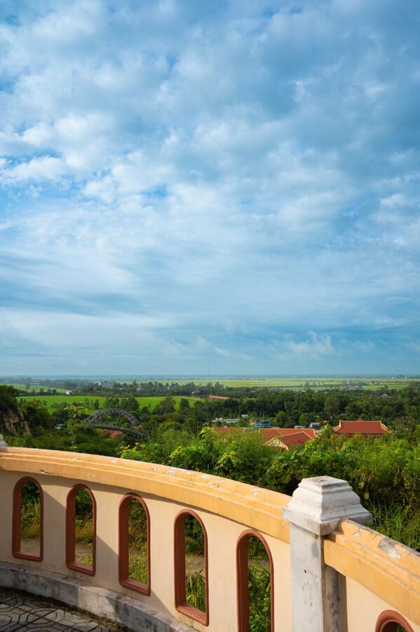
Almost everything sits around its eastern foot along National Highway 91: the temple of the Lady, Tây An pagoda and the tomb of Thoại Ngọc Hầu, a few minutes’ walk apart. A motorbike taxi or taxi from the town center takes about ten minutes.
The temple of Bà Chúa Xứ
The temple of the Lady of the Realm (Miếu Bà Chúa Xứ Núi Sam) was probably founded soon after the Vĩnh Tế canal was finished in 1824. A shelter of bamboo and leaves at first, it was rebuilt in brick in 1870 and again between 1972 and 1976 to a design by the architects Huỳnh Kim Mãng and Nguyễn Bá Lăng. Legend says villagers could not move the statue from the summit until a medium told them to choose nine young girls to carry it down; the stone platform where it stood is still on the hilltop.
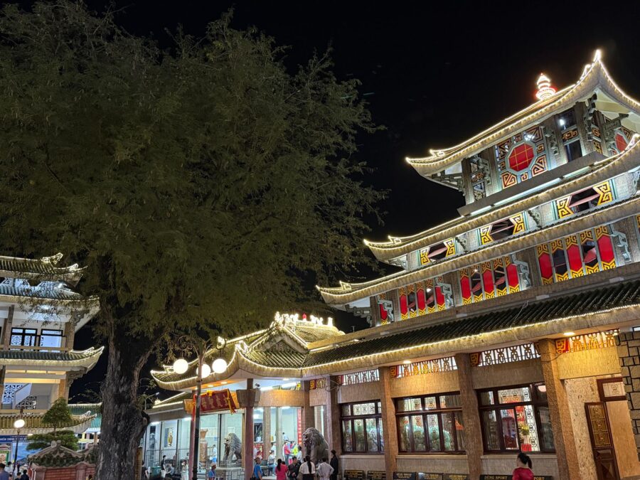
The festival, Vía Bà Chúa Xứ, runs from the 23rd to the 27th day of the fourth lunar month, between mid-May and mid-June. The statue is bathed at midnight on the 23rd; on the 24th the decree and tablets of Thoại Ngọc Hầu and his wives are carried down from his tomb, and offerings and traditional opera fill the nights that follow. UNESCO inscribed the festival as intangible cultural heritage of humanity in December 2024. In 2026 the main ceremonies ran from 6 to 12 June.
Expect crowds on a scale few places in Vietnam match. The pilgrim season builds from Tết through the first four lunar months, and Châu Đốc’s hotels fill on festival nights. For a quiet temple, come in the second half of the lunar year on a weekday morning.
Tây An pagoda
Beside the temple is Tây An pagoda (Tây An Cổ Tự), founded in 1847 by the governor Doãn Uẩn. Its fame came from Đoàn Minh Huyên, remembered as Phật Thầy Tây An, the Buddha Master of Tây An, who founded Bửu Sơn Kỳ Hương and drew followers by healing the sick during an epidemic in 1849.
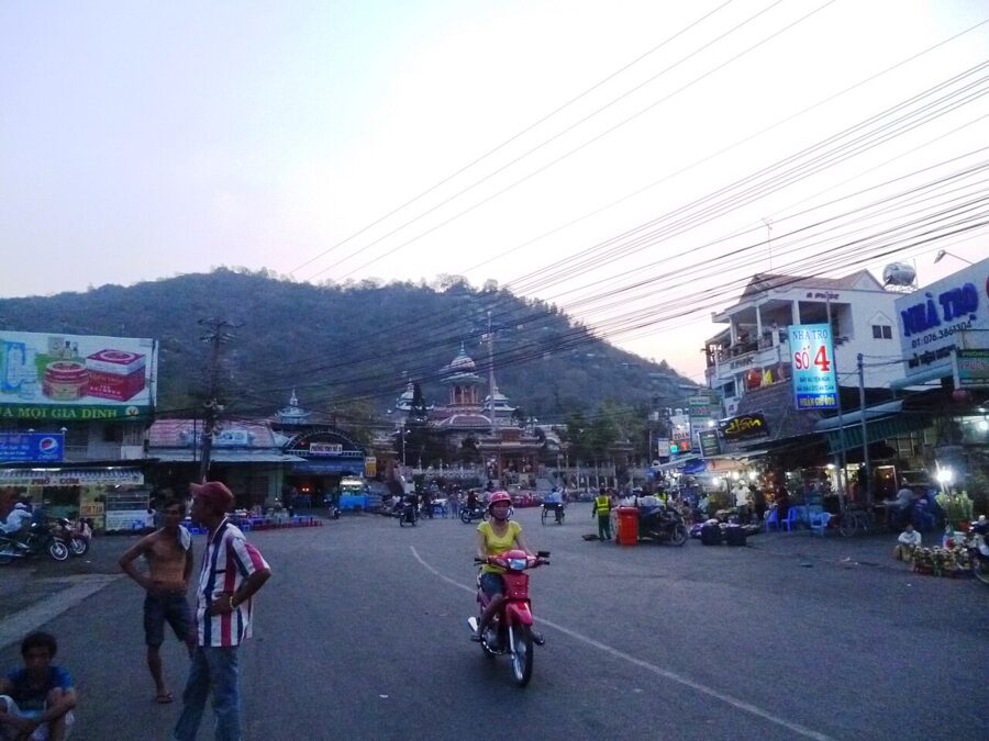

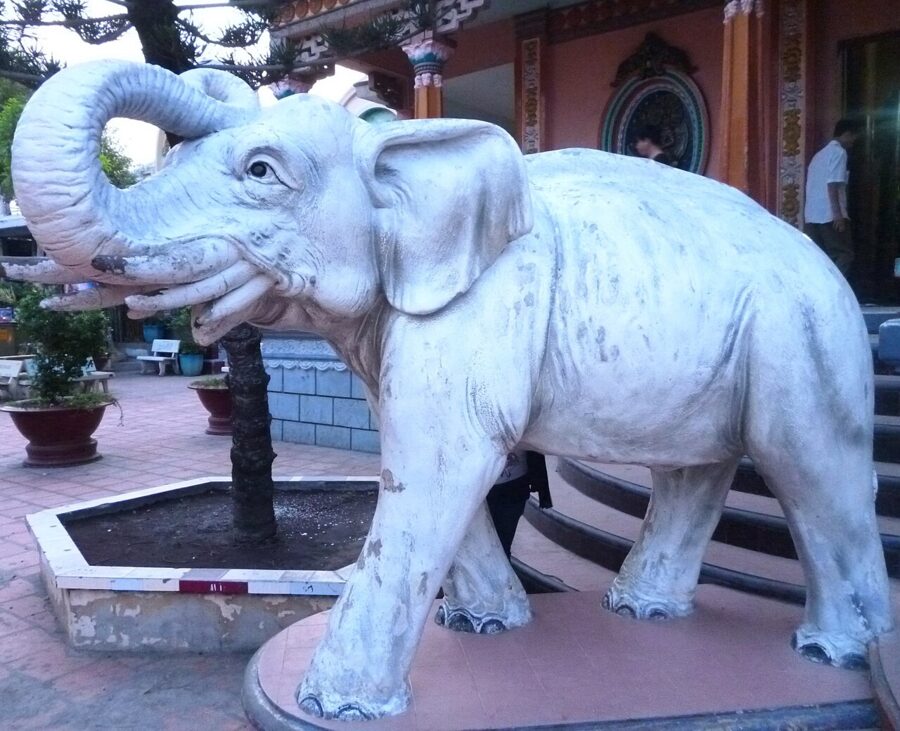
Rebuilt in 1958, its facade carries three towers with onion domes that owe something to India and, some think, to the minarets across the river. Inside are about 150 statues of Buddhas, bodhisattvas and guardians. It became a national monument in 1980, by the same decision as the temple next door.

The tomb of Thoại Ngọc Hầu and the canal he dug
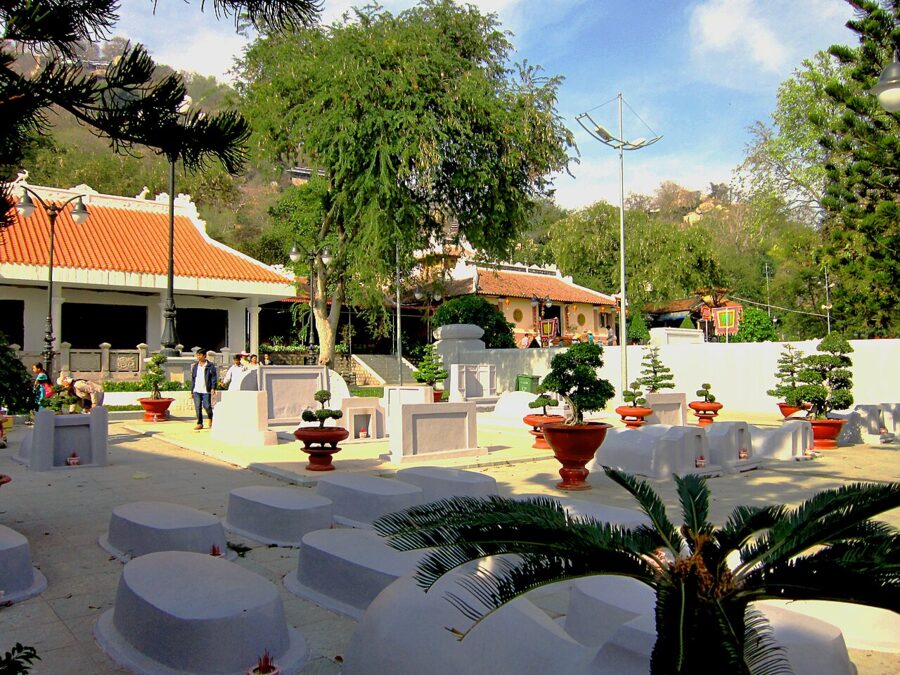
Across the road, steps climb to the tomb of Thoại Ngọc Hầu, the mandarin Nguyễn Văn Thoại. In 1819 the emperor Gia Long ordered him to dig a canal from Châu Đốc to the sea at Hà Tiên, giving the border a defensible waterway to the gulf. About 80,000 Vietnamese and Khmer laborers worked on it until 1824. The Vĩnh Tế canal runs 87 km along the frontier and is still in use.
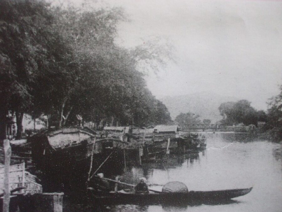
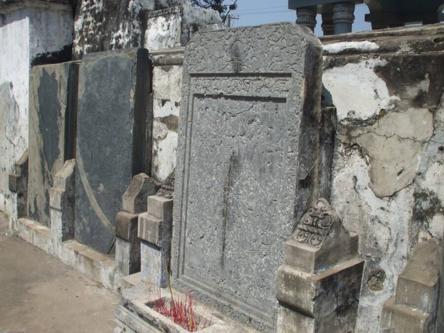
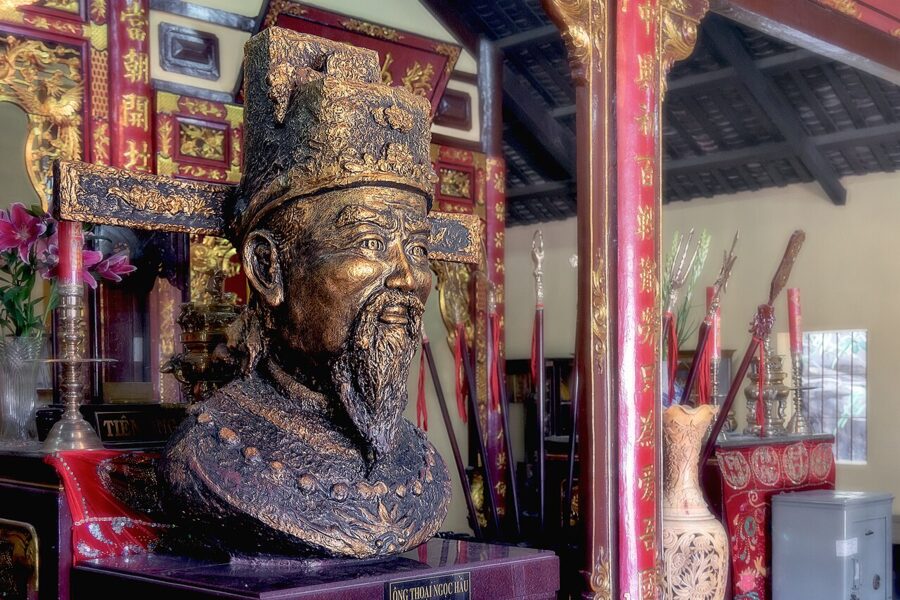
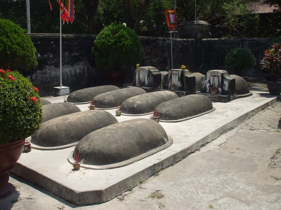
Minh Mạng named the canal for Thoại’s wife, Châu Thị Vĩnh Tế, who is said to have cared for the workers’ families. Thoại died in 1829 and lies between his two wives on a terrace; a shrine behind holds his bust. Beside the tomb are rows of small graves, more than fifty in all, where he had the remains of workers who died on the canal reburied. They get far fewer visitors than the mandarin.




Chùa Hang and the summit
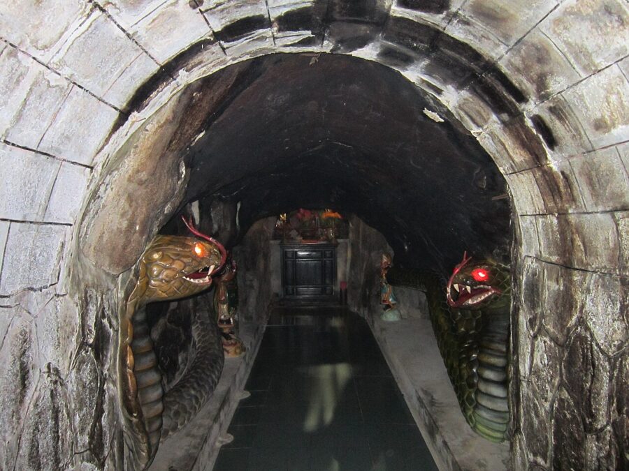
About a kilometer around the mountain, Chùa Hang (Phước Điền pagoda) climbs the slope in red-brown terraces to a cave at the back. Its story centers on a nun who lived here in the 19th century and is said to have tamed two pythons that came to share her vegetarian food; statues of the snakes now guard the cave.

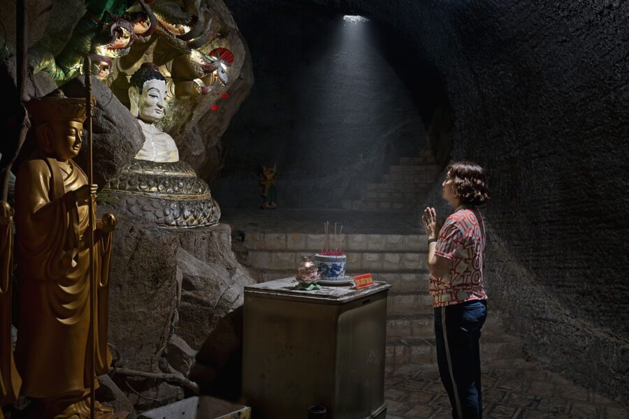
A steep stepped path to the summit starts behind Thoại Ngọc Hầu’s tomb, past small shrines and drink stalls, a stiff climb in the heat. A paved road of more than 2 km winds up the back for cars and motorbikes, and since 2021 a cable car has run up the eastern face, 900 m of line with 37 eight-seat cabins.
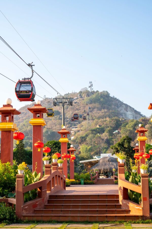
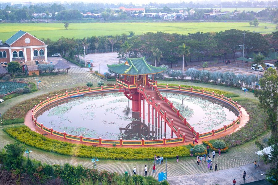
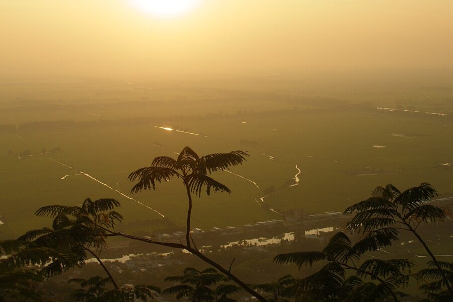
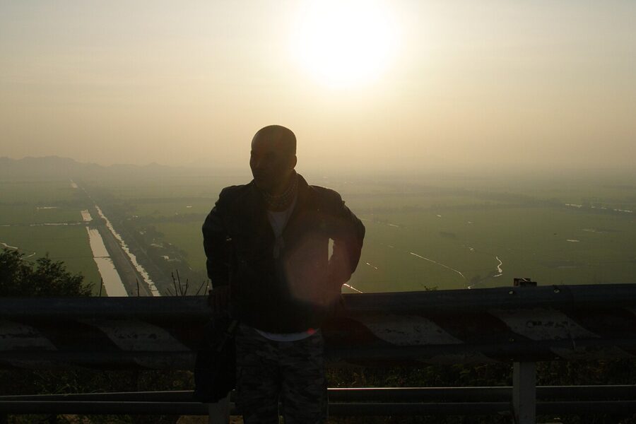
The summit was a military post until 1975, called Pháo Đài, the Fort. The post is gone; the views remain, west over the canal to Cambodia and east over Châu Đốc. Go up at the end of the day, when the heat eases and the fields turn gold.

Trà Sư melaleuca forest
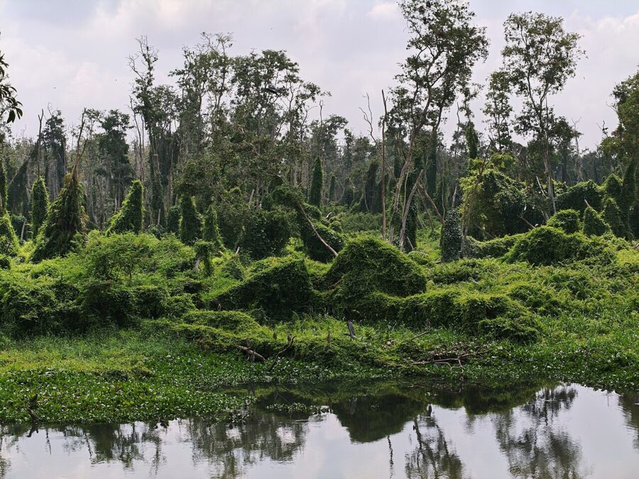
Thirty kilometers southwest of Châu Đốc, the road passes a block of trees standing in water. Trà Sư was planted with melaleuca (tràm) in 1983, on land too acidic for much else. The province made it a protected area in 2003, and since 2018 its visitor area has been run by the provincial tourism company.
Sources give its size as 845 ha or, more recently, over 1,050 ha; its old address was Văn Giáo commune, and it now lies in An Cư commune. It holds about 70 species of birds, including painted storks and Oriental darters, both in Vietnam’s Red Data Book.
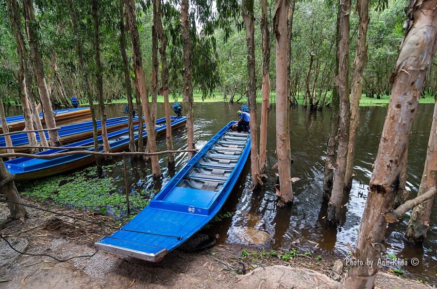

The boat ride
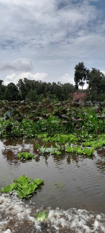
The visit is a boat ride in two stages. A motorboat carries you about 3 km along the main channel into the heart of the forest, through duckweed so dense it looks solid. There you change to a small rowing boat for three or four passengers, paddled by a local boatman into channels the motorboats cannot reach. The quiet after the engine stops is the point of the trip.
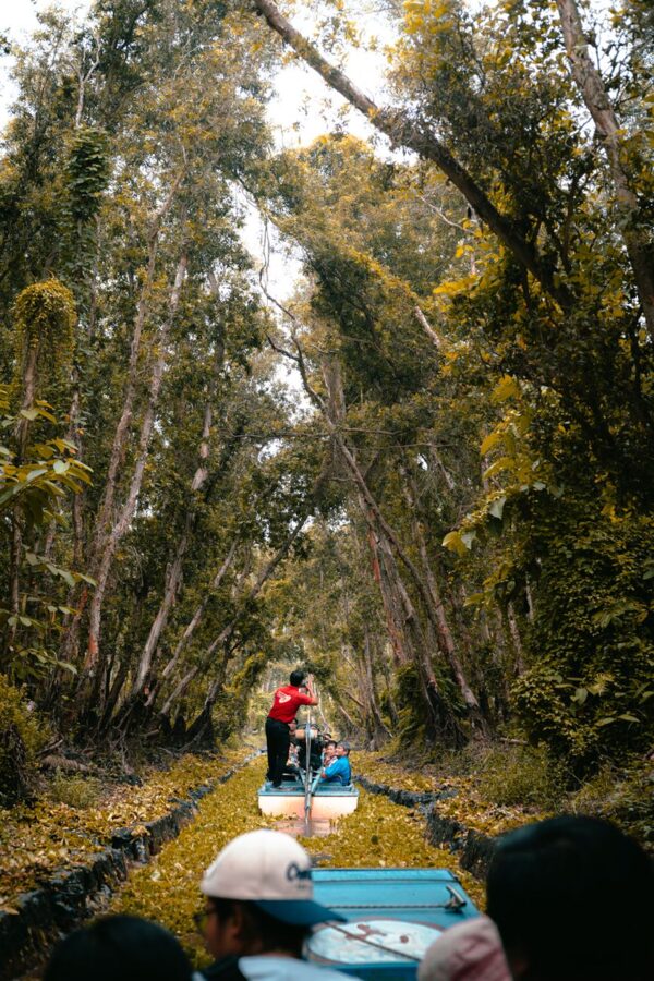
An observation tower, charged separately, looks over the canopy to Khmer villages several kilometers away. There is also a long bamboo walkway through the trees, and a restaurant at the landing serves delta dishes such as lẩu mắm.

Tickets, hours and the season
According to the forest’s own price list, entry costs 120,000₫ (about US$4.50) per person, the motorboat 80,000₫ (about US$3) from 15 May 2026, and the rowing boat 70,000₫ (about US$2.70). Children under 1.3 m enter free. The site is open daily from 6:30am to 6:30pm, through Tết as well.
Come between September and November for high water, birds and the brightest green; in the dry months the channels shrink, though the boats still run. Early morning is best in any season, before the tour groups from Châu Đốc arrive.
The Seven Mountains and the Khmer pagodas
Beyond Trà Sư the Seven Mountains begin. The usual list names Núi Cấm, Núi Dài Năm Giếng, Núi Cô Tô, Núi Dài, Núi Tượng, Núi Két and Núi Nước, though older lists disagree. Monks, hermits and the followers of new faiths have lived in their caves since the 19th century, and a local saying sends you to Phú Yên to seek Buddhahood and to the Seven Mountains to seek immortality.

Núi Cấm
Núi Cấm, the Forbidden Mountain, reaches 705 m (some sources say 710 or 716 m), about 37 km from Châu Đốc. Stories differ on why it was forbidden; one says Đoàn Minh Huyên barred his followers from building huts on a mountain he held sacred, and Bửu Sơn Kỳ Hương believers expect the future Buddha, Maitreya, to appear here.
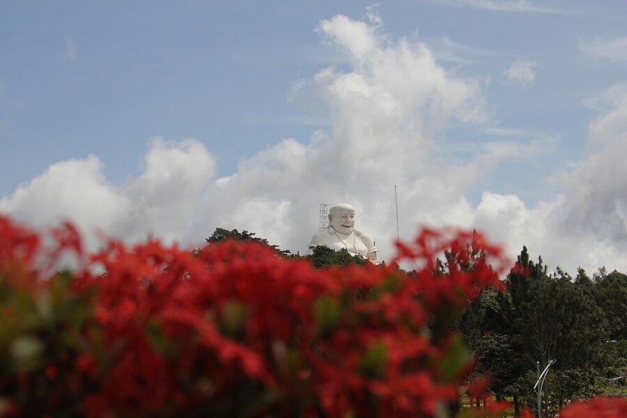
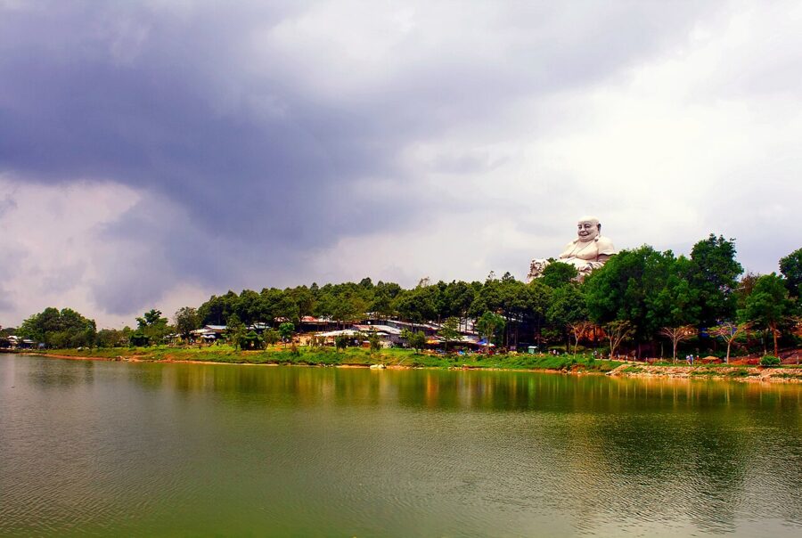
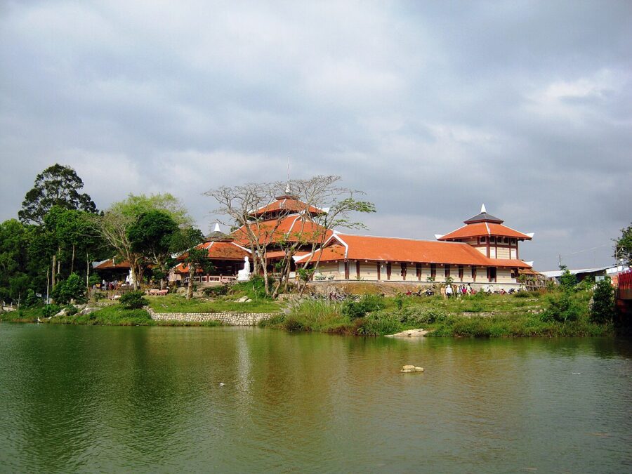
A road and a cable car, opened in February 2015, reach the top. Near the summit are Thủy Liêm lake, the pagodas of Vạn Linh and Phật Lớn, a 26.5 m statue of the Bodhisattva of Compassion and a seated Maitreya of 33.6 m, built in 2004 and 2005. It is cooler up here than on the plain, and busy with pilgrims at weekends.


Tri Tôn and the Khmer pagodas
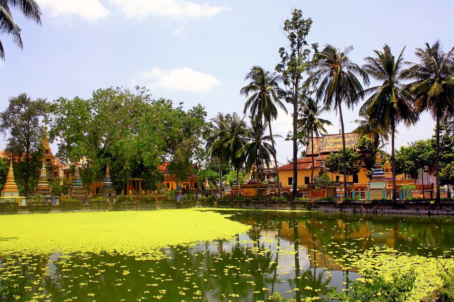
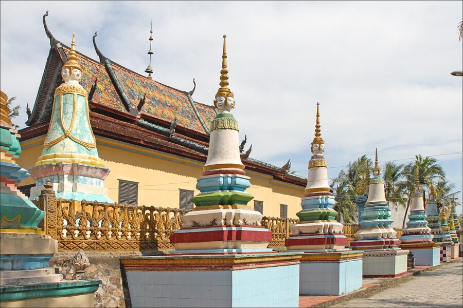
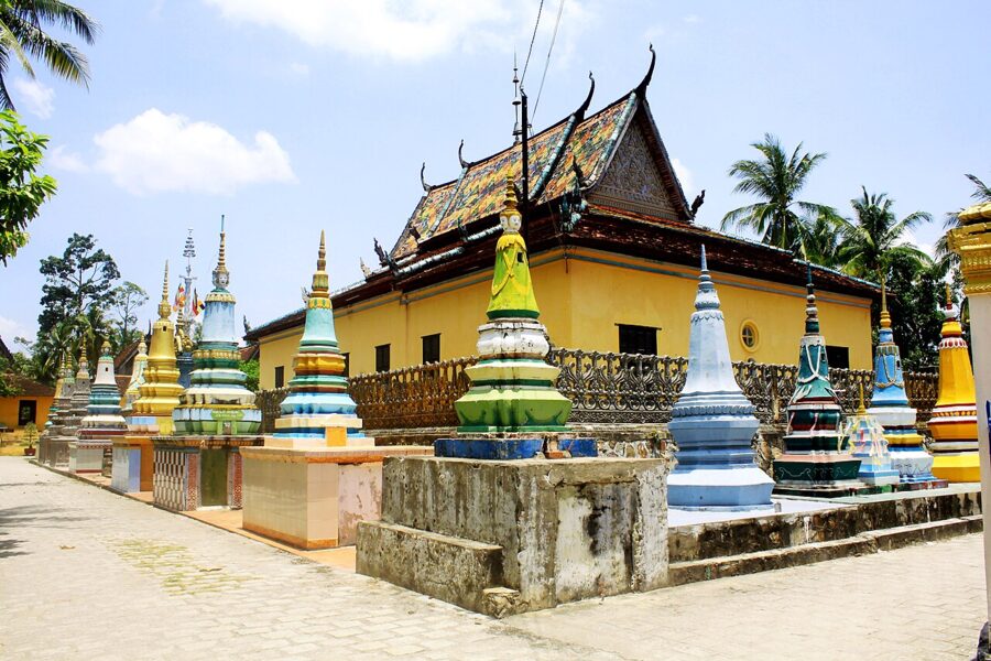
The Khmer heartland lies around Tri Tôn and Tịnh Biên. The pagodas follow the Cambodian plan: a main hall facing east, a steep roof with curling naga finials, small stupas holding the ashes of monks, and often a pond in front.
Xà Tón pagoda (Chùa Xà Tón, or Xvayton) in Tri Tôn is the one to see. Its founding date is unknown; the monks say more than two centuries ago. In 1896 a pond was dug in front to raise the floor 1.8 m above the flood, and the brick hall dates from then. It keeps more than a hundred sets of scriptures on palm leaves, the largest such collection in Vietnam, and became a national monument in 1986.


Cover shoulders and knees, take off your shoes and leave a small donation in the box. The same etiquette applies as in Saigon’s pagodas, with one addition: women should not touch a monk or hand him anything directly.

The ox races
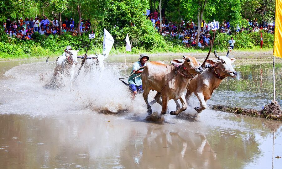
The best time in the Khmer villages is Sene Dolta (Đôn Ta), the festival of the ancestors, in late September or early October. Its climax is the Bảy Núi ox race, national intangible heritage since 2016: pairs of oxen drag a wooden harrow and a standing driver through a flooded field at full gallop. The 30th edition, on 20 September 2025, drew 64 pairs to the grounds at Tà Pạ.

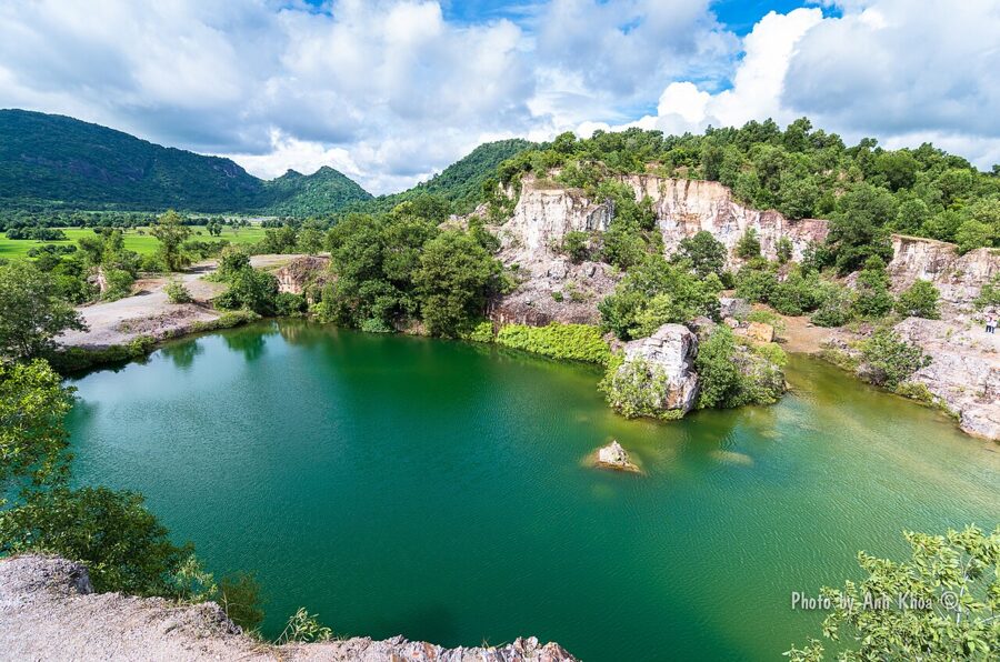
Tà Pạ itself, near Tri Tôn, has a granite quarry filled with green water, a hilltop Khmer pagoda and a view across the palm-dotted plain, a good stop on the loop back toward Châu Đốc.

Ba Chúc
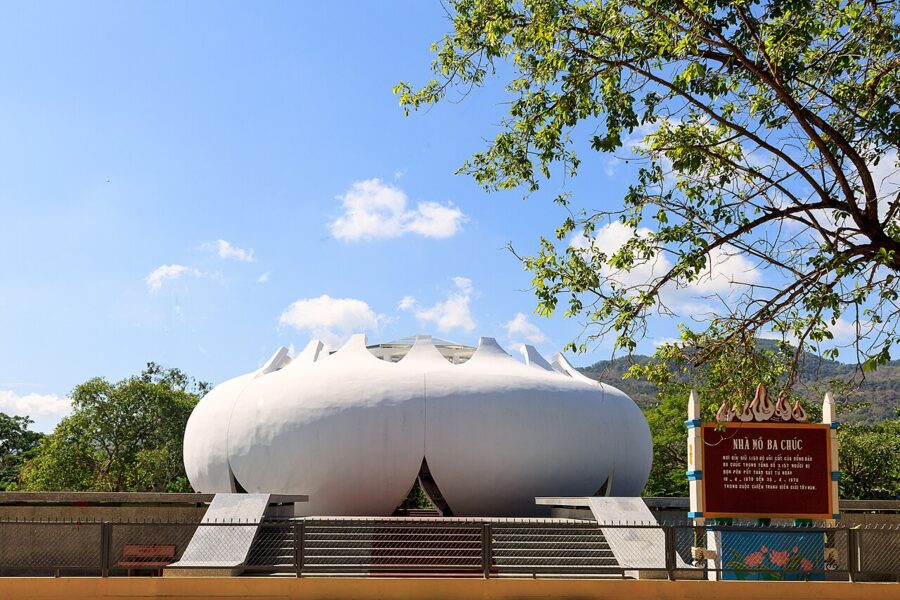
South of the mountains, the town of Ba Chúc keeps a darker memory. Between 18 and 30 April 1978 Khmer Rouge troops crossed the border and killed 3,157 civilians here, many inside the Phi Lai and Tam Bửu pagodas where they had sheltered. A memorial ossuary holds the remains of 1,159 victims never claimed. The massacre was one of the border attacks that preceded Vietnam’s invasion of Cambodia in December 1978, and the memorial is not a place to linger with a camera.

Óc Eo and Ba Thê: the port of Funan
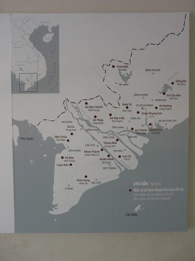
The oldest place in An Giang is a rice field. At the foot of Ba Thê mountain, in Óc Eo commune west of Long Xuyên, lies the site of Óc Eo, a city and port that flourished from about the first to the seventh century, when the kingdom Chinese chroniclers called Funan controlled the coast between the Mekong and the Gulf of Thailand.
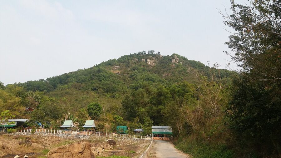

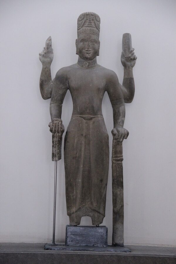
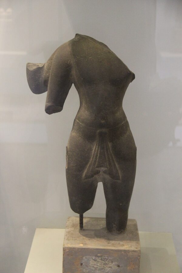
French archaeologists spotted its outline in aerial photographs, and Louis Malleret excavated it in the 1940s. The city covered about 450 ha, crossed by canals, one running some 68 km to Angkor Borei in what is now Cambodia. Finds include gold jewelry, glass and stone beads, statues of Vishnu and the Buddha in Indian style, and Roman gold coins of the emperors Antoninus Pius and Marcus Aurelius, which must have come by way of India.
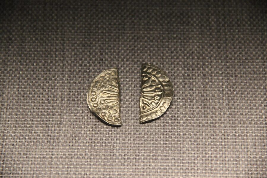
What you can see
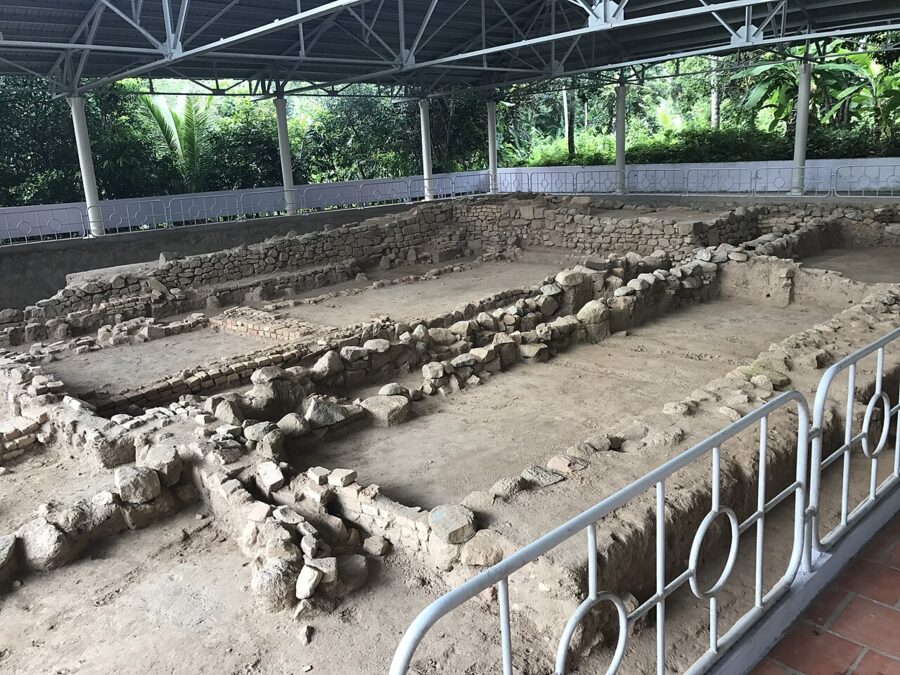
Manage expectations: the finds are in museums, and what remains on the ground are brick and stone foundations, some under protective roofs. Gò Cây Thị has the clearest, low brick walls laid out in rectangles, the bases of temples or halls.
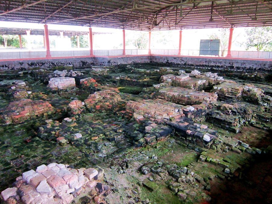

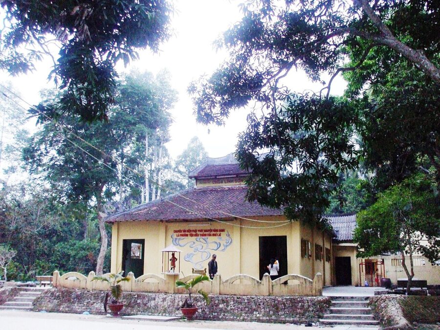
On the mountain, Linh Sơn pagoda shelters an ancient stone figure that locals call the four-armed Buddha, and higher up, Nam Linh Sơn has ruins from the Funan period. A display house run by the Óc Eo heritage board shows finds and models; it is closed on Mondays and open other days from 7:30am to 11am and 1:30pm to 5pm, and the outdoor sites are open daily. The board can arrange a guide.


The UNESCO bid
Óc Eo and Ba Thê became a special national relic in 2012 and went on UNESCO’s tentative list in 2022. Vietnam submitted the nomination, sixteen sites across 453.1 ha, at the end of January 2026; ICOMOS experts inspected them in August 2026, and the province hopes for inscription in 2027. The display house is being upgraded to a museum meanwhile.
The best finds are in Ho Chi Minh City. The Museum of Vietnamese History beside the zoo has a room of Óc Eo jewelry, statues and ceramics, and the Fine Arts Museum holds Óc Eo stone sculpture. See them before or after the trip and Ba Thê makes much more sense.

What to eat in An Giang
The dish to try in Châu Đốc is bún cá, rice noodles in a broth yellow with turmeric and fragrant with lemongrass and ngải bún, a ginger-like root, with flaked snakehead fish, bean sprouts, herbs and often slices of roast pork. Locals eat it for breakfast around the market, and a few Saigon restaurants serve it under the town’s name.
Lẩu mắm, a hot pot built on fermented fish broth, is the evening meal. It comes with a basket of field greens and flowers, many gathered in the flood season, plus pork, shrimp, fish and eggplant. Order it for two at least, and don’t judge the smell before the first spoonful.
Palm sugar
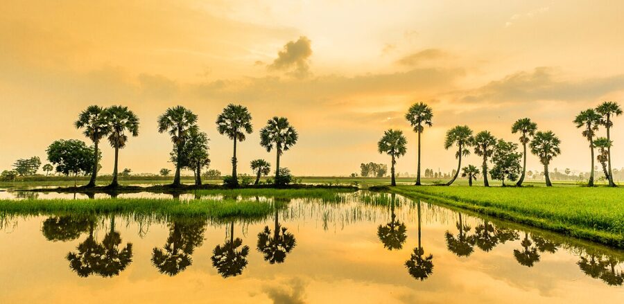
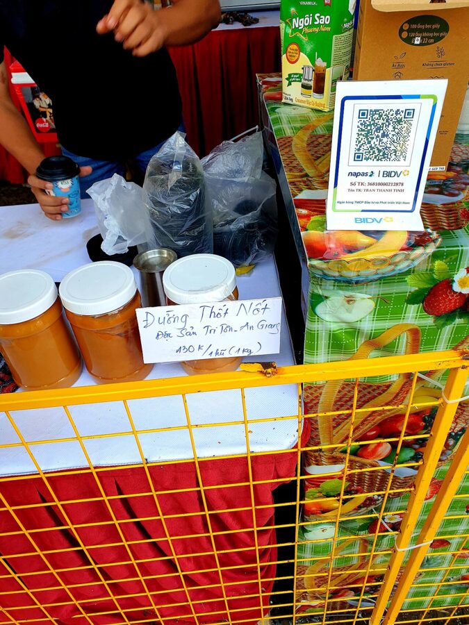
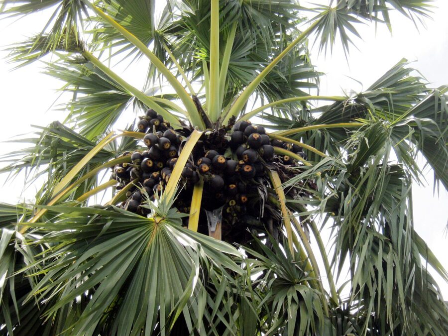
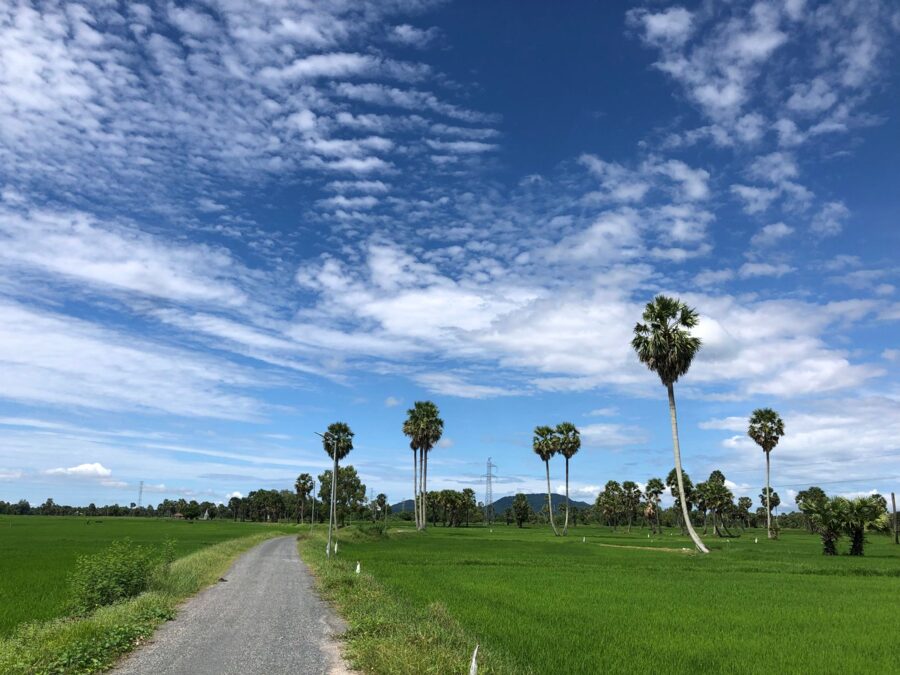
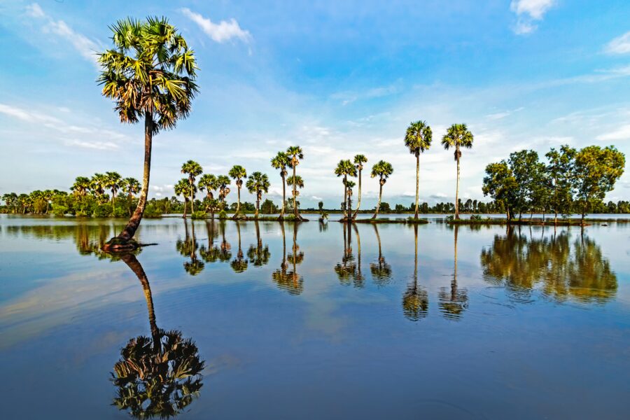
The tall palms in rows along the paddy dikes are palmyra palms (thốt nốt), the signature of the Khmer country around Tri Tôn and Tịnh Biên. Men climb them on bamboo ladders to collect sap from the cut flower stalks and boil it down over wood fires into palm sugar. About 2,000 households make it, and the craft became national intangible heritage in February 2024.
Roadside stalls sell the sugar in cakes, with fresh palm juice and the jelly-like flesh of the young fruit, eaten cold. Bánh bò thốt nốt, a spongy steamed cake sweetened with palm sugar, is the one to take home; Châu Đốc’s market sells it by the box.


Getting there from Saigon
If you are flying in, Tân Sơn Nhất airport in Saigon is the usual gateway; Châu Đốc has no airport, and the nearest are at Cần Thơ and Rạch Giá.
By bus or limousine van
Buses to Châu Đốc leave the Western Bus Station (Bến xe Miền Tây) around the clock. Phương Trang (FUTA Bus Lines) runs the most departures, with sleeper buses at about 210,000₫ (about US$8) one way, and the trip takes six to seven hours. Limousine vans with fewer, larger seats cost more and are a little faster, and many pick up at hotels. Book a week ahead for Tết and the Lady’s festival.
By private car or tour
A car with driver is the comfortable way, and the only way to fit Châu Đốc, Trà Sư and the Seven Mountains into two days. The road follows expressways to Cần Thơ, then the Hậu River. A new expressway from Châu Đốc to Cần Thơ and Sóc Trăng opened its An Giang section to traffic on a technical basis in December 2025; the full route is due in 2027.
Many Saigon tour companies sell two- and three-day trips that pair Châu Đốc with a night in Cần Thơ, three hours away, and its floating market. It is a sensible combination.
The boat to Phnom Penh
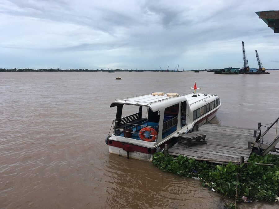
Speedboats run up the Mekong to Phnom Penh, crossing the border at Vĩnh Xương, where passengers step off for passport checks on both sides. The best-known operator, Hang Chau, leaves from a jetty near the Victoria Châu Đốc hotel at about 7:30am. Travelers in 2025 reported about five and a half hours including the border, and the company’s fare from June 2026 is 1,580,000₫ (about US$61), raised that May for fuel costs. Confirm time and fare with the operator, and check Cambodia’s visa rules for this crossing.

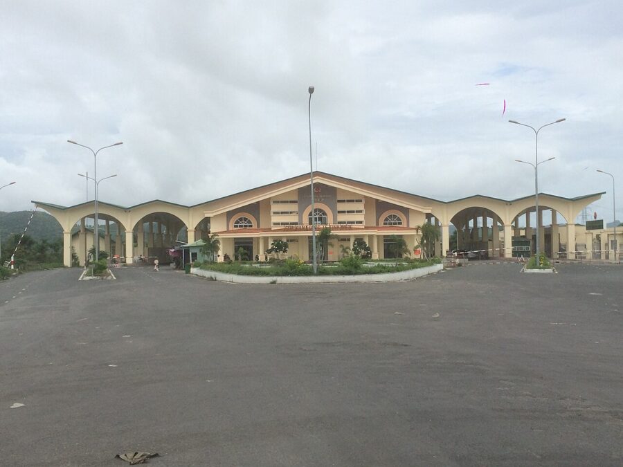
By road, the main crossing is at Tịnh Biên, on the Vĩnh Tế canal west of Sam Mountain, on the highway toward Takéo and Phnom Penh.
Planning the trip
One day from Saigon
Leave Saigon by 6am with a car and driver and reach Sam Mountain around noon for the temple, Tây An and the tomb. In mid-afternoon take a boat from the Châu Đốc waterfront to the rafts and a Cham village, then start back by 4pm. You will be home after 10pm, having spent twice as long in the car as at the sights, without seeing Trà Sư.
Two days
Day one: arrive in Châu Đốc at lunchtime and spend the afternoon on Sam Mountain, finishing on the summit at sunset, then eat lẩu mắm in town. Day two: the market and a boat to the rafts at 6:30am, Trà Sư by 9am before the groups, then Núi Cấm or Tri Tôn and the palm country before heading back. A third day adds Óc Eo and Ba Thê, or the boat to Phnom Penh.
Where to stay
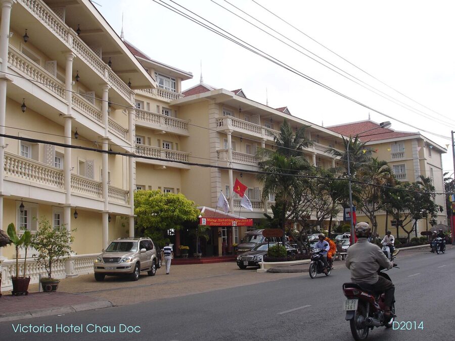
The Victoria Châu Đốc, a colonial-style hotel on the river junction, and the Victoria Núi Sam Lodge, on the side of Sam Mountain with a pool over the fields, are the two upmarket choices; both were taking bookings in 2026. Cheaper hotels cluster around the market and the river. For the festival, book weeks ahead or stay in Long Xuyên.

When to go, and when not to
September to November brings the flood, Trà Sư at its fullest and the Khmer festivals; late November and December add golden rice. January to April is hot and dry but good for climbing Sam Mountain. The rainy season, May to October, follows the pattern of Saigon’s weather: a short, heavy storm most afternoons. Avoid the Lady’s festival and the weeks after Tết unless you want the crowds.
Money and practicalities
Carry cash in dong: boatmen, stalls and most small restaurants take nothing else. Cover shoulders and knees for the temple, pagodas and mosques. Outside town, hire a car or a motorbike with driver for the day and agree the price first.
On your last evening, go back to Sam Mountain at dusk. The square in front of Tây An fills with flower sellers and families eating at plastic tables, the domes light up, and the line to see the Lady is still moving.