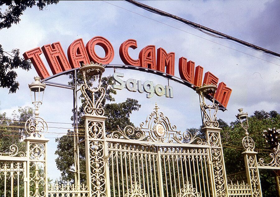
The postal address of the Saigon Central Post Office is now 2 Công xã Paris, Sài Gòn ward. Since 1 July 2025, when Vietnam abolished its districts and redrew every ward in the country, Saigon has been an official name again: not for the city, which is still Ho Chi Minh City, but for the ward that covers the old French core around the cathedral, the opera house and Nguyễn Huệ.
The name had been off the official map since 2 July 1976, when the National Assembly of the reunified country renamed the city of Saigon–Gia Định after Hồ Chí Minh. It never left the street. People say Sài Gòn for the center and for the city they are fond of, Thành phố Hồ Chí Minh on forms, and nobody is confused.
Both names are young. The city counts its age from 1698, when the Nguyễn lords’ envoy Nguyễn Hữu Cảnh set up a Vietnamese administration here, and it celebrated its 300th birthday in 1998. Before that the place had a Khmer name, Prey Nokor, and before that a prehistory that archaeologists are still digging out of the mangroves at its southern edge.
Each layer left something you can still stand in front of, and most of it lies within a half-hour walk of the post office. The rest is a short ride by Grab or on the city’s new metro, which runs under the square where Bến Thành Market has stood since 1914.
On this page
- Before the name: Funan, the Khmer and Prey Nokor
- Tax posts, refugees and 1698
- Gia Định, the citadel city
- The French take Saigon
- Nationalists, a revolution and two republics
- The war years in the city
- 30 April 1975, and a new name
- Hard years, fence-breaking and Đổi Mới
- Towers, a metro and a bigger map
- Where to see each period today
Before the name: Funan, the Khmer and Prey Nokor
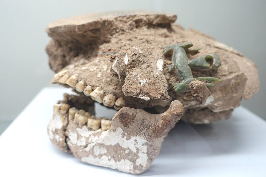
The oldest known people of Ho Chi Minh City were buried in jars. At Giồng Cá Vồ, a sandy ridge in the Cần Giờ mangroves at the city’s southern tip, archaeologists first dug in the 1990s and found a cemetery of burial jars whose glass and grave goods date it to roughly 2,400 to 2,100 years ago. A dig of just over 200 square meters in 2022 turned up 224 more jars and the skeleton of a man about 1.65 meters tall.
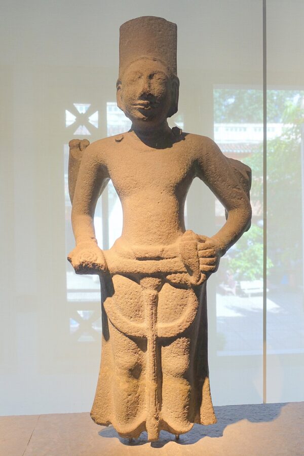
In the first centuries AD the lower Mekong belonged to the trading state Chinese envoys called Funan, whose port at Óc Eo in what is now An Giang traded with India and, through middlemen, with Rome. Khmer kingdoms followed. For a thousand years the land along the Saigon River was a thinly settled Khmer frontier of forest, swamp and tidal creek, far from Angkor.
At the start of the seventeenth century, according to the Cambodian chronicles the French scholar Louis Malleret translated, there were two small Khmer settlements here. Prey Nokor stood roughly where Chợ Lớn is now, and Kas Krobei, later Bến Nghé, lay on the river in the modern center. Prey Nokor is usually glossed as “the town in the forest”.
Most Vietnamese scholars, Nguyễn Đình Đầu and Lê Trung Hoa among them, trace the name Saigon to it, by way of an early Vietnamese spelling written with the Chinese characters 柴棍. A rival theory derives it from the Cantonese name of Chợ Lớn, which means “embankment”. Neither can be proved, and the argument has run for a century and a half.
Very little Khmer building survives from before the Vietnamese came. The place to see the deep past is the Museum of Vietnamese History in the zoo grounds, whose galleries put the finds from Giồng Cá Vồ beside Óc Eo statues and Khmer sculpture of the Angkor period.
Tax posts, refugees and 1698
Vietnamese settlers reached the area before any Vietnamese state did. Families from the Nguyễn lords’ realm in central Vietnam, squeezed by the long war with the rival Trịnh lords in the north, came south by sea in the early 1600s and cleared land among the Khmer.
Politics followed them. In 1620 the Cambodian king Chey Chettha II married Nguyễn Phúc Ngọc Vạn, a daughter of Lord Nguyễn Phúc Nguyên. In 1623, by the account Malleret translated, a Nguyễn envoy asked the king for leave to set up customs posts at Prey Nokor and Kas Krobei, where Vietnamese traders already stopped on the way to Cambodia and Siam. The two posts became the seeds of a market town.
The first Vietnamese written mention of the name comes from that border world. Lê Quý Đôn’s Phủ biên tạp lục, finished in 1776, records that in 1674 a Nguyễn general broke the “Sài Gòn rampart” while intervening in a Cambodian succession quarrel. In 1679 Lord Nguyễn Phúc Tần let some 3,000 Ming loyalists, soldiers and families who refused to serve the new Qing dynasty, settle at Biên Hòa and Mỹ Tho.
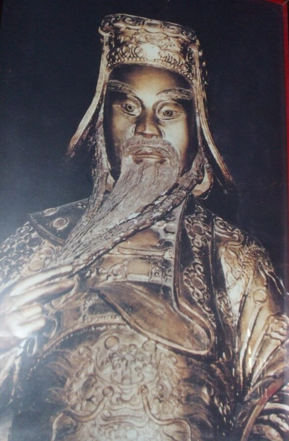

In 1698 Lord Nguyễn Phúc Chu sent Nguyễn Hữu Cảnh south to put the region in order. He found, the court chronicle says, land opened for a thousand leagues and more than 40,000 households, and he gave it a government: Gia Định prefecture, with Phước Long district on the Đồng Nai River and Tân Bình district around Saigon. Chinese settlers were registered in villages of their own, Thanh Hà at Biên Hòa and Minh Hương at Saigon.
Cảnh died in 1700, on the way home from a campaign in Cambodia, and is still worshipped as the founder of the south. The Minh Hương Gia Thạnh communal hall in Chợ Lớn keeps an altar to him. The 300th anniversary of 1998 was counted from his arrival, and one of the city’s main riverside roads carries his name.
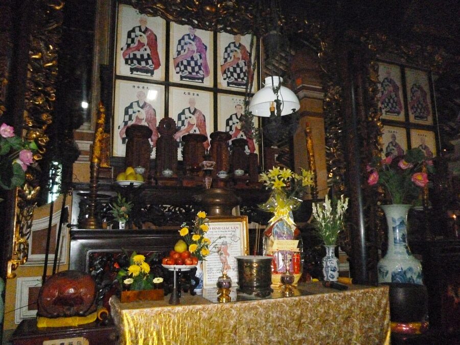
The oldest building in the city that still does its original job dates from this frontier century. Giác Lâm Pagoda was founded in 1744 by Lý Thụy Long, a Minh Hương layman, on a low hill then well outside the town. It was rebuilt in 1799 to 1804 and again in 1906 to 1909 and stands at 565 Lạc Long Quân Street, in the old Tân Bình district, with a statue of Avalokiteshvara under a tall bodhi tree just inside the gate and a seven-story stupa finished in 1994.

Gia Định, the citadel city
For a generation after 1771 Saigon was a prize. The Tây Sơn brothers, rebels from Bình Định, overthrew the Nguyễn lords and took the town again and again, and the surviving Nguyễn prince, Nguyễn Phúc Ánh, took it back almost as often. In 1782 Tây Sơn troops killed more than ten thousand Chinese in the Saigon area for backing the Nguyễn.
Ánh retook Saigon for good on 7 September 1788 and made it his capital. On 4 February 1790 work began on a citadel planned with the help of French officers recruited by the missionary Pigneau de Béhaine, Olivier de Puymanel and Théodore Lebrun among them. Some 30,000 laborers built it, taxed and driven hard enough to provoke a revolt.
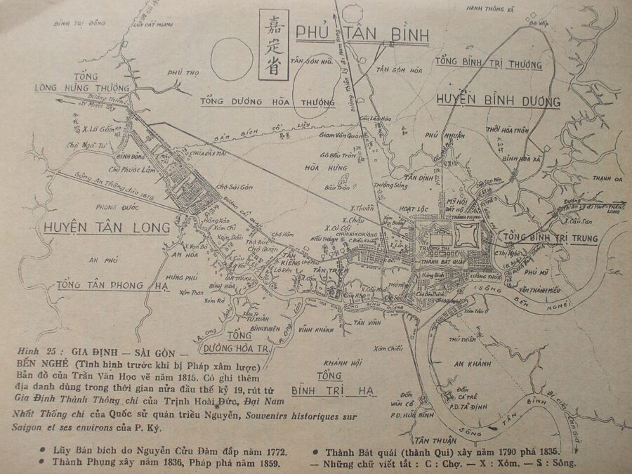
Vietnamese records call it the Bát Quái, the Eight Trigrams citadel, and describe an octagon with eight gates. The French plans of 1799 and 1815 and the British envoy John Crawfurd, who saw it in 1822, describe something closer to a square fort in the style of Vauban, with bastions, a glacis and a ditch, its longest side perhaps three quarters of a mile. Inside stood Ánh’s palace, the granaries and the arsenal.
From that base Ánh won the war. In 1802 he took the whole country and the throne as Emperor Gia Long, and the capital moved to Huế. Saigon became the seat of Gia Định Thành, a viceroyalty over the five southern provinces, and by one count it had about 180,000 people in 1819, 10,000 of them Chinese.
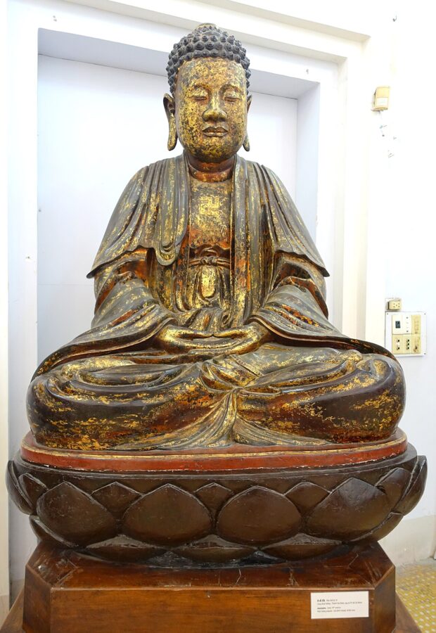
Lê Văn Duyệt and the razed citadel
The man who ran the south for most of the next thirty years was Lê Văn Duyệt, a peasant’s son from the Mekong delta who had served Ánh since 1780 as a eunuch of his household and then as one of his best generals. As viceroy in Gia Định he protected Chinese traders and Catholic missions and kept the port open to foreign ships. In the south he is remembered as fair, fearless and blunt with emperors.
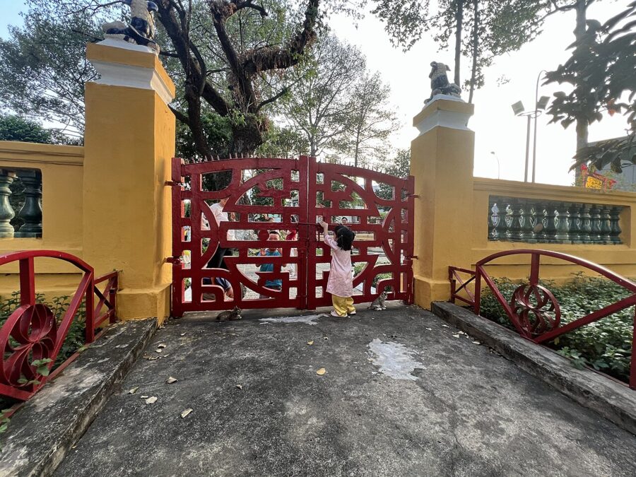

The court in Huế saw a rival. Emperor Minh Mạng, Gia Long’s son, distrusted Duyệt’s power and his tolerance of Christians, and after Duyệt died in 1832 the court moved against his memory and his followers. In 1833 his adopted son Lê Văn Khôi seized the citadel and held it for two years against the imperial army.
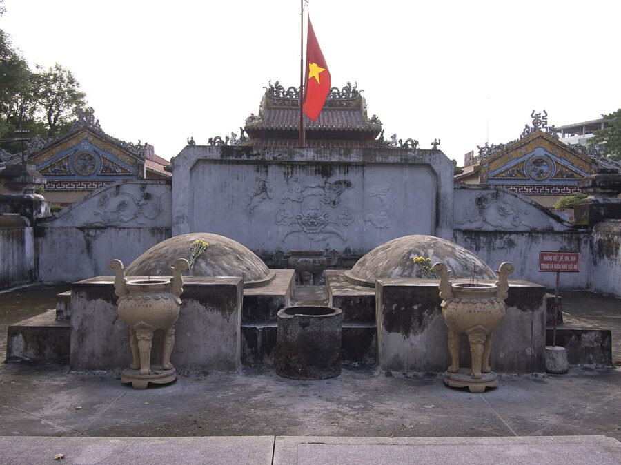
When it fell in 1835, Minh Mạng had Duyệt’s grave leveled and a stone set up branding him a eunuch who had been punished by law. Sources disagree on whether the tomb was first defaced before the revolt or only after it. Emperor Thiệu Trị restored it in 1841, and Tự Đức enlarged the temple.
Minh Mạng also had the great citadel pulled down and in 1836 built a smaller square one, the Phụng citadel, northeast of the old site. It had sides of about 475 meters and walls of stone, brick and earth, and it lasted twenty-three years. Nothing of either citadel stands today; Vietnamese accounts place the last traces along Đinh Tiên Hoàng Street toward the old Ba Son shipyard.
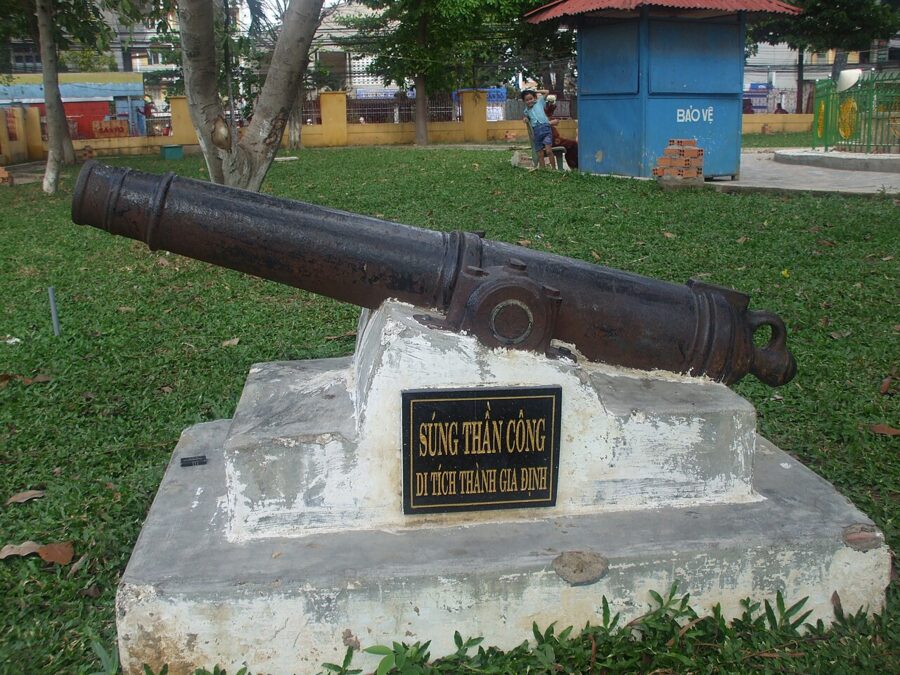

Duyệt’s tomb is the period’s best monument. Lăng Ông Bà Chiểu, at 1 Vũ Tùng Street in Gia Định ward (the old Bình Thạnh district), was listed as a national monument in 1988, and a society of devotees has run its rites since the early twentieth century. People come to pray to the Tả quân, the Marshal, and burn incense in the main hall; in the grounds sits a cannon from the old citadel.

Chợ Lớn: the Chinese town on the embankment
The town the Vietnamese called Saigon in the eighteenth century was not today’s center. It was the Chinese market several kilometers west, the “Chợ Sài Gòn” on the 1815 map. Chinese traders driven from Cù Lao Phố, the river port near Biên Hòa, by the Tây Sơn wars rebuilt along the canal banks there and raised a dike against the tides; the Cantonese name for the place is written 堤岸, “embankment”, and read Đề Ngạn in Vietnamese.
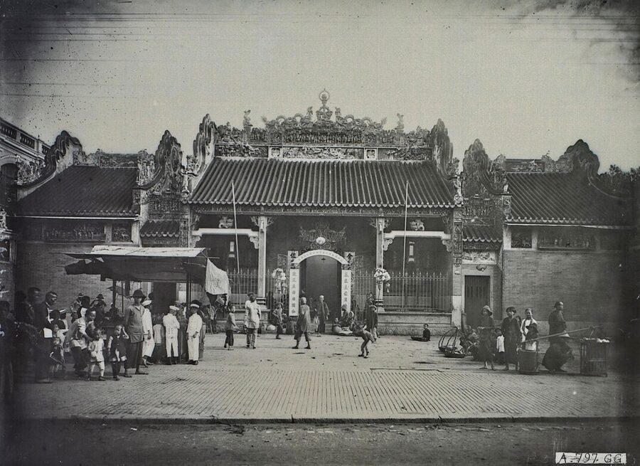
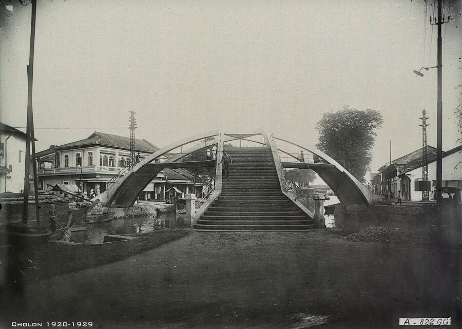
When the French arrived they kept the two towns apart but moved the names. A decree of 3 October 1865 gave the name Ville de Saigon to the Vietnamese and French settlement at Bến Nghé on the river, and the name Ville de Cholon, from Chợ Lớn, “big market”, to the old Chinese Saigon. The two grew toward each other along the Tàu Hủ canal and a steam tramway, met around today’s Nguyễn Văn Cừ Street by 1930, and were merged into one Saigon–Cholon region in April 1931.
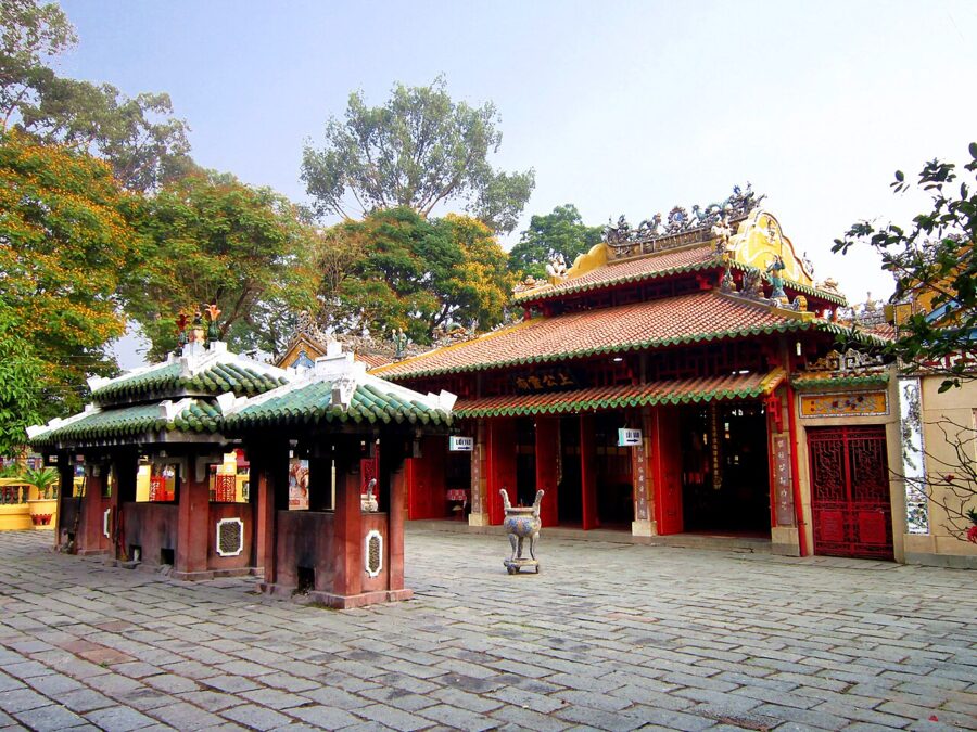
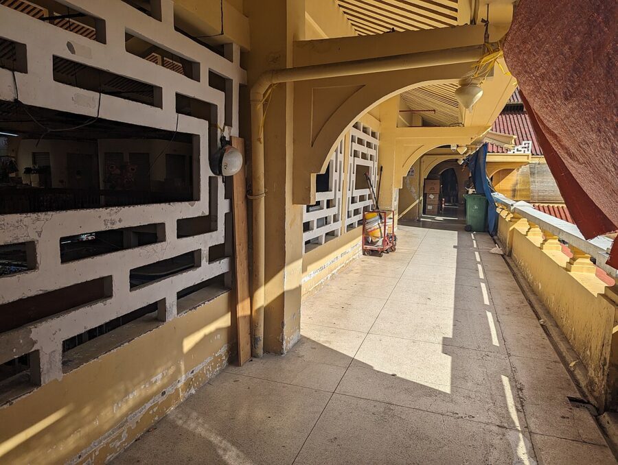
Chợ Lớn is still the place to see the Chinese city. The assembly halls along Nguyễn Trãi include the Thiên Hậu Pagoda, and a few blocks west the rice merchant Quách Đàm’s Bình Tây Market, opened in 1928, still trades wholesale under its clock tower.
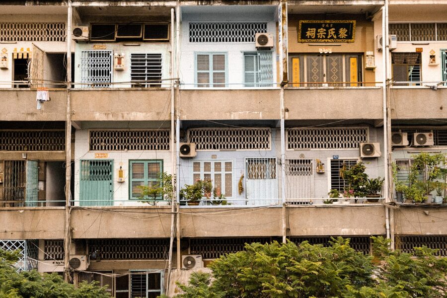
The French take Saigon
France came for its missionaries and stayed for the rice. A Franco-Spanish fleet that had made no headway at Đà Nẵng sailed south in February 1859, silenced the forts on the river and on 17 February stormed the Phụng citadel, taking more than 200 cannon and enough rice to feed an army for a year. Unable to hold the place, the French blew it up in March; sources give the 8th or the 18th.
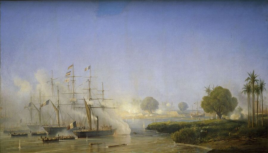
For two years a small garrison held a ring of forts around the town while a Vietnamese army under Nguyễn Tri Phương dug in at Kỳ Hòa to the west. Reinforcements under Admiral Léonard Charner broke the lines in February 1861. By the Treaty of Saigon of June 1862 the court in Huế ceded Biên Hòa, Gia Định and Định Tường, the three eastern provinces of the south, and in 1867 the French took the three western ones too.
A plan for 500,000 people
In 1862 the military engineer Paul Coffyn drew up a plan for a city of 500,000 people on the plain between the river, the Thị Nghè creek and the Bến Nghé canal. That was absurdly large for a town of soldiers and traders, and in 1865 the colony cut the city limits back to about three square kilometers. What survived was the idea: straight streets running inland from the river, and canals filled in to make boulevards.
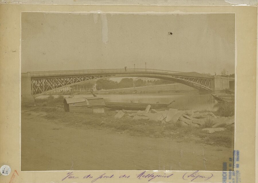
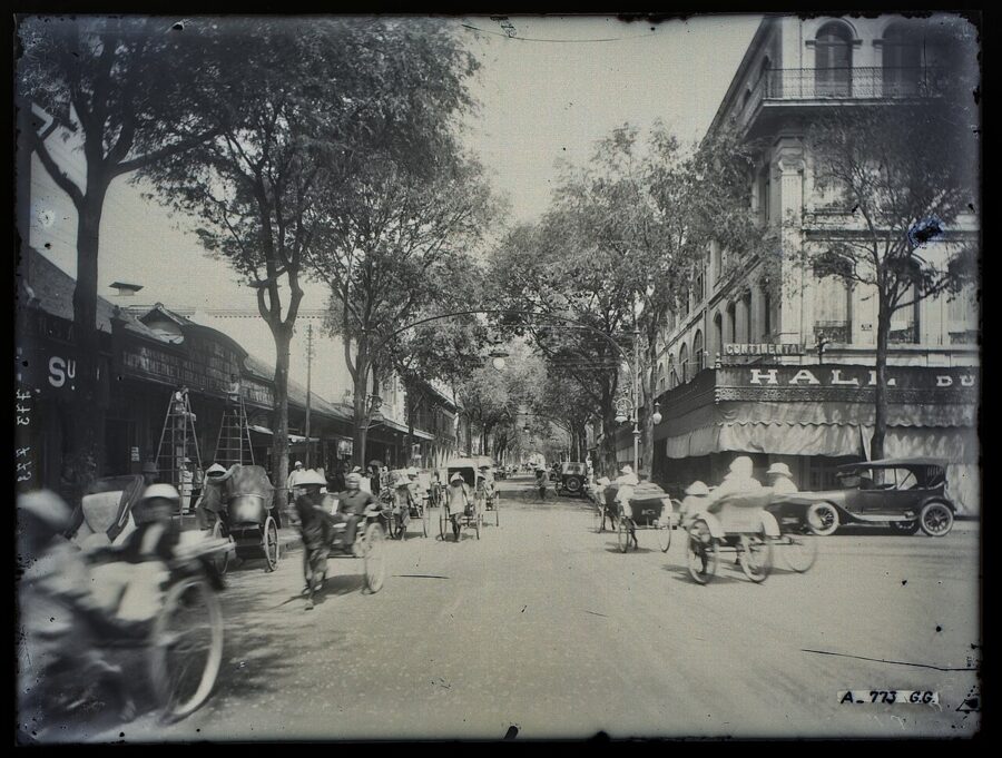
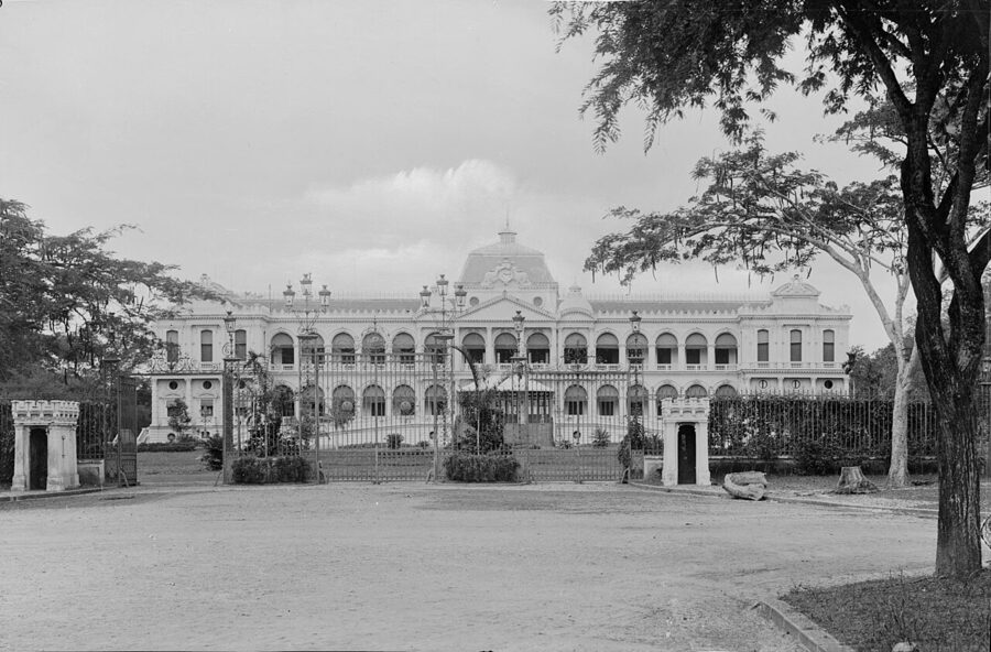
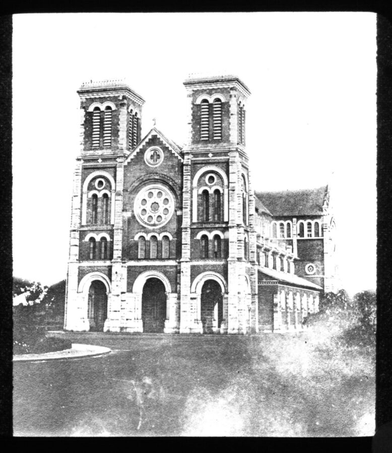
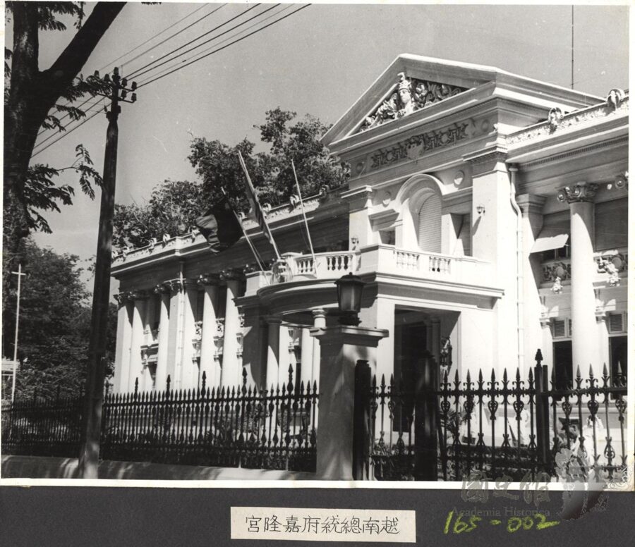
The public buildings came over the next half century. The governor’s palace by Achille-Antoine Hermitte, begun in 1868, opened in 1873 on the site the Independence Palace occupies now. The cathedral followed between 1877 and 1880 and the post office between 1886 and 1891, and the Gia Long Palace went up in 1885 to 1890 as a museum of commerce, then became the residence of the colony’s senior officials.
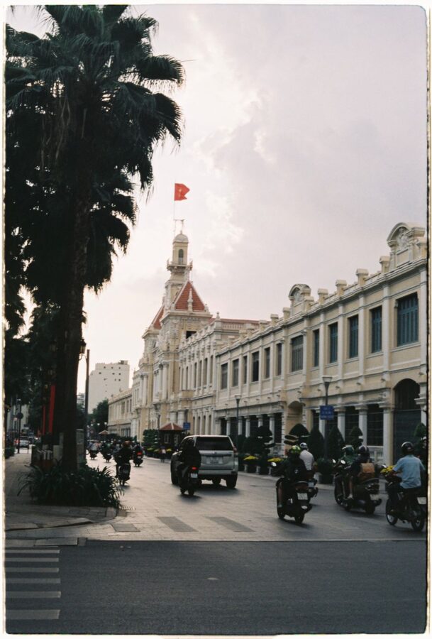
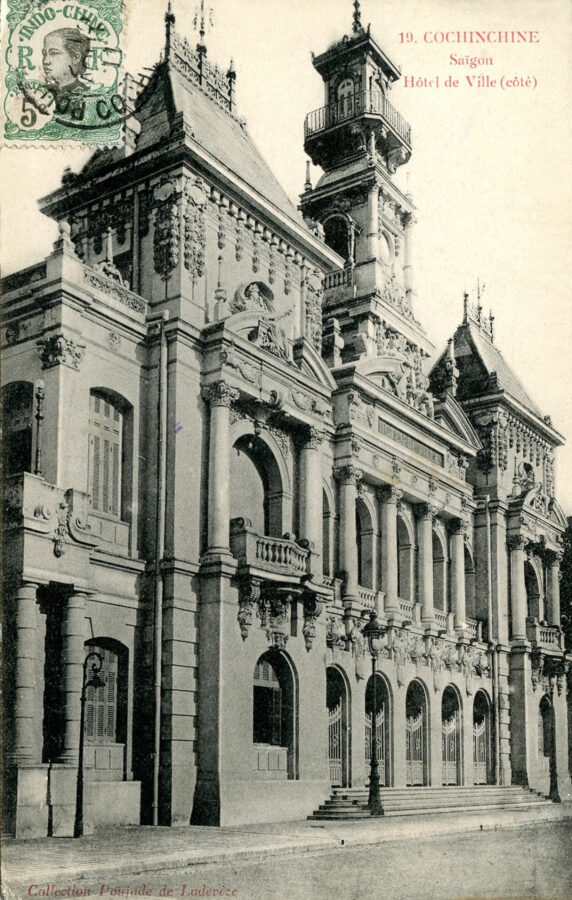
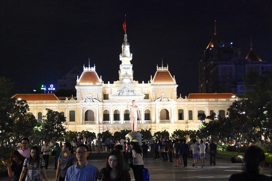
The Municipal Theatre opened in 1900. The Hôtel de Ville, first planned in 1870 and held up by the mud of a canal that had to be filled first, was built from 1898 to 1909. Bến Thành Market moved into its new hall in March 1914 with three days of fireworks. All of them still stand, and most still do the job they were built for: the Notre-Dame Cathedral, the Central Post Office, the Municipal Theatre and Bến Thành Market.
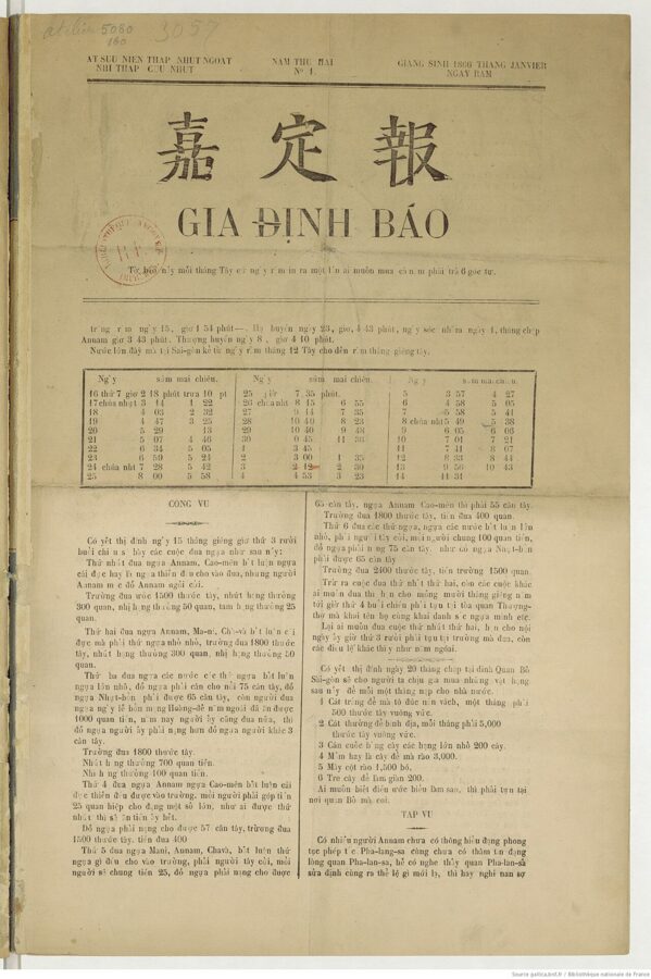
The colony also brought print. Gia Định Báo, the first newspaper in Vietnamese, appeared in Saigon in 1865, set in quốc ngữ, the romanized script that missionaries had devised and the colonial schools pushed. Within two generations Vietnamese writers were using the same script to argue against French rule.
Pearl of the Far East, at three square kilometers
Colonial brochures called Saigon the Pearl of the Far East and the Paris of the Orient. Vietnamese historians point out how small the pearl was. The French spent their money inside the three square kilometers of the 1865 city, bounded roughly by the river, Nguyễn Thị Minh Khai, Nguyễn Thái Học and the Bến Nghé canal, while much of the rest stayed paddy, graves and thatch.
The writer Sơn Nam recorded ponds and mud in front of Bến Thành when the market opened in 1914. Saigon had about 256,000 people in 1930, when Bangkok and Hong Kong were several times its size. The mandarin and journalist Phạm Quỳnh, visiting Singapore in 1922, wrote that every street there was as fine as Saigon’s rue Catinat.
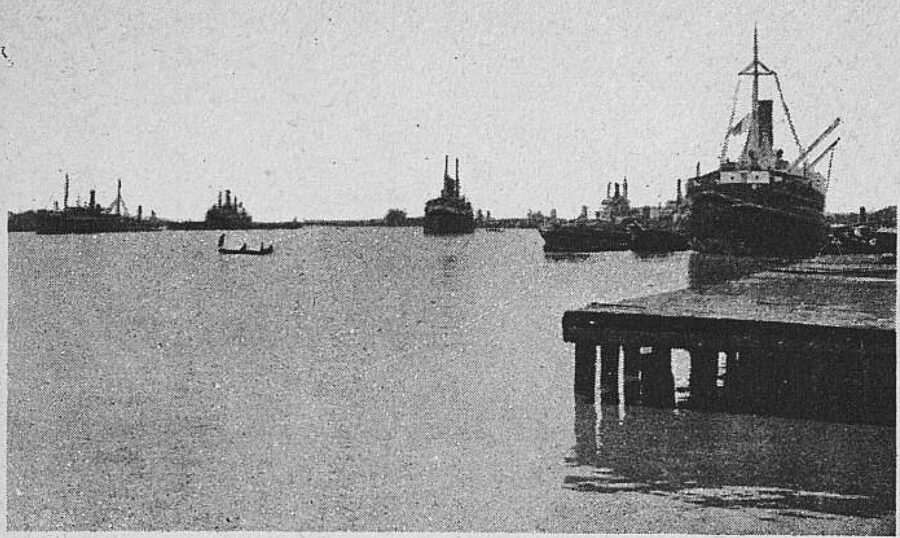
The money came from rice. Paddy from the delta came up the canals on sampans to the Chinese mills of Chợ Lớn and left from the port, where French mail steamers called between Marseille and the Far East. Chinese fortunes built mansions in Saigon too; one built for the family of the property magnate Hui Bon Hoa now houses the Fine Arts Museum.
Nationalists, a revolution and two republics
On 5 June 1911 a 21-year-old from Nghệ An signed on as a kitchen hand aboard the French steamer Amiral Latouche-Tréville at the Nhà Rồng wharf, under the name Văn Ba. Nguyễn Tất Thành did not return to Vietnam for thirty years, and when he did he was Hồ Chí Minh. The wharf’s 1863 headquarters building, put up for the French mail line and nicknamed the dragon house for the ornaments on its roof, is now the city branch of the Ho Chi Minh Museum.
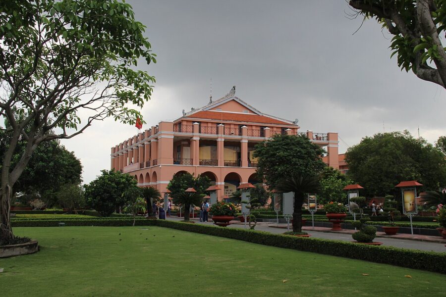
Saigon was also where colonial politics was loudest. Cochinchina was a colony under French law rather than a protectorate, so it had a press, elections for a few and, in the 1930s, a city council where Trotskyist and Communist candidates of the La Lutte group won seats. The Communist rising across the south in November 1940, the Nam Kỳ khởi nghĩa, was crushed within weeks; the street named after it runs past the Gia Long Palace.
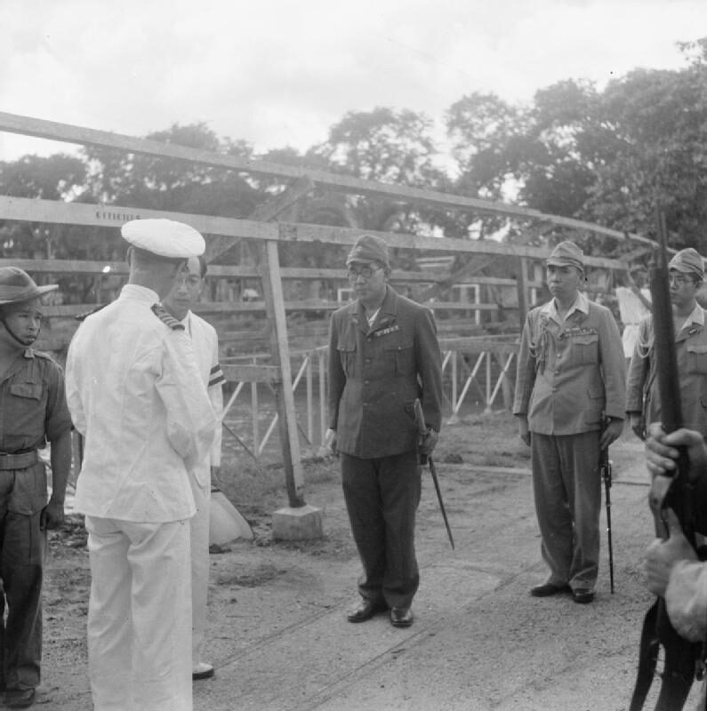
Japanese troops arrived in 1941 and left the French administration in place until 9 March 1945, when they overthrew it in a night. After Japan’s surrender the Việt Minh took over Saigon on 25 August 1945. On 2 September, the day Hồ Chí Minh read the declaration of independence in Hanoi, a huge rally in Saigon ended in shooting.
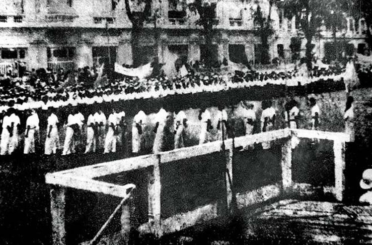
British and Indian troops under General Douglas Gracey landed in September to disarm the Japanese and instead helped the French back into power. On 23 September French troops seized the public buildings, and the war for the south began that day. Three days later Việt Minh troops shot an American intelligence officer, Lieutenant Colonel A. Peter Dewey, apparently taking him for a Frenchman; he was the first American killed in Vietnam.
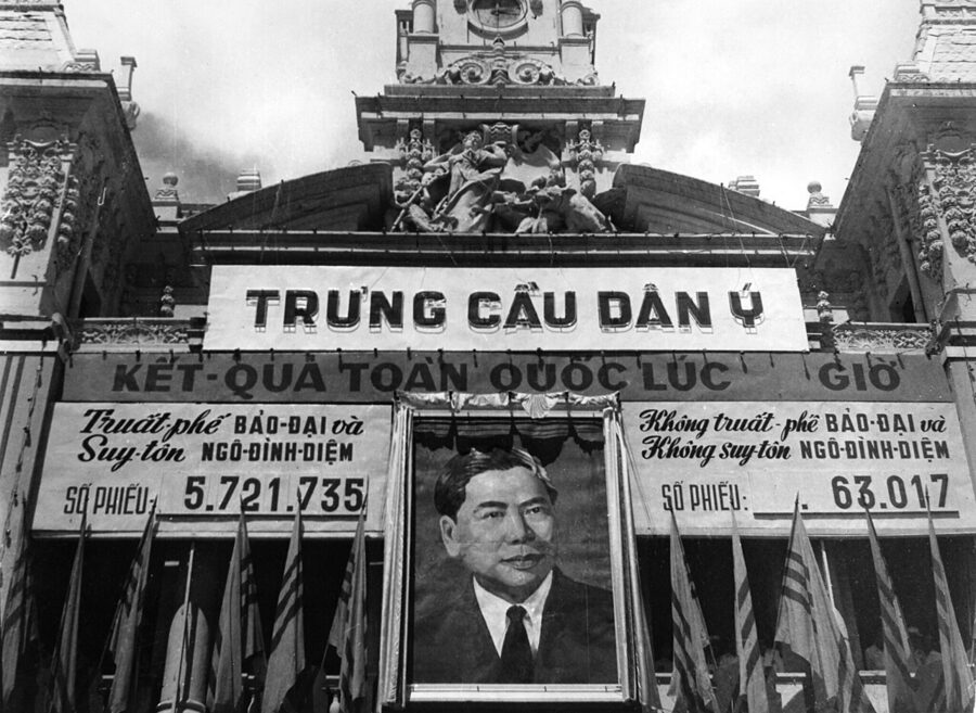
In June 1949 the former emperor Bảo Đại made Saigon the capital of a French-backed State of Vietnam, and after the Geneva partition of 1954 it became the capital of the south. Prime Minister Ngô Đình Diệm fought the Bình Xuyên, a gangster militia that controlled the police and the gambling dens, in the streets of the city in April and May 1955, at a cost of about 500 dead and 20,000 homeless. That October he won a referendum against Bảo Đại and proclaimed the Republic of Vietnam.
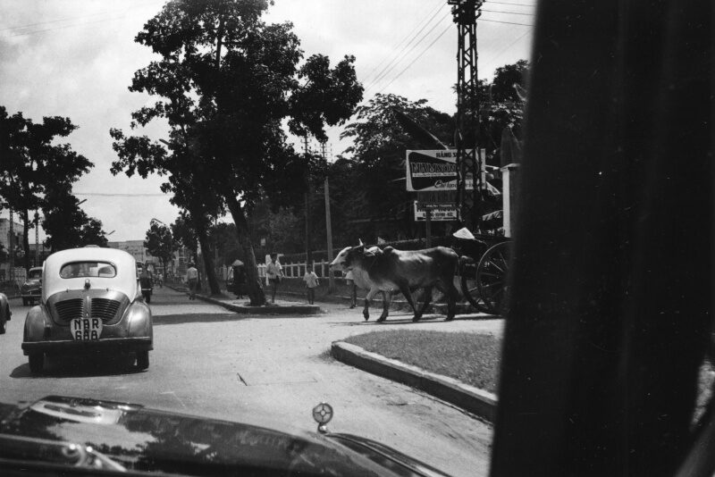
The late 1950s and early 1960s were the Republic’s boom: American aid, new factories, a school of modernist architecture led by Ngô Viết Thụ, and suburbs of villas. A 1959 decree divided the capital, officially Đô thành Sài Gòn since 1956, into eight numbered districts, the beginning of the District 1, District 3 and District 5 that people still use. Buddhist building flourished too; the Vĩnh Nghiêm Pagoda went up in the 1960s for northern Buddhists who had moved south in 1954.
The war years in the city
On the morning of 11 June 1963 the monk Thích Quảng Đức sat down in the intersection of Phan Đình Phùng and Lê Văn Duyệt streets, now Nguyễn Đình Chiểu and Cách Mạng Tháng Tám, and was set alight in protest at the Diệm government’s treatment of Buddhists. Malcolm Browne’s photograph of the burning monk went round the world.
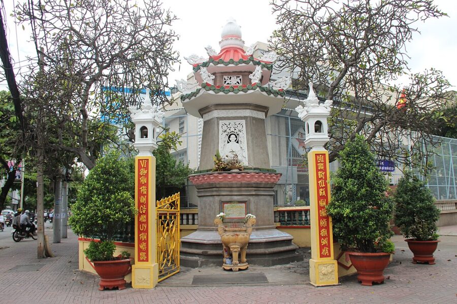
In August special forces loyal to Diệm’s brother Ngô Đình Nhu raided pagodas across the country, beginning with Xá Lợi Pagoda, where the monk’s heart was kept.
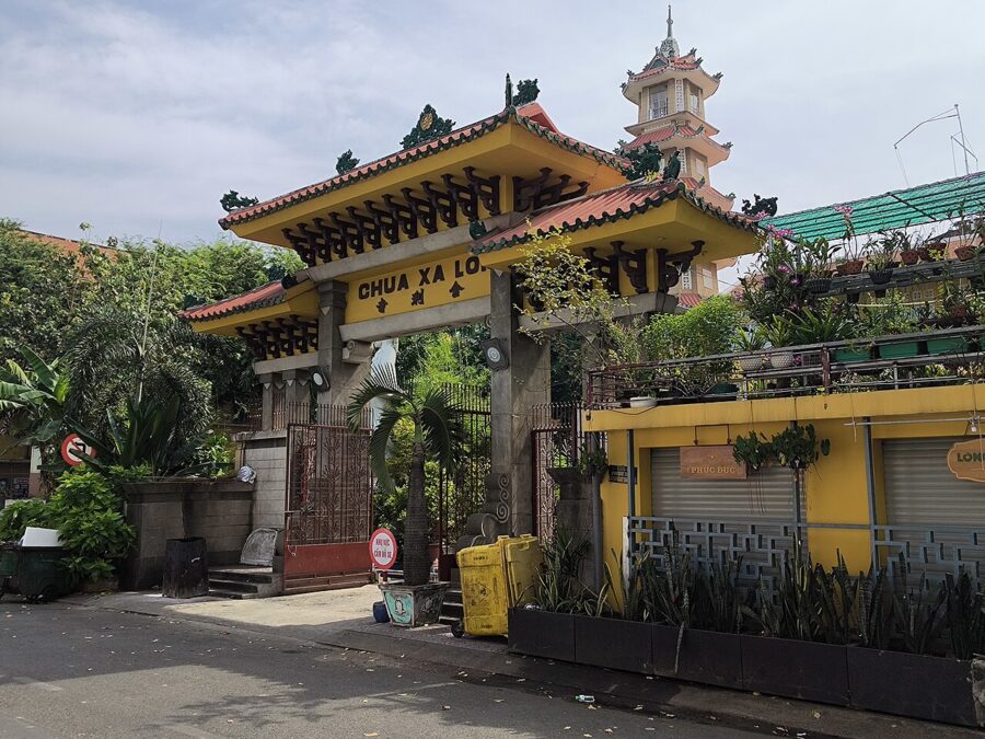

On 1 November 1963 generals led by Dương Văn Minh overthrew Diệm. He and Nhu slipped out of the Gia Long Palace, spent the night in Chợ Lớn, and came to Cha Tam church the next morning, where they gave themselves up. Both were killed in the armored car taking them to the army’s headquarters.
American combat troops arrived in 1965 and the city filled with them: soldiers on leave on Tự Do street, the former rue Catinat, press officers giving their daily briefing at the Rex Hotel, and bombs in cafés and outside the US Embassy. By 1970 the wider city had about 3.3 million people, many of them refugees from the fighting in the countryside living in shanties along the canals.
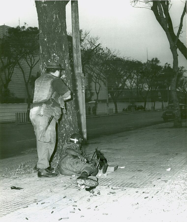
Tết 1968 brought the war into the streets. In the early hours of 31 January sappers attacked the embassy and fought in its grounds until morning, while other units hit the palace, the radio station and Tân Sơn Nhất air base. Chợ Lớn, where fighting flared again in May, took the worst of the damage.
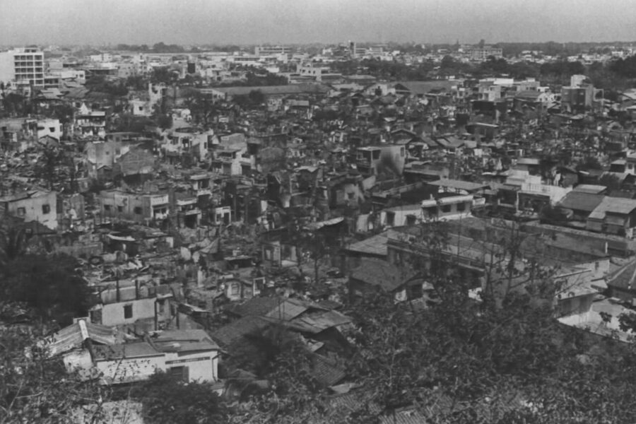
The War Remnants Museum, opened five months after the war ended, tells these years from the side that won, mainly through the work of war photographers of many nationalities and the evidence of Agent Orange. For the guerrilla side, the Củ Chi tunnels, now inside the city’s own boundary, are a half-day trip from the center.
30 April 1975, and a new name
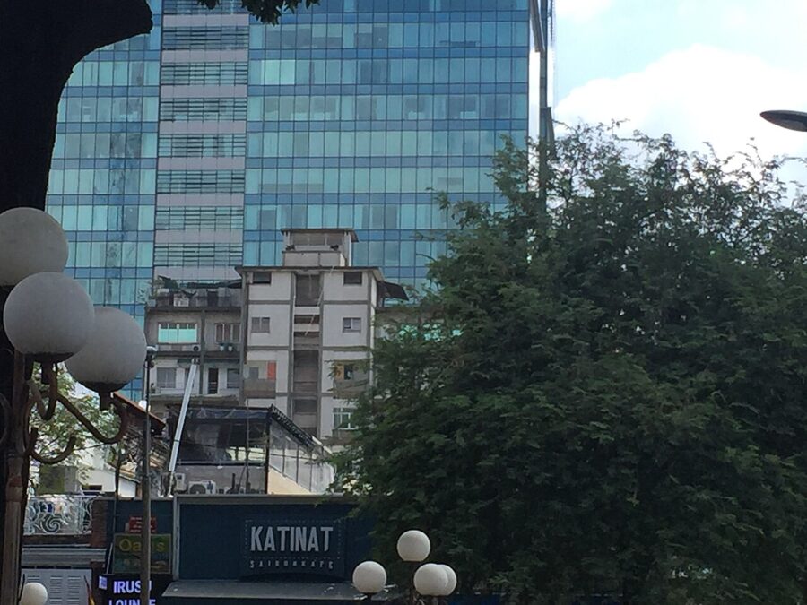
By late April 1975 the northern army had the city surrounded. On 29 and 30 April American helicopters lifted out the last Americans and thousands of Vietnamese from the embassy and from rooftops in the center. The one in Hubert van Es’s famous photograph is not the embassy at all but the roof of 22 Gia Long Street, a block of flats for American staff, which still stands at 22 Lý Tự Trọng with no plaque to mark it.

Dương Văn Minh, president for two days, broadcast an unconditional surrender that morning; sources put it between about 9:30am and 10:24am. At 10:45am, by the palace’s account, tank 843 rammed the side gate of the presidential palace and stuck, and tank 390 broke through the main gate. At 11:30am the flag of the National Liberation Front went up over the roof.
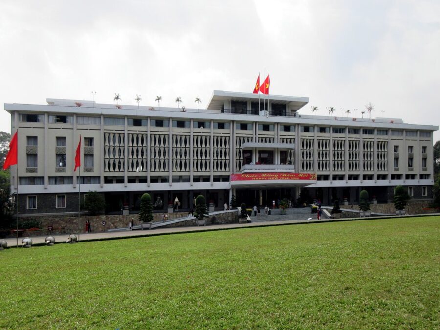

In Vietnam the day is a public holiday, the Liberation of the South; for many Vietnamese abroad it is the day they lost a country. Both are memories of the same morning, and the Independence Palace, kept close to the way its last occupants left it, is where visitors from both sides now walk through the same rooms.
On 2 July 1976 the National Assembly of the reunified country, at its first session, renamed the city of Saigon–Gia Định as Ho Chi Minh City, after the leader who had died in 1969. The new municipality joined the old capital, Gia Định province and parts of two others into a single municipality.
Hard years, fence-breaking and Đổi Mới
The new government moved fast against the old city. Officers and officials of the Republic went to re-education camps, many of them for years, and families were pressed to move to new economic zones in the countryside. A 1975 campaign against “comprador capitalists” was followed in March 1978 by the closure of some 30,000 private businesses, most of them Chinese-owned in Chợ Lớn, and by a currency change that wiped out savings.
Hundreds of thousands left by sea in 1978 and 1979, a large share of them ethnic Chinese, as relations with China collapsed into war. The city counted about 3.5 million people in May 1975 and fewer, 3.42 million, at the census of October 1979.
Food ran short in a city that had always lived off the delta’s rice, because the state paid farmers so little that they would not sell. The city’s leaders, with Võ Văn Kiệt as party secretary, quietly bought rice at market prices and let state factories trade outside the plan, a practice that came to be called xé rào, fence-breaking. Hanoi adopted the lesson for the whole country as Đổi Mới, renovation, at the Sixth Party Congress in December 1986.
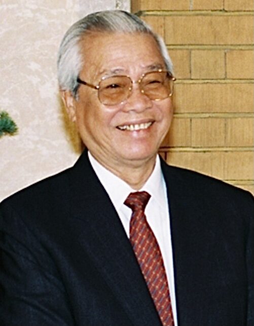

The 1990s brought export processing zones, the first of them at Tân Thuận on the river south of the center, along with Taiwanese, Japanese and Korean factories and a flood of migrants from the provinces. The city had 5 million people at the 1999 census and 7.2 million in 2009.

Towers, a metro and a bigger map
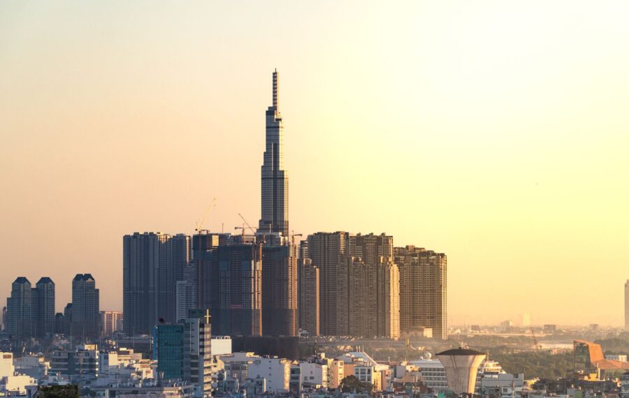
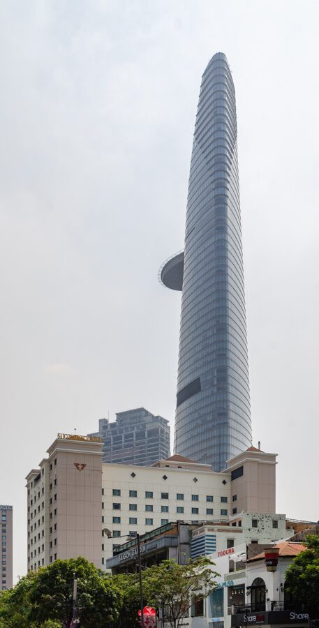
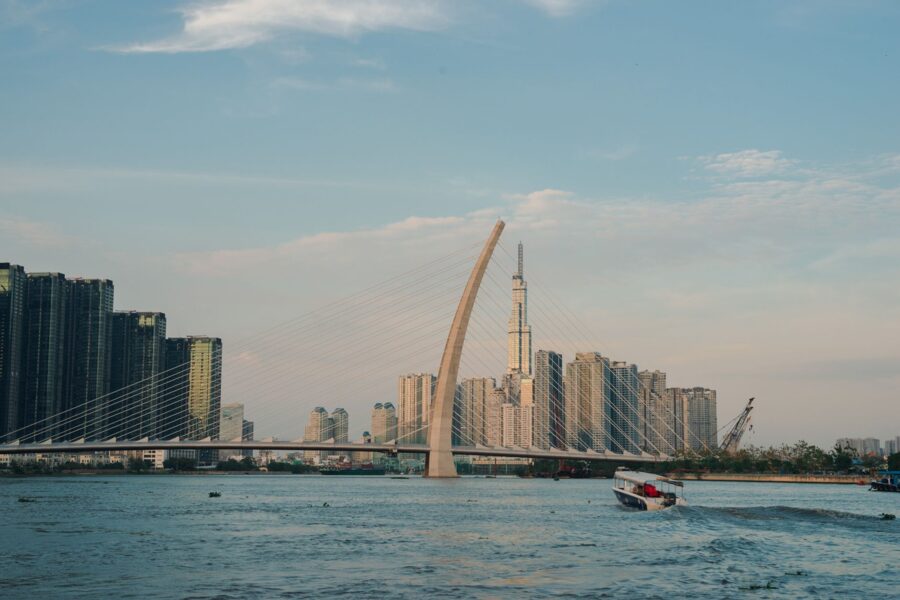
The skyline is the newest layer. The Bitexco Financial Tower, 262 meters with a helipad on its flank, opened on 31 October 2010, and Landmark 81, at 461 meters the tallest building in the country, followed in 2018. In 2015 Nguyễn Huệ, the boulevard in front of the city hall, became a walking street, with a statue of Hồ Chí Minh at its head.

Across the river the marsh of Thủ Thiêm, which Diệm had judged too wild to build on, became a new downtown after a road tunnel opened in 2011, though the clearing of its villages left disputes over land that ran for years.
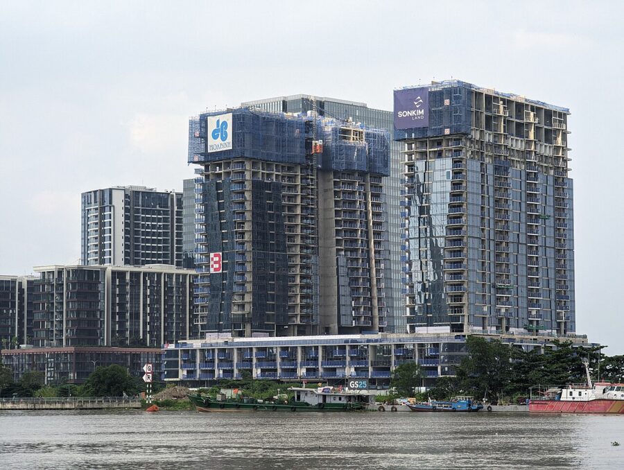
In 2021 Districts 2 and 9 and Thủ Đức district were merged into Thủ Đức city, a city inside the city that the 2025 reform broke up into wards again. Covid-19 struck harder here than anywhere in Vietnam: the country’s first case was found in the city in January 2020, and nearly 20,000 residents died, most of them in the lockdown summer of 2021.
Metro Line 1
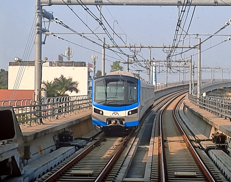
Metro Line 1 took longer to build than any of the colonial landmarks. Approved in 2007 and financed mainly with Japanese loans, it ran years late and far over budget and finally opened at 10am on 22 December 2024. It runs 19.7 kilometers from Bến Thành to Suối Tiên in Thủ Đức, the first 2.6 kilometers underground through Bến Thành, Opera House and Ba Son stations and the rest on a viaduct beside the old Hanoi Highway.

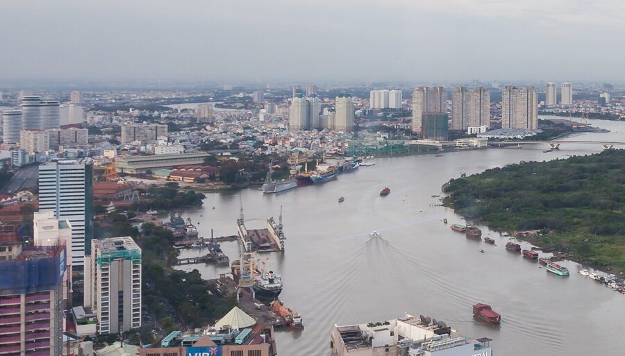
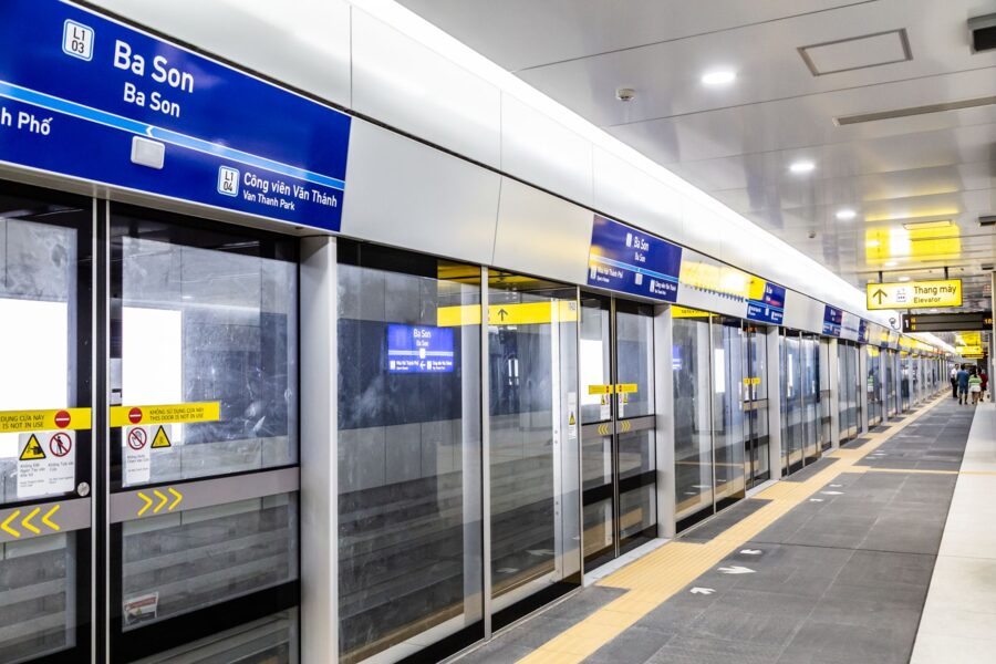
The underground stations sit on top of the history. Ba Son station is named after the shipyard that grew from the Nguyễn navy’s yard on the river, close to the site of the old citadels, and Bến Thành station lies under the square in front of the market.

The 2025 merger
On 1 July 2025 Vietnam cut its 63 provinces to 34 and abolished districts altogether. Hồ Chí Minh City absorbed Bình Dương, the factory province to the north, and Bà Rịa–Vũng Tàu, the province of oil fields and beaches to the southeast. The new city covers about 6,772 square kilometers and some 14 million people.
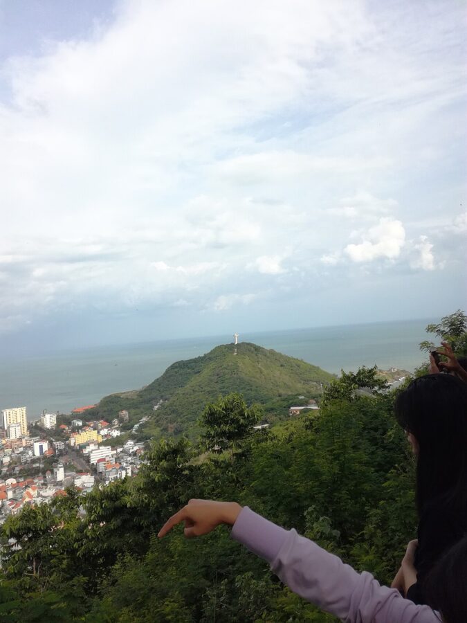

Below the city there are now only 168 units: 113 wards, 54 communes and the special zone of Côn Đảo, the islands whose French prison held Vietnamese nationalists from the 1860s and political prisoners until 1975. The district numbers vanished from addresses overnight but not from speech, and taxi drivers and street signs still say District 1.
Where to see each period today
The layers sit close together in the old center, and a long day can take you through most of them in order. Here they are by period, with the place to go for each.
| Period | Where to see it | What to look for |
|---|---|---|
| Prehistory, Funan, the Khmer | Museum of Vietnamese History, 2 Nguyễn Bỉnh Khiêm | Jar burials from Giồng Cá Vồ, Óc Eo statues, Khmer sculpture |
| Settlers and the 1700s | Giác Lâm Pagoda, 565 Lạc Long Quân | The pagoda of 1744, its bodhi tree and stupa |
| Gia Định and the citadels | Lăng Ông Bà Chiểu, 1 Vũ Tùng, Gia Định ward | Lê Văn Duyệt’s grave and temple, the citadel cannon |
| The Chinese city | Chợ Lớn: Nguyễn Trãi, Bình Tây Market, Cha Tam church | Assembly halls, the 1928 market, the church where Diệm gave himself up |
| French Saigon | Đồng Khởi, Nguyễn Huệ and the cathedral square | Post office, cathedral, Municipal Theatre, city hall, Bến Thành |
| The nationalists | Nhà Rồng wharf, 1 Nguyễn Tất Thành | The 1863 dragon house where Nguyễn Tất Thành sailed in 1911 |
| The Republic and the war | Independence Palace, War Remnants Museum, the Thích Quảng Đức memorial | The 1966 palace and its bunker, the war photographs, the 1963 corner |
| 1975 | 22 Lý Tự Trọng; the palace gates | The rooftop of the evacuation photograph, from the street only |
| The new city | Metro Line 1, Thủ Thiêm, the river | The underground stations, the skyline from the Thủ Thiêm bank |
The city’s own history museum is worth an hour of the day. The Museum of Ho Chi Minh City occupies the Gia Long Palace at 65 Lý Tự Trọng, Sài Gòn ward, the building Diệm fled from in 1963. It opens 8am to 5pm every day, public holidays and Tết included; from 1 October 2026 admission is 60,000₫ (about US$2.30), with students and children free.
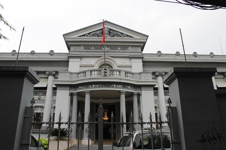
For a day in order, start at the Museum of Vietnamese History when it opens at 8am (it closes for lunch from 11:30am to 1pm and all day on Mondays), then walk down to the cathedral square for the post office. Spend the early afternoon at the Gia Long Palace and the Independence Palace, which are five minutes apart, and take a Grab or Be car to Chợ Lớn for the late afternoon, when the temple courtyards are full of incense and the market is winding down.
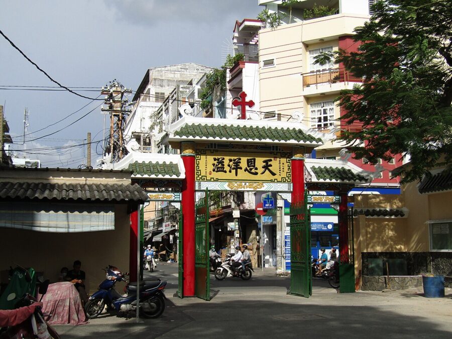
Lăng Ông and Giác Lâm sit out in the old Gia Định suburbs and are best by car, one in the morning, one in the afternoon. The cathedral is closed to sightseers during its restoration but open for Mass, and the city hall is the city government’s office, seen from Nguyễn Huệ.

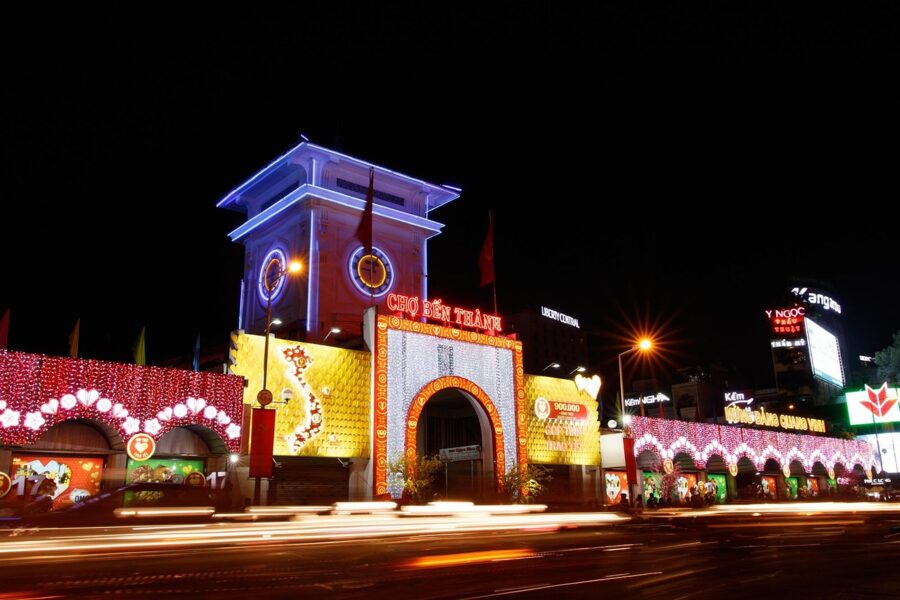
End at Bến Thành at dusk. Take the escalator up from the metro, past the turnstiles of a line that took seventeen years to go from approval to its first passengers, and come out under the clock the French put up in 1914, a few streets from the ward that is called Sài Gòn again.